

report by Edmund Dummer and Thomas Wiltshaw
scroll cartouche
foliage cartouche
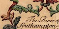
The title cartouche is in scrolls of foliage, coloured red, blue, green and yellow; centre bottom is a bearded face. The title is:-
The River of Southampton wth: the Scituation of Bussleton Beauley & Lymington Rivers within the Isle of Wight
Printed in the middle of the map is a table linking letters on the map to an explanation.
compass rose
up is NNW

In the sea, The Solent, is a compass rose. This has four arrow pointers for the cardinal and half cardinal points coloured in red, pink, grey, blue and a yellow fleur de lys marking north. Up on the sheet is about NNW.
sandbanks
foreshore
rocks
The sea is uncoloured. Major sandbanks are marked and tinted pale brown, and some labelled with a letter keying to the table of particulars.
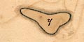
y - BrambleThe sands west of the Isle of Wight are shown but not named.
x - Middle in Southampton River
z - Middle Grounds
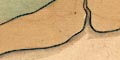
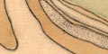
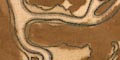
The coastal foreshore is drawn, between the tides? coloured pale brown. River channels are clearly drawn through these flats.
At Hurst Point there is a darker area which could be mistaken for the Shingles sandbank; it ?is a stain on the paper. Hurst Beach, pebbly, is indicated clearly.
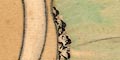
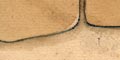
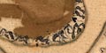
Rocks on the foreshore are shown by scattered + signs; for example on the NW edge of the Isle of Wight.
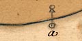
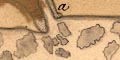
Three large pillars off the island are labelled
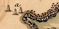
a - Needles
At the entrance to the River Meon where Titchfield Lake is marked, are drawn two features which could be taken to be marker posts for the channel.
and west of Calshot.
coastal defence
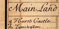
m - Calshott CastleSome are not, Netley castle and the castles in Yarmouth and West Cowes.
g - Hurst Castle
bridges
lakes
River channels are clearly drawn through foreshore areas and inland. Rivers are not drawn above their estuary, and are not named, but can be identified from an adjacent settlement. Except:-
d - Newton Creekeon the Isle of Wight is labelled, having no settlement.
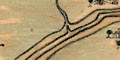
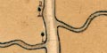
Bridges are drawn by a double line crossing the river at Beaulieu and Redbridge.
A pool is drawn at the boggy area of the River Meon's estuary at Titchfield Haven, labelled:-
v - Titchfield Lakelake in Hampshire is much used as a term for a river course.
hillocks
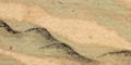
Little relief is shown on the map except the clear distinction of sea/foreshore/land and the coast appearance of low cliffs. A few hillocks, some wooded, are drawn on the Isle of Wight, as navigation aids?
Trees are drawn in settlements, coloured emerald green, but other woods are not shown except on a ridge of hills on the island. The spit down to Hurst seems to be covered in bushes.
town walls
town gates
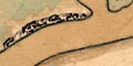
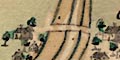
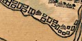
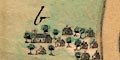
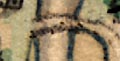
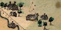
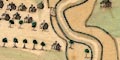
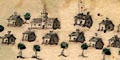
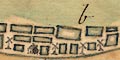
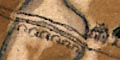
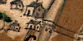
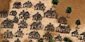
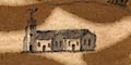
Settlements along the coast are shown by clusters of little houses - look at these magnified, they are nicely done, the rooves tinted slate blue. The size of the cluster matches, sort of, the size of the place.
Southampton has town walls, town gates at north and south, and two churches. Other villages and towns have a church drawn with tower or steeple - which seem mostly to match what is there now.
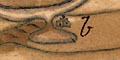
Most places are labelled by a letter keying to the table of particulars, qv.
Salterns are shown by a series of rectangular ponds along the coastal land west of the Lymington River.
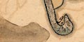
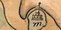
drape cartouche
The map has a cartouche of red drapes, with branches of leaves, held up by an eagle, bottom centre.
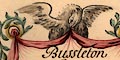
Bussleton RiverThe cartouche also holds:-
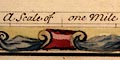
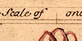
scale
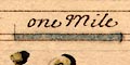
A Scale of one MileThe 1 mile = 72.4mm assuming a statute mile is 1 to 22229 or assuming a sea mile of 6082.95 ft is 1 to 25608. The map scale is about:-
1 to 22000 or 1 to 26000
3 or 2.5 inches to 1 mile
compass rose
up is N

There is a compass rose in the sea W of the river mouth. It has arrow points for the cardinal and half cardinal points, coloured red, pink, grey, blue, with a yellow fleur de lys marking north. The map is orientated roughly up is north.
foreshore
The sea is plain and uncoloured.
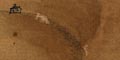
The foreshore area is coloured a sandy brown. An area east from the river mouth has what could be a bank of shingle on the upper foreshore. There is an inlet, almost a lake, in the foreshore east side at the mouth.
The coast line is pretty flat. An area on the E side of the estuary, about 2 miles in, is drawn with low ?rocky cliffs. There is another low cliff about 3 miles up on the W side. The landward area is tinted pale green.
ferries
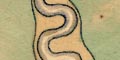
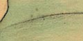
The Hamble river mouth is the subject of the map. A small creek on the west side, 2.5 miles in, is drawn through the foreshore and a little inland. This seems to be the small stream that runs down from the area named Lowford.
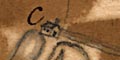
The ferry at Bursledon is labelled by letter:-
c - Bussleton Ferry
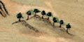
hillocks
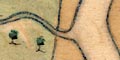
The land area is modelled with low hills, shaded to the east, with a tree or two on each. The drawing of the spit on the E of the river mouth suggest a lower lying area, tinted a paler green (almost layer colouring!)
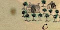
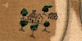
Woods are shown by groups of trees at settlements, and elsewhere. There are occasional trees about the land, tinted emerald green.
b - HambleAnother can be identified by being adjacent to:-
c - Bussleton FerryA hamlet on the E side of the river mouth is not labelled. On Milne's map, 1791, this is Hook.
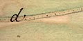
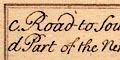
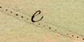
d - Road to Southamptondrawn by a double line from a tiny hamlet NE of Bursledon, on the river bank, by the ferry, through Bursledon, and off to the west towards Netley. This road continues east as a single dotted line across the foreshore, crosses by the ferry, is drawn as a single dotted line along the opposite foreshore to a house opposite Burseldon, where it become a double dotted line off to the ESE towards Fareham, labelled:-
e - Road to Portsmouth
a - Salt Pansdrawn as a series of rectangular ponds, with a house. These salterns were still visible on Milne's map, 1791, on Hamble Common.
scroll cartouche
title
Bottom centre of the map is a scroll cartouche with some acanthus leaf decoration, tinted in reds and greens. The map title is:-
Beauley. RiverThe title cartouche contains:-
scale
A Scale of one Milewith divisions at quarter miles. The 1 mile = 72.1mm; assuming a modern statute mile this gives a scale 1 to 22290; or, if a sea mile of 6082.95 feet, 1 to 25715. The map scale is about:-
1 to 22000 to 1 to 25000
2.5 or 3 inches to 1 mile
compass rose
up is NW

The map has a compass rose. There are four star points for the cardinal directions, tinted red/pink, and four more for the half cardinal directions, tinted grey/blue. North is marked by a yellow fleur de lys. Up on the sheet is NNW.
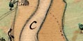
There are tables at left and right at the bottom of the map, in plain rectangular cartouches. These explain letters used to mark some features of the map. Eg:-
b. Road to Lymington
foreshore
The sea is plain. The expanse of sandy or muddy flats across the river mouth is tinted sandy brown.
bridges
The subject of the map is the Beaulieu River, which is drawn from its large bends seaward for about 7 miles inland. Various creeks are shown in the estuary mudflats and there is a series of meanders about 5-6 miles from the sea.
At Beaulieu village a bridge is shown by a double line arching over the river. The river is tinted pale blue along its edge.
The land is tinted pale green with suggestions of low hills drawn in profile.
forests

Trees are drawn sparingly over the land, but grouped closer in:-
d Part of the New Forestwhich is clearly bounded by a line.
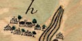
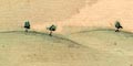
Trees are drawn in settlements, with a small wood SE of Beaulieu.
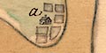
Settlements are drawn by small buildings, roofs tinted grey. One place is marked by letter:-
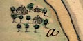
a. Ginnswhich is a great house more than a village?
c. Road to SouthamptonThis route crosses to Southampton over the Hythe Ferry. Another road is marked:-
b. Road to Lymingtonon the west side of the village. But nothing of the road is drawn.
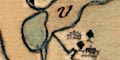
title
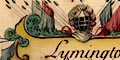
The map's title cartouche bottom centre is a panel surrounded by foliage scrolls tinted in reds, greens and yellows. Top centre is a ?helmet with spears and flags to each side. The title is:-
Lymington River East of Hurst Castle within the Isle of WightThe central item above the cartouche could be a cresset - perhaps the basket of Jack?
The cartouche contains:-
scale
A Scale of one MileThe 1 mile = 72.1mm; assuming a modern statute mile this gives a scale 1 to 22290, or if a sea mile of 6082.96ft then 1 to 25715. The map scale is about:-
1 to 22000 or 1 to 25000
25. or 3 inches to 1 mile
compass rose
up is NW

The map has a compass rose. There are four star points for the cardinal directions, tinted red/pink, and four more for the half cardinal directions, tinted grey/blue. North is marked by a yellow fleur de lys. Up on the sheet is NNW.
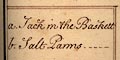
There are tables at left and right at the bottom of the map, in plain rectangular cartouches. These explain letters used to mark some features of the map. Eg:-
b. Salt Panns
foreshore
sea marks
The sea is plain, uncoloured. The expanse of sand or mud flats at the mouth of the Lymington River is tinted sandy brown and is drawn with many creeks off the main channel.
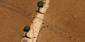
The outer marker of the channel into the river is a post with triangle and circle at the top, named:-
a. Jack in the BaskettThe land is tinted pale green.
harbours
The navigable channel in the river is marked all the way up by posts, the circle at the top tinted dark green.
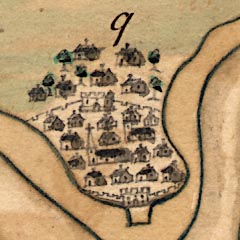
Lymington is by a meander, where there is a landing stage at the harbour.
Settlements are drawn by groups of houses, roofs tinted grey-blue, with groups of trees, tinted emerald green. Lymington, a town, has a church with a tower, and a turret? on that, and is not named. It has a landing stage at the river's edge.
Other settlements are small and unnamed, except:-
c. Bucklandwhere is drawn a great house.
e. Road to Beauleyrunning westward from Lymington, and:-
d. Road to Christ Churchrunning northward parallel the river.
windpumps
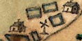
b. Salt Panns
Many rectangular ponds are drawn, tinted blue at their edges, and some windpumps, and some buildings.
wreath cartouche
title

The title cartouche bottom centre is a wreath of leaves, tinted green, tied with a red ribbon. The title is:-
Christ Church River Westward of Hurst Castle wth:out ye. Isle of Wight'without' not meaning lacking but outwith (outside).
The cartouche contains:-
scale
A Scale of one Milewith divisions at quarter miles. The 1 mile = 72.1mm; assuming a modern statute mile this gives a scale 1 to 22290; or, if a sea mile of 6082.95 feet, 1 to 25715. The map scale is about:-
1 to 22000 or 1 to 25000
2.5 or 3 inches to 1 mile
compass rose
up is NW

The map has a compass rose. There are four star points for the cardinal directions, tinted red/pink, and four more for the half cardinal directions, tinted grey/blue. North is marked by a yellow fleur de lys. Up on the sheet is NW.
Left and right at the bottom, in plain rectangular cartouches, are explanations of letters used to mark features on the map. Eg:-
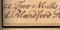
cc. Two Mills
rocks
sandbanks
coast appearance
The sea is plain. Off shore at the river mouth are the outlines of rocks or sandbanks, tinted grey, looking like a hazard to navigation. The shore at the river mouth is drawn with circles, perhaps indicating a pebbly shore.
The coast to westward is drawn with the appearance of low cliffs.
harbours
a. Peer now makingfor the harbour.
Inland the river is a confusion of channels and creeks and mud flats. It divides into two main arms:-
d. Blandford RiverThe rivers are being described, not named - a pernickety distinction perhaps. They are the River Stour and River Avon respectively.
e. Salisbury River
On a pool by a creek half a mile inland is:-
b. Store-housePresumably a harbour warehouse.
then a smaller one of 2 arches nearer the town, carry a road into Christchurch from the eastward, over two arms of the River Avon.
The land area is tinted a muddy brown, with a little green. Westward of the town low hills are suggested in profile, with smaller hillocks west of the river mouth.
There are a few trees drawn about the land area, tinted emerald green. Most trees are clustered around settlements, or along roads.
streets
Settlements are drawn by groups of buildings, roofs tinted grey. Christchurch is not labelled, but is implied by the map's title. It has a fine array of buildings drawn along streets.
Christchurch Priory is drawn as a great church.
water mills
cc. Two Mills
g. Road to PoolAnd eastward out of the town, crossing the River Avon on fine bridges, is:-
f. Road to Lymington
A turning off this road goes by a few houses, southwards to the coastal area.
report by Edmund Dummer and Thomas Wiltshaw