
 Return to list of Features

NB: typical illustrated examples are described, NOT ALL examples.
absence of evidence is not evidence of absence
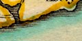
The coast line is just a line. Land is uncoloured.
Harbours are not obvious, and as an earlier commentator says:-
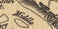
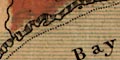
Southampton Water is inconspicuous
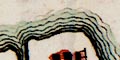
The coast line is shaded for emphasis.
Portsmouth Harbour is not clearly recognisable.
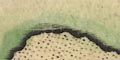
The coast is shaded for emphasis.
The coast line is shaded.
Harbours, havens, along the coast are labelled clearly
The coast line is shaded for emphasis.
the coast shaded for emphasis with a darker blue tint.
Harbours relevant to Hampshire which can be recognised easily are:-
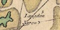
Portsmouth Harbour
Langstone Harbour
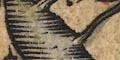
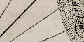
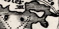
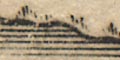
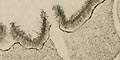
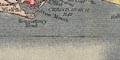
It is difficult to see on the copy, but it looks as if the coast line has a drawing of the coast's appearance drawn along its inland edge. At the top of the sheet are three drawing of the coast seen from the sea. For example:-
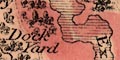
The opening of the land or Coast of Beache / with the seven Cliffs or hillesfor a drawing of Beachy Head etc. The coast line is not as accurate as it could be. The position of features is all awry.
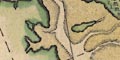
Southampton Water and Hamble Haven are drawn; Portsmouth Harbour is drawn; Langston and Chichester harbours are missing.
Interpretation is chancy; while the gross information of the chart is fine, I would not have liked to have relied upon it for harbouring!
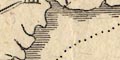
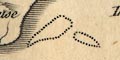
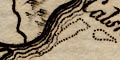
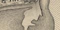
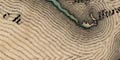
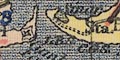
The coast is shown by a line with hatchings to landward. Two channels are identified between the Needles, off the Isle of Wight, and the mainland at Hurst Spit:-
the mane Chanell
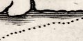
the north Chanelland a ?sandbank is shown by a dotted area between them, labelled:-
[ ]There are hints of other sandbanks along the coast.
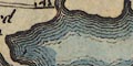
The coast line is shaded for emphasis. It is possible to recognise:-
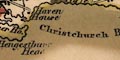
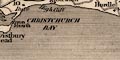
Christchurch Harbour [large]
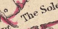
Solent, The
Southampton Water [over large]
Portsmouth Harbour [perhaps small]relevant to Hampshire
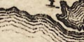
The coast line is shaded for emphasis. Some headlands are noticed, eg:-
C: Lizard
Start point
S. forlandHarbours are not labelled. In Hampshire it is possible to recognise Southampton Water, but the three harbours of Portsmouth, Langstone and Chichester are all one bay.
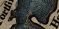
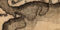
The coast line is indented by oversize estuaries of rivers. The three islands of Portsea, Hayling, and Thorney can be recognised. Christchurch Harbour is obvious, as are Southampton Water and Portsmouth and Langstone Harbours. the shape of the Solent and Spithead leaves a lot to be desired between the county and an ill shaped Isle of Wight.
The coast line is shaded.
A few harbours are labelled, eg:-
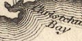
Rye haven
Orford havenand at least one headland:-
ye Nesse pointeoff Sussex.
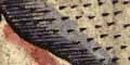
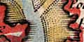
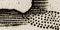
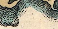
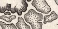
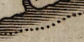
The coast line is emphasised by shading. Foreshore areas of mudflats or shingle are shown pecked, and
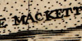
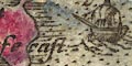
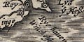
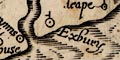
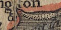
THE MACKETTis labelled off Hayling. Only:-
Titchfeilde ha
Hamble haare explicitly labelled as harbours, and:-
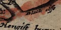
black cliffe
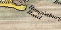
Hengistbury headas coastal features.
The coast line shaded for emphasis.
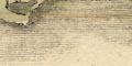
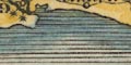
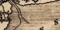
The coast is shaded with horizontal lines extended into harbours and river mouths.
The coast line is shaded.
The coast line is shaded.
The coast line is shaded.
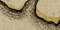
The larger islands:-
Portsey Ile
Haling Ile
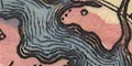
Thorney Ilehave a naked nymphs, with wigs or headdresses, hands held aloft - perhaps dancing? (The Isle of Wight has a more imposing wench, with a little drapery.)
The sea is engraved in a moire effect pattern; the sea area south of Hampshire is labelled:-
Oceanus Britannicus
The coast line is shaded for emphasis.
The coast is shaded. Harbours are not labelled. The shape of Thorney Island, and thus Langstone Harbour, is not good.
The sea area is plain and the coast line shaded for emphasis.
The coast line is shaded. Southampton Water, and Portsmouth and Langstone Harbours are clearly shown; Hamble and Titchfield Havens are exagerated.
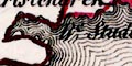
It is possible to interpret the drawing of the coast between Portland to Peveral, as showing the coast appearance of low hills.
Windmills might be drawn as sea marks, eg East of Cuckmere. Some leading lines are drawn.
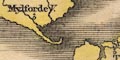
The coast line is emphasised by shading, which is tinted blue. The is crudely drawn but well enough to recognise the harbours and estuaries in the Hampshire area, where a couple of harbours are labelled:-
Lemington haven
Hamble haven
Bouley havenThe last is perhaps Beaulieu, but is labelled off the mouth of the River Meon.
The coast is shaded, extending into river mouths and harbours.
Headlands, harbours, etc, might be labelled, eg:-
Hengistbury head
Rameshead
Titchfield Bay
Hamble HavenCliffs are suggested by vertical lines, and may be labelled, eg:-
Black cliffe
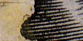
The coast shaded horizontally.
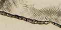
The foreshore flats off Hayling Island, the Hayling Shoal, are labelled:-
The MackettTwo headlands are labelled:-
Rameshead
Hengestbury headealso note:-
Black cliffeThe only harbour labelled is:-
Hamble haven
The coast line is shaded inland and tinted.
It is possible to recognise Portsmouth, Langstone and Chichester harbours, and Southampton Water.
The coast is shaded, pretty crudely. The shading is taken into harbours and river mouths. Mudflat or sandbank areas are stippled, and:-
A few coastal features are labelled, headlands etc, eg:-
Hengist bury head
Black cliffe
Rames headSome harbours are labelled, eg:-
Hamble haven
Titchfeilde hav.
The coast line is shaded for emphasis. The Hampshire coast is crudely drawn, inaccurate in detail though the main features can be seen. The Meon estuary is too large; the Hamble's too small; Hayling and Thorney Islands are missing though their spaces are there; etc.
The coast is shaded with horizontal lines with are carried into harbours and river mouths. Portsea Island and Hayling Island are (too) clearly marked.
The coast lne is shaded.
A few headlands are noticed, eg:-
Christchurch headand a very few harbours, eg:-
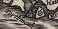
Bewley H.
The coast line is shaded for emphasis. Some harbours can be recognised, but are not labelled.
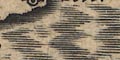
The coast shaded, this extending into river mouths etc.
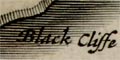
Cliffs are labelled east of Christchurch:-
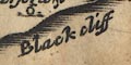
Black cliffA couple of harbours are labelled:-
Hamble haven
Titchfield ha
The coast line is emphasized by shading. Harbours in Hampshire are bareley recognisable.
The coast line is shaded, on the landward side. Some headlands are labelled, eg:-
Start PtA few harbours are labelled, eg:-
Plymouth H
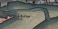
The coast shading has been re-engraved; a more thorough job than Saxton. And there are some changes to the coast line. The lower left corner of the map now shows Poole Harbour with:-
North haven point
South haven pointeach with a castle.
The coast line from Allum Chine to Christchurch Head is drawn with low cliffs, the seaward appearance of the shore.
Christchurch headis labelled, as is:-
Rams headeThe alterations to sea and coast owe little or nothing to John Speed's map.
The coast line is shaded by horizontal lines for emphasis.
The coast line is shaded inland, and tinted on the sea side.
The line of the coast is mostly just a bold line, shaded on the landward side.
In places low cliffs are indicated by vertical shading to seaward, for example west of Hurst Spit.
The foreshore is drawn and labelled much the same way as sandbanks.
The Needles are drawn as a group of rocks, labelled:-
Needlesalso explained at the bottom:-
Needles are steep Chalk stones high and Steep:too.
Although various river entrances, estuaries, and harbours are charted in reasonable detail only a few are clearly labelled, eg:-
Langston Haven
Chichester HavenIslands are drawn in the harbour areas, and the larger islands labelled:-
PORTSEA ISLAND
HALING Islandsome are just shapes:-
which is Pewit Island in Portsmouth Harbour.
The coast line is shaded.
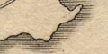
One headland is labelled:-
Rams - headoff Portsmouth.
coast with shading and sandbanks, around Portsea and Hayling Islands
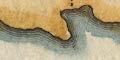
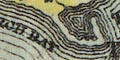
Hengistbury headis labelled, and
Black cliffeat the entrance to Christchurch Harbour.
The coast line is shaded,
Sea coast shown by horizontal shading carried into harbours and river mouths. Hurst and Calshot Castles are shown on sandbanks, pecked.
Hengistbury, Spit and Rams Heads are named.
Harbours are not named.
Some headlands are noticed, eg:-
Start Pt.The coast is shaded. Some harbours are recognisable but are not much labelled.
The coast line is shaded for emphasis. The country's outline is not a meaningful coast line but just an enclosure for the lines of roads.
The coast line is shaded for emphasis. Hampshire harbours are recognisable, but not labelled.
The coast line shaded for emphasis.
The islands and harbour areas at Portsmouth etc are fairly well drawn, enough to recognize each.
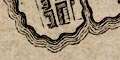
The coast line is drawn with shading or hachures on the inland side to suggest low land, or with rocks to show cliffs. Some areas of cliffs might be labelled, eg:-
Stubington CliffsThe large harbours of Langstone, Portsmouth, etc can all be recognised, as can smaller harbours down to:-
Camberlabelled by Hurst Castle.
Headlands like:-
Stans Ore Pointmight be labelled. But not all, for instance Christchurch Head, referred to by sailing directions, has no label.
Channels in the foreshore might be named, eg:-
Oxsey Lake
Limington CreekThe spit at Calshot is labelled:-
Lands end
The coast line is shaded for emphasis. The coast line is also tinted; pale green-blue around England and Wales, pale green around France, pink for Scotland and Ireland, and the Isle of Man.
Some headlands are noticed, eg:-
Dumnoniorum Prom. / Start Pt.where there is a roman place name.
Hampshire's harbours are not noticed. Elsewhere some are labelled, eg:-
Dubris Portus / Dover
Portus Madurni / AldringtonThe latter is an example of misinterpretation by Stukeley. It is likely to be Portus Ardaoni thought to be the roman fort at Portchester, Hampshire.
The coast is shaded for emphasis.
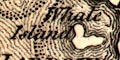
Some headlands and points are named, eg:-
Hengistbury HeadThe county's harbours can be recognised, but are not labelled. The two large harbours are drawn with dotted outlines of their main channels, and some islands, for example:-
Whale Island in Portsmouth Harbour.
The coast line is shaded, and, in the reproduction seen, tinted.
The coast line is shaded for emphasis.

The coast is shaded, but has form lines up Southampton Water and in larger harbours.
A few headlands are labelled:-
Hengistbury Head
Ram's headThe spits at Hurst and Calshot are drawn with dotted lines, like sandbanks.
Harbours are not labelled.
The coast line is emphasised by shading which extends into harbours and up river estuaries.
Some headlands are labelled, eg:-
Hengistbury Head
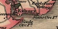
Stanes Ore Point
Rams HeadHarbours are not labelled.
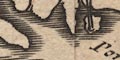
As well as the three large islands, Portsea, Hayling, Thorney, a few smaller islands are drawn in Portsmouth and Langstone Harbours.
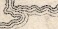
The coast is drawn with form lines, broken lines and dotted lines giving an attractive wavy effect lacking the elegance of strictly engraved form lines. The form lines extend into river mouths and into harbours, which are not labelled.
The coast line is shaded for emphasis on the landward side, and tinted blue to seaward. The land side is tinted for each country. A few headlands are noticed, eg:-
Start Pt
Peveral PAt the top of the sheet is a series of views of coasts. For example:-
Thus the Lizard Point bearing Et. 5 Leagues
The coast line is emphasized by form lines which extend into harbours and river estuaries. A headland might be noticed, eg:-
Hengitsbury Hd. [sic]Harbours are recognisable, but not labelled. The crowded form lines in the harbours suggest several islands.
The coast is drawn with form lines which extend into harbours and river estuaries. As well as Portsea, Hayling and Thorney Islands some smaller islands in Portsmouth and Langstone Harbours are drawn. Only:-
Chichester Harbr.is labelled.
The sea coast is emphasised by form lines which continue up estauries and into harbours, and into the lower part of rivers.
None of the Hampshire harbours happens to be labelled. Spit Head is labelled.
The coast is drawn with form lines, continued into harbours and river estuaries. Some harbours are labelled, eg:-
Langston Harbour
Lymington Hav.
Christ Church Harb.but not Portsmouth Harbour!
The coast line is emphasised by form lines which continue into harbours and estuaries in a wonderful pattern round islands.
Some headlands are noticed, eg:-
Hengistbury Hd.
Spit HeadMost harbours are not named, but see:-
Langston Harb.and a couple more.
The coast line is shaded far out from land.
Some headlands are noticed, eg:-
Selsey Billand perhaps
Spitheadis meant for the headland not the sea area.
The bold line of the coast has either hachures, like shading to landward, to suggest a low slope, or is drawn with rows of little jagged cliffs. At Stubbington these are labelled:-
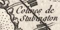
Colines de StubbingtonThe foreshore is dotted, like sandbanks, with creeks and channels clearly shown. These might be labelled, eg:-
Lac Oxsey
Crique LimingtonThe coasts north east of Portsey Island and south of Bedhampton and Farlington are labelled:-
Maraisie marsh; Farlington Marshes etc.
The harbours of Portsmouth and Langston, Southampton Water, and smaller harbours are charted with sandbanks, foreshore areas and channels, which might be labelled, eg:-
Chenal de LangstonIn the sea at the:-
Entree du Havre de Chichesteris the harbour bar:-
BarreNear Keyhaven on the foreshore is labelled:-
Camberfor a small dockyard.
The coast line is shaded. Headlands are not noticed, except:-
Hengistbury HeadSome harbours are labelled, eg:-
Keyhaven
Lymington Hav.
Portsmouth Harb.
Langston Harbour
Same as Kitchin (as far as I can see).
The coastline is shaded, this shading extended into harbours and estuaries. A headland is labelled:-
Hengistbury Head
The coast line is shaded for emphasis.
The coast line is shaded on the landward side giving an impression of its appearance? or perhaps it is just a conventional slightly rounded landform.
The harbour entrance channels are labelled:-
Havre ou Port de Portsmouth
Havre de LangstonPortsea Island is labelled:-
ISLE DE PORTSEYother islands are shown in the harbours, including:-
I Horsey
(plate 20 scroll 1 mile 78)The sea coast is drawn with form lines, for example at Southampton. The form lines extend into river estuaries and harbours.
Only two maps have been studied. In other series of strip maps different treatments of coast have been found on different plates.
There is little opportunity to include harbours. They are drawn at Poole, etc. A turning beyond Christchurch is labelled (plate 20 scroll 5 mile 12):-
to ye Haven
The coast line is emphasised by shading, which extends into harbours and estuaries. Some headlands are labelled, eg:-
Hengistbury Hd.
Spit HeadThe bigger harbours can be recognised, but they are not labelled.
At Redbridge at the end of Southampton water, the coast is drawn with form lines. These extend up the rivers and the canal.
The coast line shaded for emphasis.
Some headlands are noticed, eg:-
St Albans Head
Selsey BillWhile harbours can be recognised only a few are labelled. The Portsmouth, Lansgtone, Chichester harbour area is badly drawn, almost just a bay with small islands.
The coast line is shaded for emphasis. Some headlands are noticed, eg:-
Beachy Hd.
St Catherines Ptand a few harbours are labelled, eg:-
Falmouth HBut not Plymouth or Portsmouth harbours. The harbours of Portsmouth, Langstone and Chichester are badly drawn. But Southampton Water can be recognised.
The coast line is emphasized by form lines. Some headlands are labelled, eg:-
St. Albans Hd.
Spit Hd.
Selsey BillHampshire's harbours are not labelled, but can be recognised.
The coast line is shaded for emphasis, and foreshore areas are shown dotted. Some headlands are labelled, eg:-
St. Albans Hd.
Selsea BillA lighthouse might be shown, eg:-
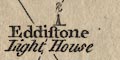
Eddistone / Light Houseon a rock. And harbours might be labelled, eg:-
Pool Harb.Hampshire's large harbours can be recognised, but are not labelled.
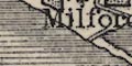
The coastline is drawn to suggest its appearance; a low line of cliff at Milford, a flat line at Pilewell, etc. The foreshore is shown as a graded dotted area, perhaps with labelling, eg:-
Vase
GravierOne part of the foreshore, and its navigation hazards, is described in greater detail (forgive my translation):-
The highest part of the mud bank bewteen Hurst and Pilewell covered at about 5 3/4 hours of the flood of spring tides at 17 feet. It is rarely or almost never covered by the top of the tides at New Moon.Headlands are noticed and labelled, mostly on the Isle of Wight; the Hampshire coast doesn't have headlands much on this particular stretch of coast.
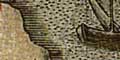
The map studied has two views of the coast from seaward.
View 1
The view is taken on the line where Sconce Point begins to appear behind Round Tower Point.These are points on the Isle of Wight. The view shows Hurst Castle, The Solent, and the coast of the island. The other view is the entrance to The Solent from further out to sea.
(page 10/104 scroll 4 mile 75)There are coast form lines which extend into river mouths.
The coast is shaded and tinted inland. The islands are harbours at Portsmouth etc, are recognisable, as is Southampton Water.
The coast has form lines which continue into harbours and estuaries.
The coast is emphasised by form lines which extend into river estuaries and harbours. Some headlands are labelled, eg:-
Hengistbury HeadAnd some harbours, eg:-
Portsmouth Harbour
The coast line is shaded horizontally, taken up into harbours and river estuaries.
Coast form lines emphasize the coast line. These are more extensive in estuaries and harbours, which also have channels marked between shallows. harbours may be labelled, eg:-
PORTSMOUTH HARBOUR
Titchfd. Haven
Langstone HarbourSome of the islands in Portsmouth Harbour are named:-
Whale Island
Horsey IslandThe coast is drawn in some detail, with some features named, eg:-
Hengistbury Head
High Cliff
Barton CliffAlthough it is not unusual, the shape of the spits at Hengistbury, Hurst, opposite Exbury, Calshot, Titchfield Haven, etc, are all drawn with the form typically caused by a tidal stream along a coast.
The coast line is emphasised by form lines.
The form lines are continued into harbours, round the three 'islands'.
PORTSMOUTH HARBOURis labelled and has islands, of which
Whale I.
Horsea I.
Pewit I.are labelled. The main channels and some islands in Langstone Harbour are shown as are those around Thorney Island which is drawn well separated from the mainland. Some channels are labelled, eg:-
Emsworth ChannelIslands:-
PORTSEA ISLD.
HAYLING ISLAND
THORNEY ISLD.are all drawn as distinct islands.
The coast is emphasised with form lines.
and an island
Portsea I.is labelled.
The coast is drawn with a bold line plus form lines which extend into harbours and river estuaries.
Only a couple of harbours are labelled:-
Portsmouth Harbour
Langstone HarbourThe only headland labelled is:-
SPITHEAD
The coast is drawn with a bold line and form lines. These extend into harbours, and into river estuaries, which are exagerated.
The coast line is shaded for emphasis extending into harbours and estuaries. There may be hachures along the coast line to suggest cliffs, eg:-
near Milton.
Harbours can be recognised but are not labelled. Numerous islands are shown in Portsmouth Harbour, and one in Langstone Harbour.
The coast line is emphasised by form lines, tinted a mid blue.
The coast line is emphasized by form lines. Extending some way from the coast these produce very satisfying patterns of engraving.
In places the foreshore shallows are indicated, for instance off Selsey Bill.
There is a suggestion of coast appearance; by hachures for low cliffs near Lymington River, by dotted tussocks for marshy areas at Southsea.
A few headlands are labelled, eg:-
Hengistbury of Christchurch Head
Needsore Pt.Harbours are recognisable but mostly not labelled, except:-
PORTSMOUTH HARBOURA crude beacon/tower symbol on Hurst Point is labelled:-
Lighthouse
The coast is drawn by a bold line feathered to landward, with indications of the sort of beach, or cliffs, or rocks, ... Coast features are labelled, for example:-
Hengistbury Head
Stans Ore Pt.
Cliffs
Soley hardDotted areas show foreshore along the coast.
Islands are cleared charted, using the same coast line as the main land, and might be labelled, eg:-
Binster Is.
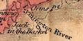
Horsey
Pewit I.A ?lighthouse is drawn near Hurst Castle, a tower labelled:-
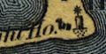
Light
Jack in the BasketA ?beacon on the sandbank off shore of the Lymington River eastuary and channel is drawn as a ?cresset, a fire basket, on a post, labelled:-
The coast line is basically a thin line. In places the line becomes cliffs; low cliffs west of Hurst:-
more dramatic cliffs at:-
CULVER CLIFFon the Isle of Wight.
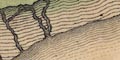
To landward of the coast line there might be hill hachuring to suggest landform.
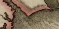
At the end of Hurst Spit are three dots, buildings, and a label:-
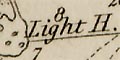
Light H.Some harbours are labelled, eg:-
PORTSMOUTH HARBOUR
Langston Harb.Channels are shown through the shallows in Portsmouth Harbour.

The coast is emphasised by form lines which extend into harbours and estuaries.
The coast is drawn with foreshore shallows, drawn by pecking as sandbanks. The coast appearance is suggested by hill hachuring in places, for example north of Stokes Bay.
The coast line is shaded.
The large harbours and islands, Portsea Island and Hayling Island, are recognisable, but ill drawn.
The sea is plain; the coast line is shaded for emphasis. The shading extends into estuaries and harbours; which are otherwise not noticed.
The coast is emphasised by form lines.
A harbour might be labelled, eg:-
Port. Ha.
The coast is shaded for emphasis. Although the map shows, crudely, the configuration of Southampton Water and Portsmouth Harbour, these are not labelled.
The coast line is just a bold line. But in harbours, estuaries an the lower parts if rivers there might be form lines as well:-
Portsmouth Harbour
Southampton Water
The coast line has horizontal shading and a darker blue tint, for emphasis. The shading extends into river mouths and harbours.
Some harbours are labelled:-
Portsmouth Harbour
Langstone Harbour
The coast line is shaded for emphasis.
Along the coast headlands might be labelled. While Portsmouth Harbour can be recognised it and other harbours are not labelled.
The coast line is emphasized by elegant form lines. The engraving is in two stages: from the coast line out across the foreshore, reducing to nothing; from the edge of the foreshore out into the sea, reducing again. The engraving is eye catching, particularly around the channels in Portsmouth Harbour and the East and West Winner at the entrance to Langstone Harbour, sheet 11.
Channels in the foreshore are clearly marked, and occasionally labelled, eg:-
Ashlet Lake
Oar CreekRocks might be marked on the foreshore.
Where there are cliffs the coast line is drawn to show their appearance from the sea, for example west of Hengistbury Head and the coast off Milton.
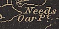
Headlands are noticed eg:-
Needs Oar Point
Stone Point
Gilkicker PointThe shallows and channels and islands are drawn in the harbours, some of which are labelled, eg:-
PORTSMOUTH HARBOUR
Langston HarbourIn Portsmouth Harbour there are labelled:-
Pewitt Island
Horsea Island
Whale Id.
Porchester Lake
Fountain Lake
Fareham Lakeas well as the coastal features. Notice the use of 'lake' for channel. The term has two meanings, from two separate roots; here it means channel from its teutonic root.
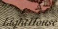
On Hurst Spit there is labelled:-
Light House
The coast line is shaded for emphasis.
Portsmouth Har.is labelled.
The coast is just a line.
Harbours can be recognised, but are not labelled, except, perhaps:-
Portsmouth Hd
The coast line is emphasized by shading, with extra shading as a shadow to the east and south. The coast line appears to be detailed and accurate.
The coast line is shaded for emphasis, the shading extending far into the sea, and extra shading on east facing coast lines.
One headland is named on the Hampshire coast:-
Hengistbury HeadThe various harbours can be recognised, but only the larger ones are labelled:-
Portsmouth Harbour
Langstone Harbour
The coast line is pretty well drawn; it is possible to recognise Hampshire features - The Solent, Spithead, Southampton Water, Portsmouth Harbour, Langstone Harbour, Portsea Island, Hayling Island, etc etc.
Some headlands are noticed, eg:-
BEACHY HD.
The coast line is emphasised by a blue tint. Some headlands are noticed, eg:-
Hengistbury Head
Stans Ore Point
Woolston Pt.Most harbours are not labelled, but see:-
Portsmouth HarbourThis and the other large harbours are drawn with some islands.
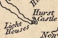
On Hurst Spit there are:-
Light HousesAlso notice the lighthouse on the cliff above the Needles.
The coast line is shaded more densely for emphasis, and tinted blue. The shading is continued into harbour areas; Southampton Water, Portsmouth Harbour, and Langstone Harbour, can be recognised, but are not labelled.
The coast line is shaded for emphasis.
Harbours can be recognised, the areas drawn with from lines, not shading.
The coast is drawn with form lines which extend into harbours and river mouths. One harbour is noticed:-
Por. Har.
The coast is drawn with a bold line and form lines extending out into the sea area. On this very small map only Southampton Water shows clearly, Portsmouth and Langstone harbours are shown inaccurately.
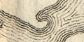
The coast line is emphasised by form lines which are drawn decreasing across the foreshore, and then a new sequence decreasing further into the offing. In other places a narrower foreshore is just dotted. Where the coast has cliffs their appearance is drawn, or suggested, in perspective, perhaps with hachures behind. At river mouths, especially with a shapely foreshore, the engraving of the form lines is fascinating and attractive.
Some headlands are labelled, eg:-
Hengistbury Head
Gilkicker PointAt Hurst Spit a tower is drawn, labelled:-
Light Ho.and off St Helens, Isle of Wight, is a drawing a ship with a light atop its mast, labelled:-
LightOn a cliff top south west of Milton is a:-
Preventive StationThe large harbours are labelled:-
PORTSMOUTH HARBOUR
LANGSTONE HARBOURand one small harbour is named:-
Hell Head Havensouth of Titchfield.
In the harbours the shallows and channels are drawn and emphasised by form lines; islands might be labelled, some channels might be labelled.
Although some care has been taken to prevent hachures from obscuring other features and labelling, the form lines often do make it difficult to read other stuff on the map.
The coast line is emphasised by form lines extending some way out to sea and into harbours and river mouths.
Harbours are clearly shown. The form lines continue into the harbours, and main channels are also indicated. Some harbours are labelled, eg:-
PORTSMOUTH HARBOUROn the channel of the Lymington River there is a ?post labelled:-
A 'Beacon' and something labelled:-
Beaconand a further post with a ?cross bar, labelled:-
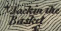
Jack in the BasketSome headlands and are labelled, eg:-
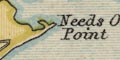
Needs Ore Point
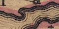
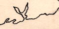
The coast is emphasised by being drawn with a wiggly line which is for effect, not representing the exact coast line.
Harbours are shown, and might be labelled, eg:-
Portsmouth Harbour
LANGSTON HARBOUROthers are implied by harbour or haven placenames.
Some headlands, etc, are labelled, eg:-
Hengistbury Head
Needs Ore Point
Stans Ore Point
Browndown PointAt Hurst Spit there are:-
Light Houses
The coast is shaded or hachured on the landward side, further emphasised by the tinting of the county boundaries. Although headlands, harbours, etc are clearly drawn, none are labelled for Hampshire. Further east a headland and lighthouse:-
Beachy Head
Revolving Lightare labelled.
Heyling I.is labelled.
The coast line is shade.
Some headlands are labelled, eg:-
Needs Ore Pt.
Hengistbury Hd.Some channels in harbours are marked by a foreshore line, for instance in Southampton Water, and the harbours of Portsmouth, Langstone and Chichester.
Portsmouth Harb.
Chichester Harbourare labelled.
The coast line is emphasised by form lines. Of the headlands only:-
Hengistbury Headis labelled, and of the harbours only:-
Portsmouth Harb.The form lines in the larger harbours suggest some of the islands.
The coast line is emphasised by form lines.
Some headlands are labelled, eg:-
Hengistbury HeadSome harbours are explicitly labelled, eg:-
Keyhaven
Portsmouth Harbour
The sea and coast line are plain.
The coast line is emphasised by one or two form lines.
Portsmouth, Langstone and other harbours can be recognised but are not labelled.
The coast line shaded for emphasis.
The two larger harbours are labelled:-
PORTSMOUTH HARBOUR
LANGSTON HARBOURSome headlands are labelled, eg:-
Needs Ore Point
The coast line is perhaps shaded.
A few headlands are labelled, eg:-
Hengistbury Head
Needs Oar Pt.and some of the harbours are labelled, eg:-
Portsmouth HarbourOn Hurst Spit there is labelled a:-
Light Ho.The two large islands are labelled:-
PORTSEA ISLE
Hayling I.
The coast line is not emphasised. Some headlands are noticed, eg:-
Hengistbury Hd.
Needs Oar Pt.Harbours are not particularly noticed, only:-
Portsmh. Harb.is labelled.
The coast drawn by a line. No coastal features are noticed.
The coast line emphasized by form lines and tinted blue. The form lines are continued in estauries and harbours. Harbours are recognisable, but not labelled.
The coast line is shaded, the shading taken into harbours and river mouths, and extended out into the sea. Some sea areas are labelled, eg:-
SPITHEAD
Christ Church Bayas are some harbours, eg:-
Southampton Water
Portsmouth HarbourFew headlands are labelled, eg:-
Hengistbury Head
The coast line is plain.
Besides clearly drawn estuaries some harbours are explicitly labelled, eg:-
Key Haven
PORTSMOUTH HARBOURSome headlands are noticed, eg:-
Stans Ore Point
Gillkicker Pt.On Hurst Spit there is labelled:-
Lightand another on Tennyson Down above the Needles on the Isle of Wight.
The coast line is shaded.
The coast is just an engraved line. In places the coast appearance, eg cliffs, is drawn, as in Christchurch Bay. There is also a dotted foreshore line, whichshows channels in the harbours.
Some coastal features are labelled, eg:-
Hengistbury Head
Needs Ore Point
Gillkicker pointHarbours are clearly drawn, and some are labelled:-
Portsmouth Harbour
Langston Harbourbut not the smaller havens.
A lighthouse is labelled at Hurst:-
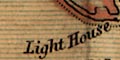
Light House
The coast line is drawn with some pecked shading to landward, and tinted pale brown. The land behind is tinted pale green. The foreshore is dotted and tinted, and might have letters indicating its nature, eg:-
clfor clay. Some foreshore areas are labelled, eg:-
Hamilton Bk.
East WinnerHeadlands are labelled, eg:-
Lee point
Gilkicker Pt.Harbours are clearly drawn with channels with depth soundings, etc. Eg:-
PORTSMOUTH HARBOUR
Hill Head HavenThe River Hamble has a series of posts marking the channel.
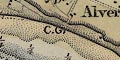
Along the coast there are letters:-
C.G.where there are coast guard stations.
Topography inland is noticed only for a short way from the shore, but includes features for their usefulness as sea marks - windmills, monuments on the sky line, stark white chalk quarries, etc. Some of these are used to define leading lines which are drawn in the sea areas, eg:-
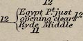
Egypt Pt. just opening clears Ryde Middle
Kickergill in one with the Centre of Fort Monkton N.N.W. leads up to Spithead
N. 1/2 E. Nelson's Monument in one with E. end of trees on Portsmouth lines, leads E. of the Princessa and warner, & W. of the Nab.
Dock Mill in one with W. end of large Chalk pit. Mark for the Buoy. View H.The last refers to a windmill, Dock Mill, east of Southsea village, drawn by a post mill symbol, and the chalk pit on Portsdown. This leading line marks the buoy 'Bembridge Ledge Black' off Bembridge Point, Isle of Wight. Coast view H is printed at the bottom centre of the chart, labelled:-
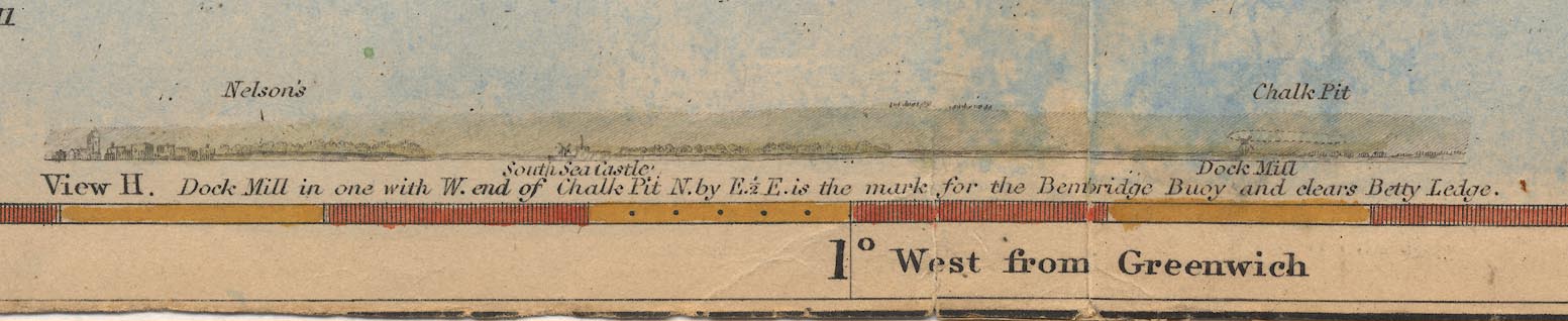
View H. Dock Mill in one with W. end of Chalk Pit. N. by E. 1/2 E. is the mark for the Bembridge Buoy and clears Betty Ledge.The view includes Nelson's Monument on Portsdown, Southsea Castle and part of Portsmouth.
Lights are noticed along the coast, for example:-
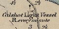
Calshot Light Vessel R. every minutedrawn by a small ship, a black disk atop its mast. And marked by a black disk within the castle area:-
Southsea Castle Light F. 51 feet Green to the W. Red to the E.Off the coast off the Isle of Wight, north of Ryde is a hilk labelled:-
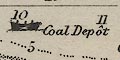
Coal DepotAnd another labelled:-
Lazarettoan isolation hospital to quaranteen seamen with infectious diseases.
The coast is emphasisied by shading which extends into harbours and river estuaries.
The coast line is unemphasised.
On Hurst Spit is labelled:-
Light Housesand west of Stans Ore Point is a ?tower, unlabelled.
Some harbours are labelled, eg:-
Portsmouth Harbour
The coast line is emphasised by shading, a second lot of shading lines in between the sea shading. This extends to fill harbours and estuaries.
Harbours can be recognised, only a couple are labelled, eg:-
Portsmouth Har.
Key Haven
The coast line is emphasised by form lines. The map has an accurate outline, so harbours are recognisable, though unlabelled.
The coast line is emphasised by shading. A variety of coastal features are labelled, eg:-
Hengistbury or Christchurch Head
Stans Ore PointAt a few places there is an attempt to show the coast appearance; for instance, indication of low cliffs between Browndown Point and Titchfield Haven:-
Harbours are noticed and labelled, but the name is sometimes implied by the nearby place as at Christchurch where is:-
Haven
Titchfd. Haven
Langston Harbour
PORTSMOUTH HARBOURwhich also has:-
Dock YardThere is another
Dock Yardat Buckler's Hard on the Beaulieu River.
The coast line is tinted blue. Some headlands are labelled, eg:-
Hengistbury Head
Stone Point
Gilkicker PointThe coast is finely plotted, estuaries and harbours in some detail. The larger harbours are labelled, eg:-
PORTSMOUTH HARBOUR
Langston HarbourOff Cadland Park is a:-
QuayOn Hurst Point there is a:-
Light Ho.
The coast line is emphasised by form lines out to a line for the foreshore; perhaps the low tide mark, also showing channels in harbours and estuaries. From this line form lines continue seawards conforming to the new line. The effect is very attractive.
Some headlands are labelled, eg:-
Hengistbury Head
Gilkicker Pt.and along the coasts of Poole and Christchurch Bays there are labels for a series of chines, cliffs and bunnys.
The coast appearance, low cliffs, is drawn on the shore of Christchurch Bay. A line of hill hachures continues this suggestion, low rising land from the coast, from Lymington to Exbury.
Some lighthouses are indicated, for example at Hurst Spit:-
Lightsand at Southsea:-
Southsea Cas. & Lt.Also notice some lightships. In the entrance to Southampton Water is a ship with a single mast labelled:-
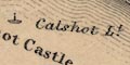
Calshot Lt.and off the east end of the Isle of Wight is a two masted ship:-
Nab LightA few harbours are labelled:-
Key haven
LANGSTON HARBOUR
PORTSMOUTH HARBOURChannels are shown in the larger harbours, and small islands are shown, perhaps labelled, eg:-
Pewit Is.
The maps include a few stretches of Hampshire coast. The coast line is unemphasised.
Foreshore areas might be outlined by a dotted line.
Some headlands are labelled, eg:-
Gilkicker Pt.The major harbours are labelled:-
PORTSMOUTH HARBOUR
Langston HarbourIn the harbours the channels, shallows, islands are shown, and perhaps labelled, eg:-
Horsea I.
Porchester Lake
The coast line is tinted for emphasis. A few headlands are noticed, eg:-
Hengistbury Head
Selsea BillThe larger harbours are labelled, eg:-
PORTSMOUTH HARB.The foreshore of The Solent and Southampton Water, and the channels in the harbours, are outlined by a dotted line.
The coast line is not emphasised. A few headlands are noticed, eg:-
Hengistbury HeadSome harbours are labelled, eg:-
Portsmouth Harbour
Chichester Harbourthough the latter label is on Langstone Harbour by mistake.
The coast line is emphasised by form lines, which continue into river estuaries and harbours. The most important harbour is labelled:-
Portsmouth HarbOne of Hampshire headlands is labelled:-
Hengistbury Head
The coast line is unemphasised; foreshore areas are indicated by a dotted outline, with some channels marked. Some headlands are labelled, eg:-
Hengistbury Head
Stone Point
Gilkicker PointOn Hurst Spit there is a:-
Light Ho.The larger harbours are labelled:-
PORTSMOUTH HARBOUR
Langston HarbourAt Southampton there is a:-
Dock
The coast line is emphasised by shading on the inland side. A few headland are noticed, eg:-
Hengistbury Headand some lighthouses, eg:-
Light [at Hurst]
Needles Light
The coast is shown by a plain line.
Some harbours are labelled, eg:-
Portsmouth Harb.Headlands are not much noticed, but see:-
Hengistbury Head
Gilkicker Pt.
The coast line has a red tint, because it is a county boundary.
Some headlands are noticed, eg:-
Hurst Pt.Hampshire's harbours are all recognisable, but not labelled.
The coast line is unemphasised, except that it is tinted where it is the county boundary.
A couple of headlands are noticed:-
Hengistbury Head
Gilkicker Pt.The two large harbours are labelled:-
Portsmouth Harbour
Langston Harbour
The coast line is emphasised by more shading.
Some headlands are labelled, eg:-
Hengistbury Head
Needs Oar Point
Stone Pt.The larger harbours are labelled, eg:-
PORTSMOUTH HARBOUR
LANGSTON HARBOURAnd on Hurst Spit there is a:-
Light Ho.
The coast line is shaded.
Some headlands are noticed, eg:-
Hengistbury Head
Gilkicker Pt.and some harbours are labelled, eg:-
Key Haven
PORTSMOUTH HARBOURAt Southampton there are labelled:-
Docks / PierOn the end of Hurst Spit is labelled;-
Lightfor the ?two lighthouses there.
At intervals along the coast are letters:-
C.G.S.which stand for Coast Guard Station. there are quite a lot, for example at the west end of Hurst Spit, Lymington, Sowley, mouth of the Beaulieu River, Lepe, and places west and east of this group.
The letters:-
L.B.S.stand for Life Boat Station, for example at the south west tip of Hayling Island. The letters are quite hard to see as they are drowned in the sea tint and coast shading.
The coast line is emphasised with pale orange.
Only the two large harbour areas are noticed:-
Portsmouth Harbour
Langston HarbourA couple of headlands are labelled:-
Gilkicker Pt.
Hengistbury Head
The sea are is plain, some areas labelled, eg:-
ENGLISH CHANNEL
SOLENT
SOUTHAMPTON WATERThe land area is in relief, but not showing any relief features. The coast line is just the boundary between the two. Some headlands are noticed, eg:-
HENGISTBURY H[D]
The coast line is shaded for emphasis. Harbours are recognisable but not (Hampshire) labelled.
The coast line is a plain line. There are dotted lines outlining foreshore and channels in harbours etc.
The two large harbours are labelled:-
Portsmouth Harbour
Langstone Harbour
The coast line is a plain line.
Some headlands are labelled, eg:-
St. Albans Head
Selsea BillA few harbours are noticed, eg:-
Poole Harbour
The sea area is plain, labelled:-
ENGLISH CHANNEL
STRAIT OF DOVERwith smaller areas labelled, eg:-
Spithead
The Solent
Southampton Wr.
The coast line is tinted blue.
The larger harbours of Hampshire can be recognised but only:-
Langston Harb.is labelled.
Some lighthouses are noticed, eg:-
L.H. [on Hurst Spit]
The coast is emphasised by form lines.
The coast line is not emphasised.
Harbours are clearly recognisable, but not labelled.
The coast just a line.
Portsmouth Harbour is drawn with channels and labelled:-
HARBOUROn the other side of Portsea island is:-
LANGSTONE HARBOUR
The coast line is a bold dark blue line, emphasised by blue tinting in the offing.
The shape of the coast line, even allowing for the small size of the map, is not very good.
The foreshore area is printed pale brown with black dotting, and creeks and river inlets and estuaries and tussocks of marsh grass, etc:-
Some of these areas might be labelled, eg (from sheet 132):-
Thorns Beach
Little Marshboth west of the Beaulieu River estuary; and:-
Hamble Spit
East Winneretc. The coast appearance might be drawn, as at Ballard Point and around Durlston Head in Dorset (sheet 141) where hachures show lower or higher cliffs. Some headlands might be labelled, eg (from sheet 132):-
Needs Oar Point
Stone Point
Gilkicker PointHarbours are clearly drawn, with channels and islands among the mudflats, and labelled, eg:-
Titchfield Haven
Portsmouth HarbourThe large docks are shown at Southampton, eg:-
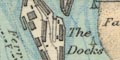
The Docks
The coast is just a line. Some headlands are labelled, eg:-
St. Alban's Hd.
Selsey BillAnd some harbours are labelled, eg:-
Poole Harbourbut not Portsmouth Harbour!
The map has a coast line across the south of England.
The coast is just drawn by line.
coast line |
|||||||||||||||||||||||||||||||||
| line |  |
 |
 |
 |
 |
|
|
|
|
|
|
|
|
|
|
|
 |
|
|
|
|
|
|
|
|
|
|
|
|
|
|
|
|
| shaded | |
|
|
|
|
|
|
|
|
|
|
|
|
|
|
|
|
|
|
|
|
|
|
|
|
|
|
|
|
|
|
|
|
| form lines | |
|
|
|
|
|
|
|
|
|
|
|
|
|
|
|
|
|
|
|
|
|
|
|
|
||||||||
| appearance | |
|
|
|
|
|
|
|
|
|
|
|
|
|
|
|
|
|
|
|
|
|
|
|
|
|
|
|
|
|
|
||
| lighthouses | |
|
|
|
|
|
|
|
|
|
|
|
|
|
|||||||||||||||||||
Williams-Freeman, J P: 1934: Coast of Hampshire: ProcHFC: vol.12: pp.215-220
Coles, K Adlard: : Creeks and Harbours of the Solent: Edward Arnold Publishers (London)
