
 Return to list of Features

NB: typical illustrated examples are described, NOT ALL examples.
absence of evidence is not evidence of absence
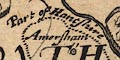
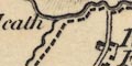
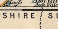
The map does not have county boundaries and on the whole does not name counties. 8 county names are given, all in the south of England; Norfolk, Suffolk, Essex, Kant, dorset, Somerset, devonia, Cornubia. Hampshire is not named.
There are no county boundaries, and only some counties are labelled, eg:-
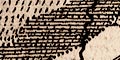
BERCHERIACounty towns are differentiated as described by the table of symbols.
County boundaries are not drawn but county areas are labelled, eg:-
Sout- / -hamptonfor Hampshire.
County boundaries and names are not shown.
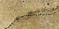
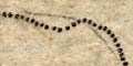
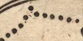
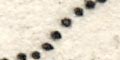
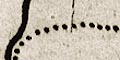
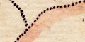
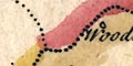
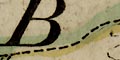
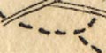
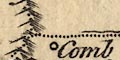
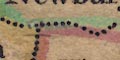
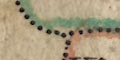
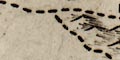
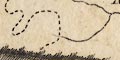
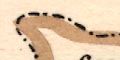
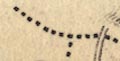
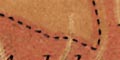
The county boundary is a finely dotted line.
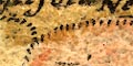
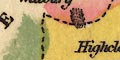
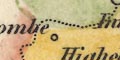
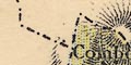
Contiguous counties area named. The detached part of Hampshire to the east is missed.
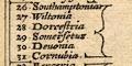
County boundaries are drawn by dotted lines. The county areas are labelled with a number referring to a table of counties which is printed upper left in a strapwork cartouche:-
INDEX OMNIUM COMITATUM, notis et figuris suum ciusq~ situm et ambitum designatibus
1. Nothumbria
2 Dunelme~sis
...
26 Southamptonia
27 Wiltonia
28 Dorcestria
29 Somersetus
30 Devonia
31 Cornubia
...
52 CardiganHampshire is bracketted together with the more south western counties.
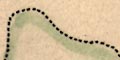
On the map studied some of the county areas are coloured, some just have a tint along their border. Hampshire has an orangey boundary, Dorset magenta, Wiltshire pale green, Berkshire yellow fill and darker yellow boundary, Surrey pale brown, Sussex pale green; all the colours are faded or aged.
IN a cartouche below this is:-
Animadvertum; nos propter locoru~ [a]ngustias urbes tantu~ oppida mercatoria castella et loca quaedam celebratiora hac tabula inclusisse.
Some counties are labelled, eg:-
VILSHIREbut there are no boundaries, and many unlabelled.
Each county on the map is painted a different colour, the colour a little deeper at the boundary, but there is no boundary line. Hampshire is a yellowish green, Wight is pale purple, Dorset pale purple, Wiltshire mid green, Berkshire a greeny yellow, Surrey pink, Sussex greeny yellow. From a cartographic point of view the choice of colours is poor, failing to clearly delimit counties, and having one colour, Kent's very dark green, badly out of balance with the rest.
The county areas are labelled, round Hampshire there are:-
DORCESTRIA
WILTONIA
HANTONIA
BERCERIA
SURRIA
SOUTHSEXIA
WIGHTetc.
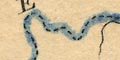
The county boundaries are dotted lines. Where these run along a river the river and boundary are drawn side by side. Counties are labelled in Latin, eg:-
SOUTH SEXIA
SOUTHAMPTONIA
The Hampshire Dorset boundary is missing (perhaps this shifting boundary confused the map maker). The county is labelled:-
SOUTH: / AMTONIAThe title cartouche has 2 Hs.
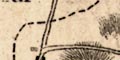
The county boundary is a dotted line. Adjoining counties are labelled, eg:-
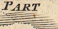
parte of Wiltshire
PARTE of SusSEXwith a mixture of swash and plainer mixed case lettering. The detached:-
part of hamshirefrom Ambersham to Fernden, is drawn and labelled.
County boundaries are not shown, but some county areas are labelled, eg:-
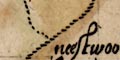
Sout Hampton
Wilshire
Southreyin upright lowercase text, usually split up on several lines.
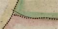
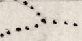
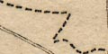
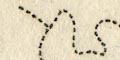
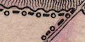
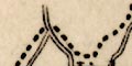
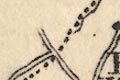
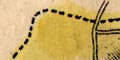
The county boundary is a dotted line
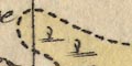
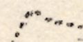
Swash lettering is used to fill space and label the adjoyning counties and the sea area south of Chichester
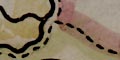
The county boundary is a dotted line.
Swash lettering is used to fill space outside Hampshire, naming the adjacent counties. Eg:-
PARTE OF WILTSHIRE
The boundaries between countries and between counties are confused by the style of engraving. The greater boundaries looks as if they should be dashed lines and the lesser dotted. If you follow the lines you will be confused. The colourist has not helped by colouring the english scottish border along Hadrian's Wall with Northumberland in Scotland. The position of Monmouthshire is also confused. Counties are labelled, eg:-
HANTSHIRE
WILTSHIRE
There is no county boundary. The map is labelled with names:-
DORSET / SHERE
HAMP / SHERE
County boundaries are drawn by dotted lines. Counties are labelled; in the Hampshire area:-
Wiltonia
Berceria
Surria
Sout sexiaand
Southamtonia
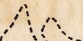
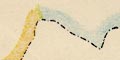
The county boundary is a fine dotted line. There are two visible lines; a lighter, less definite, continuous line as well as the bolder dotted line. Perhaps the indefinite line is a rough guide line scratched on the plate before engraving the boundary proper? There are other faint trace lines under/by some rivers.
The detached part of Hampshire to theneast is not included.
Adjacent counties are labelled in various styles, lareg and perhaps swash lettering, eg:-
PART OF WILT SHIREA few towns are also marked and labelled in the adjacent counties around the Hampshire border.
County boundaries are dotted lines. The areas are not labelled.
Counties are noticed inland, county borders are a dotted line, tinted. The areas are named, eg:-
HANTSHIRE.
Counties are not noticed.
County boundaries are a dotted line, the county areas are labelled, eg:-
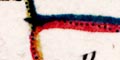
SOUTH HA~P TON SHI REspread about the area. Text placement is not one of the charms of this map! The boundaries are tinted on the county's side; Hampshire red, Dorset orange, Wiltshire yellow, Berkshire orange, Surrey yellow, Sussex, orange. The tints are faded, and may have been misinterpreted.
The county boundary is a dotted line. The external piece of Hampshire, in West Sussex, is drawn.
The adjacent counties are given 'Latin' and English names, eg:-
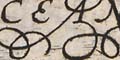
SURRIA Vulgo SURREY
DORCESTRIA Vulgo DORSETSHIREFairly decorated lettering is used for these space-filling names.
(When the names get to Somersetus on other maps in the series it is hard to keep thoughts of Asterix out of ones head, and not to giggle.)
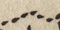
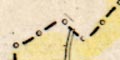
The county boundaries are dashed lines; remember the map is of two counties, Hampshire and Berkshire. The two counties are labelled, eg:-
HANT / SHI: / RE.The detached part of Hampshire in West Sussex is included, labelled:-
PART of HAMSHIRE.Adjacent counties are labelled, eg:-
PART OF SURREYwith or without flourishes on the lettering depending on how much space there is. Dotted lines delimit the adjacent counties.
The county boundaries are each tinted on their county side: Hampshire yellow, Berkshire pink. Adjacent counties also have a tint: Dorset pink, Wiltshire green, Gloucestershire yellow, Oxfordshire greenBucks yellow, Surrey green, Sussex pink, Isle of Wight green. The detached part of Hampshire and the detached parts of Wiltshire are coloured to match their county. But Hayling Island and Whale Island are coloured pink? and Thorney Island green?
Map colourists are said to have no interest in the 'four colour' theorem - which wasn't formulated, and then by a mathematician not a map maker, until the mid 19th century. However, just for fun, I note that it is possible to colour this uncomplicated map with three colours rather than the four used.
County borders are not drawn, but areas are labelled eg:-
SOUTHAMTON
The county boundary is a dashed line, emphasised by tinting. Boundaries might separate adjacent counties, which are labelled, eg:-
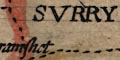
PART OF SURRY
County boundaries are dotted lines; the county shapes are crude. County areas are labelled, eg:-
HA MP SH.
The county boundary is a dotted line. The contiguous counties are labelled,
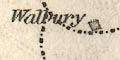
Pt. of Wiltetc. These labels appeared on the 2nd edition of the playing cards in 1676.
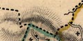
County boundaries are dotted lines. On the map studied the boundary was tinted on the inner side for each county. The county areas are labelled, eg:-
HAMPSHIRE
County boundaries are dotted lines. The county areas are labelled, eg:-
HANT SH.
The county boundary is a dotted line; pretty blobby engraving. The surrounding counties are labelled, eg:-
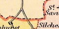
PART OF BARK SHIREHardly anything is engraved in the surrounding counties (this is not unusual). Roads and rivers are continued just over the border. Farnham in Surrey is shown.
The chart shows no county boundaries, but counties are labelled, eg:-
HANT SHIRE
The county boundaries are dotted lines, tinted differently along each county's side; Hampshire yellow, Dorset pink, Wiltshire orange, Berkshire green, Surrey orange, Sussex pink (colours have probably faded from their original hue). The county are is labelled, eg:-
HA SH.
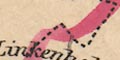
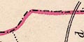
Mostly as original.The county boundary has been made bolder. There are a few minor alterations: the boundary with Dorset, just N of the coast now encloses Preston and Parley; the boundary at the Shire Oak, this non-original detail removed, is slightly altered; the border with Wiltshire near Lymwood is altered, perhaps just to make space for the added place name!
The detached part of Hampshire in Sussex is now recognised; Saxton did not show it.
There is a too broad circle around Ambersham, but the boundary of the part has not been extended north to include Fernhurst etc. It is labelled:-
Part of Hantshire
County boundaries are a dotted line, tinted on this copy of the map. Counties are labelled in upright block caps, though at a slant across the sheet to suit the county. Eg:-
HAMPSHIRE
The chart shows no county borders, but areas are labelled, eg:-
SOUTHAMPTON
The county boundary is a dotted line. Adjacent counties are labelled, eg:-
PART OF BERKSHIREand their boundaries shown for a short way from the Hampshire border. The detached part of Hampshire in West Sussex is shown, labelled:-
Part of Hampshire
The general chart has no county boundaries, but counties are labelled, eg:-
HAMP SHIRE
The county boundary is given by a dotted line. The surrounding counties are labelled in plain lettering.
County boundaries are dotted lines, tinted on the county side with a colour. The county areas are labelled, eg:-
HAMPSHIRE
County boundaries are dotted lines, and are unexpected shapes. These are not boundary lines but lines enclosing places and bits of road that belong in a county. The county 'areas' are labelled, eg:-
HAMP S.
County boundaries are dotted lines, the inner side of each county tinted. The county area is labelled, eg:-
HAMPS.
County boundaries are not shown, but county areas are labelled, eg:-
PART OF DORSETSHIRE
HAMPSHIREThe 'part of' referring to how much coast is shown.
The county boundary is a dotted line. Adjacent counties are labelled, eg:-
PART OF WILT SHIREThe detached part of Hampshire in Sussex is not shown.
County boundaries are dotted lines, tinted on the inside of each county in red, yellow or green. The county shapes and their inclusion of places is awfully bad, considering the contemporary knowledge of the shape of the country.
Each county is labelled in italic block caps, eg:-
HAMP S.
County boundaries are dotted lines, and are weird shapes. The county is outlined to separate bits of the road diagram and are not intended to show the shapes of the land areas. County areas are labelled, eg:-
HAMP / S
The county boundary is a dotted line with heavy shading. The surrounding counties are labelled, and heavily pecked to make an ugly background.
The county boundary is a dotted line, on the map studied this is tinted. The detached part of Hampshire in West Sussex is not inlcued on the map.
Adjacent counties are labelled, eg:-
Part of WILTSHIREand their boundaries shown for a short way out from the Hampshire border.
The county boundary is a dotted line emphasised by horizontal shading. Contiguous conties are labelled, eg:-
WILT SHIRE
PART OF DORSET SH.A little is drawn in the surrounding counties, Salisbury, Chichester, Farnham, Downton and some rivers and parts of roads.
The boundaries between the outside counties are not drawn except a dotted line between Surrey and West Sussex. The detached part of Hampshire in West Sussex is not included.
The county boundary is a dotted line. Adjoining counties are labelled, eg:-
SURREY
WILTSHIRE
The county boundary is a dashed line, heavily shaded on the outer side. The area outwith Hampshire is pecked, to throw the county into relief. Dotted lines divide adjacent counties, which are labelled, eg:-
P. OF DORSET SH.The detached part of Hampshire in Sussex is not shown.
Outside the county, Pool, Salisbury, Farnham and Chichester are shown for the sake of continuity of roads. Pool lies outside the latitude scale in the map border; it was not planned for. The way these places are added to the plot is symptomatic of the poor quality of the map.
The county boundary is a dotted line, Hampshire is the title of the map. Adjacent counties are named, eg:-
WILT SH.and separated by a dotted boundary lines. Significant places, road destinations, are drawn and labelled outside the Hampshire area; Salisbury, Farnham, Downton, Bagshot, and little more.
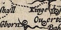
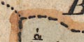
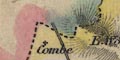
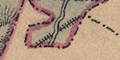
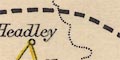
The detached part of Hampshire to the east is shown, marked:-
Hexplained as Part of Hampshire in the table of symbols. This is bounded by a chain dotted line. It looks as if the area is attached to Hampshire by a dotted line; look again, this is the Surrey Sussex border. Haslemere is drawn at the north end of this area.
The county boundary is a dashed line.
The county boundary is a bold dashed line. On the example studied this is tinted along with the hundred boundaries. Adjacent counties are labelled, eg:-
SURREYSome places outside the county are drawn for the sake of continuity, Farnham for instance, one of the main roads.
The county boundary is a dotted line. Adjoining counties are labelled, eg:-
P. OF WILTSHIREA few close-by places outside the county are drawn, eg:- Poole, Ludgershall, Downton, Farnham and Chichester ... The detached part of Hampshire on Sussex is not shown.
The county boundary is a dotted line, tinted. It is also used as the line to dissect the jigsaw. The jigsaw was a teaching toy, concerned with the shapes and positions if counties in the country. The county area, Hampshire, is labelled:-
HANTS
County boundaries and names are not noticed.
The county boundary is a dashed line. Adjacent counties are labelled, eg:-
DORSET SHIREThese are not divided, except for a dotted line between Dorset and Wiltshire. Some detail is drawn outside Hampshire, particularly to make sense of roads; and trees and hillocks are added decoratively haphazardly across the county boundary.
The detached part of Hampshire in Sussex is not shown on this map. But: the detached part is bounded by a dotted line on the map of Sussex, labelled:-
HAMP SH.
Much the same as Kitchin; but tinted. The boundaries are emphasised by a tint along the line, plus a paler wash into the adjacent county area; Dorset green, Wiltshire red, Berkshire green, Surrey red, Sussex green.
The county boundary is a dashed line. Adjacent counties are labelled, eg:-
WILTSHIRE
DORSET SH.and their boundaries drawn for a short distance from the Hampshire border.
The detached part of Hampshire in West Sussex is not included.
Very little is shown outside the county for continuity; Downton, Lopcombe Corner, Farnham, ...
County boundaries are dotted lines. The county areas are labelled with a number, keying to a table, numbering from the north:-
REFERENCES TO THE COUNTIES
1 Northumberland
2 Cumberland
3 Durham
...
51 Hampshire
...in a scroll cartouche.
County boundaries are dotted lines tinted on the county side, a paler tint being used to colour the whole county area. Four colours are used - Hampshire is yellow; Sussex green; Surrey red; Wiltshire green; Dorset red; Isle of Wight yellow; the coast is tinted blue. County areas are labelled, eg:-
HAMP SHIREThe detached part of Hampshire in Sussex is shown.
County boundaries are drawn by a dotted line, and the next county labelled, eg:-
(plate 20 scroll 5 mile 5)
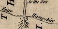
Enter HampshireThe county in which the road runs is labelled alongside the road, up the side of the column in block caps, eg:-
HAMPSHI.
WILT SHIRE
The county boundary is a dashed line. Adjacent counties are labelled, eg:-
WILT SHIREA few features are plotted outside the county, for sake of continuity.
The county boundary is a dotted line.
H A M P S H I R Eis written across the map's area.
Adjoining counties are divided by dotted line and labelled, eg:-
WILT SH.The detached part of Hampshire in West Sussex is not shown. A few places outwith the county are included to provide continuity of road routes, eg Farnham, etc.
County boundaries are dotted lines, obscured by other detail on the map. The county areas are labelled, eg:-
HAMP SH.
County boundaries are dotted lines. The areas are labelled by numbers which key to a table printed on the left, below the title cartouche:-
References to the Counties of England
1 Northumberland
...
51 Hampshire
52 SussexThis includes the welsh counties, but the scottish counties areas are labelled by name.
The county boundary is a dotted line. County areas are labelled, eg:-
HAMP / SHIREThe detached part of Hampshire in Sussex is not noticed.
County boundaries are drawn by a dotted line across the road. The county in which the road lies is labelled down the side of the scroll, eg:-
Hampshir
WILTSHIREThe change of county is also labelled at the boundary, eg:-
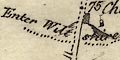
Enter Wiltshire
The boundary between Hampshire and Surrey is a dotted line, labelled:-
County BoundaryThe two areas are labelled:-
HAMPSHIRE
SURREY
County boundaries are a dotted line. The county areas are labelled, eg:-
HAMP- / SHThe detached part of Hampshire in Sussex is drawn, but not labelled.
County boundaries are shown by a dotted line. The county name is labelled in block caps alongside each piece of road.
There are no county borders, but some areas are labelled, eg:-
HAMP
The county boundary is a dotted line. Adjacent counties are labelled, eg:-
WILT SHIRE
The county boundary is a bold dotted line. This extends across the map borders in places. The detached part of Hampshire in West Sussex is not shown. Adjacen counties are labelled, eg:-
WILT SHIREand the boundary between these counties drawn for a short way from the Hapmshire boundary by a dotted line.
A few places outside the county are drawn and labelled to make sense of Hampshire places, eg Farnham, Lopcombe Corner, Ludgershall, etc.
The county boundary is a dotted line. Hundreds are not shown. Adjacent counties are labelled, eg:-
DORSET SH.The part of Hampshire in the Ambersham area, now Sussex,, is not included.
A very little is drawn in the adjacent counties, Farnham, Downton, Labcomb Corner, for example, just to make sense of the county's mapping.
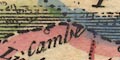
The county boundary is a dotted line. Contiguous counties are named, eg:-
BERK SHIRE
The county boundary is a dot dash line. The adjacent county:-
SUSSEXis labelled, but not Hampshire. The appearance of the map, detail in Hampshire not Sussex, suggests it is one of a series about the county, not needing the county name.
The county boundary is a dotted line. (On other copies of this map I have seen the boundary tinted.)
Adjacent counties are named, eg:-
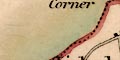
WILT SHIREThe detached part of Hampshire to the east is missed.
The county boundary is a dashed line. the contiguous counties are labelled, eg:-
PART OF WILTSHIRE
Each county is outlined by a dashed line and labelled, eg:-
HAMPSHIRE
The county boundary is a bold dashed line. Adjoining counties are labelled, eg:-
WILTSHIREThe detached part of Hampshire in Sussex is not shown. Adjacent counties are labelled, eg:-
WILTSHIREA few towns and villages outside the county are marked to provide continuity to the road network, like other towns these may be labelled with name and distance from London, eg:-
Amesbury / 78
The county boundary is a dotdashed line, tinted for emphasis. The adjacent counties are labelled, eg:-
DORSET SHIRE
PART OF WILTSHIREThe detached part of Hampshire in West Sussex is shown. And there is a tiny detached part of:-
SUSSEXembedded in Hampshire south west of Liphook. Also notice the detached parts of Wiltshire in Berkshire on the north edge of the county.
A few places outside the county are included for continuity, in the Farnham area in particular. The map includes the Isle of Wight. few boundary features are shown; two trees labelled:-
Bound Oakalready noted at Bramshaw; a series of named bridges over the Enborne , and:-
Flying Bull Inn the boundary of the Counties [by Rake]
The county boundary is a dotted line, fairly smoothed out in places. In places the engraving of the county boundary is abandoned in favour of a river. Counties are not named.
County boundaries are dotted lines, tinted for each county; Hampshire is red. The county areas are labelled, eg:-
HAMP SHIRE
County boundaries are dotted lines. The county areas are numbered, eg:-
7referring to a table of:-
REFERENCES.
ENGLAND
1 Cornwall
2 Devonshire
...
7 Hampshire
...
40 Northumberland
...Hampshire includes the Christchurch area, now in Dorset. And it is possible to make out the detached area of Hampshire which lay in West Sussex.
The county boundary is a dashed line, which also separates the adjoining counties. Adjoining counties are labelled, eg:-
WILSTHIREThe detached part of Hampshire in Sussex is not shown.
The county boundary is a dotted line, coloured bright blue. The map misses off the furthest west and east bits, around what is now Bournemouth, Dorset, and in Rushmoor. The detached part of the county at Ambersham is not included.
Adjacent counties are labelled, eg:-
WILTSHIREbut are not separated by boundaries.
Counties are labelled in block caps spread across their area. The county boundaries are a fine dotted line, shaded by colour on this copy.
The county boundary is a dotted line. The whole county is tinted plae yellow, and the boundary has a stronger yellow tint for emphasis. Some adjoining counties are labelled, eg:-
WILT SHIRE
SUSSEXThe adjacent counties have a border tint: Dorset pink, Wiltshire green, Berkshire pink, Surrey blue, Sussex pink. This is more colours than are necessary.
County boundaries are fine dotted lines. The county areas are labelled, often by an abbreviation, eg:-
HANTSThe detached part of Hampshire in Sussex is drawn, but wrongly. Part of its boundary is missed and it appears as an extension of Surrey. Another detached piece, on the north border of Hampshire, is labelled:-
P. of Wilts
The county boundary is a bold dotted line; the line might be engraved less bold where it would spoil other engraving, eg the edge of Lady Holt Park east of Charlton on the Sussex border. Remember that these maps are not 'county' maps but parts of an overall survey of the country. Topographic detail is plotted allover the sheets, not stopping at, taking little notice of, county boundaries. The county is named, labelled on sheets 12 and 11:-
H A M P
S H I R E
in large block caps which are engraved to overlie hachures and land boundaries, but underlie settlements and roads; a pretty conceit.
The detached part of the county in Sussex is bounded, and labelled:-
PART of HAMPSHIRE
The county boundary is a dashed line, tinted red alongside Dorset, blue-green alongside Wiltshire, red alongside Berkshire, green alongside Surrey, and red alongside Sussex. The adjoining counties are labelled, eg:-
DORSET SH.On the northern boundary there is an enclosed area which could be the detached part of Wiltshire then hereabouts. The detached part of Hampshire in Sussex is not shown.
The county boundary is a dashed line; the county area is tinted yellow. The boundary line is tinted for the different adjoining counties, which are labelled, eg:-
DORSET SHIRE [red/pink boundary tint]
WILT SHIRE [green boundary tint]
BERK SHIRE [red/pink boundary tint]and so on. round the county.
The map does not show counties. The area of Hampshire can be picked out as a group of deaneries in the Winchester diocese. Note that the Diocese of Winchester in 1535 included much of Hampshire, Surrey, Isle of Wight, and Guernsey. The detached part of hampshire in Sussex is clearly outlined as part of the deanery of Stoke by Guildford. The Diocese of Salisbury included much of Wiltshire and Berkshire.
County boundaries are fine dotted lines. The county areas are numbered, a separate sequence each for England, Wales and Scotland. The numbers refer to tables, eg:-
REFERENCES
ENGLAND
1 Cornwall
2 Devonshire
3 Somersetshire
...
7 Hampshire
...
40 NorthumberlandCounties are presented in a south to north, west to east order.
The county boundary is a dashed line, which might be used to separate two adjacent counties. The adjacent counties are labelled, eg:-
WILT SHIRE
SUSSEXThe detached part of Hampshire in Sussex is not shown. North of Bramshill one of the two detached parts of Wiltshire in Berkshire is drawn and labelled:-
Pt. of WiltsVery little is drawn outside the county boundary.
The jigsaw pieces are each a county. Doing the puzzle means handling and becoming familiar with the county shapes and their position; this is the idea of this teaching toy.
The county boundary is a bold dotted line, emphasised by the blue tint and degraded bluey green tint that are used for the coast and sea. The boundary line is extended to divide adjacent counties, which are labelled, eg:-
WILTSHIREThe detached part of the county in Sussex is drawn, labelled:-
PART OF HANTS.The two detached parts of Wiltshire on the county's northern border are shown. A very few places outside the county are drawn.
The county boundary is a dotted line. The whole county area is tinted yellow - makes for a gaudy map. The boundary is tinted with a different colour for each adjacent county, which is labelled:-
DORSET [green]
WILTS [red/pink]continuing with Berkshire green, Surrey bold yellow, and Sussex pink. The juxtaposition of yellow and yellow was not necessary.
A few places outwith the county are shown for continuity of roads.
County boundaries are fine dotted lines, the county area labelled, eg:-
HAMP / SHIRE
The county boundary is a dash dot line, which is used to separate adjacent counties as well. The contiguous counties are labelled, eg:-
WILTSHIRE
The county boundary is a dotted line. The two counties are labelled:-
WILT
HAMPand adjoining counties are labelled in a similar abbreviated style. Each county has a tint on the inner side of its boundary: Wiltshire yellow, Hampshire red; and around them, Dorset brown, Somerset blue, Gloucestrshire red, Berkshire blue, Surrey brown, and Sussex brown.
The map if of England and wales. County boundaries are dotted lines; counties are not labelled.
The county boundary is a circle dash line, which is also used to mark the boundary between adjacent counties. Adjacent counties are labelled, eg:-
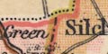
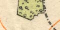
B E R K S H I R EThe detached part of Hampshire in Sussex is shown, not labelled, but drawn in detail like the rest of the county. Very little is drawn outside the county boundary, just a few villages are marked, though Farnham is plotted with roads and buildings. The detached parts of Wiltshire on the northern boundary near Silchester are shown.

The county boundary is shown by a bold dotted line crudely tinted yellow. Contiguous counties might be labelled, eg:-
WINCHESTERThe adjacent county each have a tint along the boundary: Dorset pink; Wiltshire green, its detached parts in Berkshire are not shown; Berkshire pink, as is its detached part in Wiltshire; Surrey blue; Sussex pink. The detached part of Hampshire in Sussex is shown and labelled:-
P. OF HANTS.BUT this label's engraving is back to front, ie the engraver forgot to engrave it backwards.
Roads and settlements are shown in the adjacent counties for the sake of continuity.
The county boundary is a dotted line, the boundary is tinted as a hundred boundary.
Contiguous counties are labelled, eg:-
SURREY
Pt. of WiltsThe detached part of Hampshire, south of Haslemere, is not shown.
The county boundaries are dotted lines emphasised by tinting for each county, ie there might be a tint each side of the boundary line, one for each county. The county areas are labelled, eg:-
HAMPSHIREThe detached part of Hampshire is shown within West Sussex, not labelled, but tinted to match Hampshire. Notice also the two detached parts of Wiltshire in Berkshire, on Hampshire's north border.
The county colouring is only really worth studying for the whole sheet, nevertheless the colours around Hampshire, which is red, are: Dorset yellow, Wiltshire green, Berkshire yellow, Surrey lilac, Sussex yellow. Detached parts appear to match their county tint.
The count boundary is a bold dotted line. Adjacent counties are labelled, eg:-
SUSSEXThe detached part of Hampshire in Sussex is not shown, but the two detached parts of Wiltshire on the county's northern border are drawn and labelled. A very few places outside the county are included for the sake of road continuity; Ludgershal, Newbury, and Farnham.
The county boundary is a dotted line, which is also used to separate adjacent counties. The adjacent counties are labelled, eg:-
WILTSHIREVery little is drawn outside the county.
The detached part of Hampshire in Sussex is drawn, labelled:-
Part of Hants.This detached area existed when the map was drawn, 1830, but was absorbed into Sussex by the time the copy was published. The copy has been updated for other features (railways) but not this.
The county boundary is a bold dotted line. Contiguous counties are labelled in clear block caps, eg:-
DORSETSHIREThe detached part of Hampshire, in West Sussex, is shown.
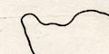
The county boundary is a continuous line.
The county boundary is a dash dot line, tinted. There is no labelling of adjacent counties.
The county boundary is a dashed line. Adjacent counties are labelled, eg:-
DORSET SH.The detached part of Hampshire in Sussex is shown, labelled:-
Part of Hants.A few places outside the county are shown for the sake of continuity of the roads: Farnham, Ludgershall, Newbury.
The county boundary is a dashed line, except where another feature, river or road, takes over. Adjacent counties are labelled, eg:-
SUSSEXbut their boundaries are not drawn. The detached part of Hampshire in Sussex is shown, labelled:-
Pt. of Hampshireand the two detached parts of Wiltshire are drawn on the northern border. A very few places, Farnham, Salisbury, Newbury, Ludgershall, Chichester, are marked and labelled, for continuity of the roads.
The county boundary is a dashed line, emphasised by pink/red tinting which follows the boundary pretty inexactly. The detached part of Hampshire in West Sussex is shown. Adjacent counties are labelled, eg:-
SUSSEXSome settlements, roads, and perhaps canals, are drawn outside the county for the sake of continuity.
The county boundary is a dash dot line. The detached part of the county in Sussex is shown, but not labelled. Adjacent counties are labelled, eg:-
DORSET SH.
SUSSEXA few settlements and roads are drawn outwith Hampshire for the sake of continuity.
The county boundary is a dash dot line tinted pink, or pinkish red. The map includes Hampshire with the Christchurch area that is now in Dorset, and the Isle of Wight. The detached part of Hampshire is Sussex is not shown. Adjacent counties are not labelled.
The county boundary is a bold dotted line, tinted on its inner side; it's meant to be like that, but the tinting is inaccurate. Adjacent counties are divided by boundaries and labelled, eg:-
BERKSHIREEach county has its own tint: Hampshire yellow, Wiltshire green, Berkshire magenta, Surrey blue, Sussex magenta. Notice that this is 1 more colour than is needed. The detached part of Hampshire in Sussex is shown, interrupting the right border of the map, unlabelled, but coloured to match Hampshire. Quite a lot of topographic detail is shown in the adjacent counties, but less densely than in Hampshire.
The county boundary is a circle dash line. The detached part of Hampshire in Sussex is shown.
Contiguous counties are labelled, eg:-
WILTSHIREOutside the county some relevant settlements, roads, etc, are shown and may be labelled, eg Poole, Wimborne, Salisbury, Downton. Chichester is drawn on the London-Chichester road, but is not labelled.
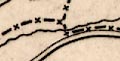
The county boundary is a dash x line. Adjacent counties are separated by boundary lines, and labelled, eg:-
SUSSEXThe detached part of Hampshire, North to South Ambersham, is drawn and labelled:-
PART OF HAMPSHIRE
The county boundary is a dotted line. Adjacent counties are labelled, eg:-
WILTSHIREThe map includes hampshire, the Christchurch area that is now in Dorset, and the Isle of Wight. The detached part of Hampshire in Sussex is not shown. Two small detached parts of Wiltshire are shown on the north border, east of Silchester. Little is included outside the county; Newbury, Farnham, and Ludgershall are marked being nodes in the road system.
The county boundary is an engraved dotted line, and the county area is coloured tan, printed from a separate litho plate. The external part of Hampshire now part of West Sussex, around Ambersham, is shown. Adjacent counties are shaded light tan, and labelled, eg:-
WILTSHIRERivers and a few settlements are drawn outside the county.
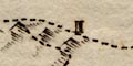
The north and south electoral divisions are bounded by a fine dotted line; the two sheets represent the two divisions. The same sort of line is used to divide the county into smaller electoral areas. These areas are labelled in roman numerals, keyed to a table of these divisions on the south sheet, eg:-
References to the Divisions.
Odiham ........ I
Basingstoke ... IIetc.
The county boundary Sussex/Hampshire is not noticed.
The county boundary with West Sussex is a dotted line. The neighbouring county is labelled:=-
SUSSEXand the county od the map is:-
HAMP / SHIRE
The county boundary is a dotted line. Adjacent counties are labelled, eg:-
WILTSH
The county boundary is a dashed line. Adjacent counties are labelled, eg:-
WILTSHIREThe detached part of Hampshire in Sussex is shown, labelled:-
PART OF HANTSand detached parts of Wiltshire appear on the northern border of Hampshire. These detached parts had all been eliminated by an Act in 1844, well before the map is thought to have been drawn.
The county boundary is a dashed line, except where a river is the border, as at Blackwater. The boundary is emphasised with tints, for example:-
Yellow for Hampshire; pink for Wiltshire; blue for Berkshire.
Adjoining counties are labelled, eg:-
BERKSHIREA few places are drawn outwith the county to give continuity to the road pattern; Farnham, Salisbury etc.
The county boundary is a dash dot line, tinted adiiferent colour for each adjacent county. The adjacent counties are labelled, eg:-
WILTSHIREA few places are marked outwith the county, for the sake of continuity of the turnpikes or railways, or just for information.
The county boundary is a dashed line, except where a river or the sea coast takes over the function. (The boundary between the electoral 'County Divisions', north and south Hampshire, is a dot dash line, as shown in the table of symbols.) The county boundary is tinted because it is also a division boundary.
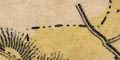
The boundaries between adjacent counties are irregular, some shown, eg Wiltshire/Dorset, some not, eg Surrey/West Sussex. The detached part of Wiltshire north of Silchester is drawn. The detached part of Hampshire in West Sussex is not drawn.
Adjacent counties are labelled, eg:-
WILT SHIRE
The county boundary is a dotted line, and is tinted by the tinting of the electoral areas.. Adjacent counties are labelled, eg:-
WILTSHIREand have a number of settlements, roads and railways to show how Hampshire fits into its surrounding area.
The county boundary is a chain doted line; dot dot dash. Similar lines divide the adjacent counties which are labelled, eg:-
SUSSEXThe detached part of Hampshire in Sussex is not shown.
A county boundary might be drawn by a dot dash line, but is not always noticed. The county areas are labelled in large open block caps, eg:-
HAMPSHIRE
The county boundary is a dash dot line tinted for emphasis. The county area is labelled:-
HANTSAdjacent counties are divided by a similar boundary, not tinted, and labelled, eg:-
WILTSHIRE
The county boundary is a dashed line. Adjacent counties are labelled, eg:-
WILTSH.but their boundaries are not drawn.
The detached part of Hampshire in West Sussex is shown.
Some main roads, railways, and settlements are shown outside the county for the sake of continuity. Geological data stops at the boundary.
The county boundary is a dotted line. The detached part of Hampshire in West Sussex is shown, labelled:-
Part of HantsAdjacent counties are labelled, eg:-
DORSETSHIRE
The county and division boundaries are dash dot lines, tinted for emphasis. The detached part of the county in West Sussex is shown, labelled:-
Part of HampshireOn each sheet the other part of the county is labelled, thus, on the north sheet, the adjacent area to the south is labelled:-
SOUTH DIVISION OF HAMPSHIREAdjacent counties are labelled, eg:-
SUSSEXSome settlements, main roads, railways, and perhaps rivers, are drawn outwith the bounds of each sheet for the sake of continuity. This includes, for example, Winchester added to the South Division sheet, and so on.
County boundaries are fine dotted lines. the county areas are labelled, eg:-
HANTS
The county boundary is a bold line, the county area, Hampshire, is printed yellow; the detached part of the county S of Haslemere is not shown (has it gone by 1868?). Adjacent counties, uncoloured, are delimited by a dot dash line and labelled, eg:-
WILTSHIREThe boundary of the N and S divisions of the county, set up during parliamentary reform is a dotted line. This is overshadowed by the division, printed in bold red, of the county into 6 areas (including the Isle of Wight), labelled in red:-
ANDOVER
BASINGSTOKE
PETERSFIELD
FAREHAM
LYMINGTON
ISLE OF WIGHTThe division boundary is near but not the sanme as the relevant red boundaries.
County boundaries are a dotted line tinted with a continuous red line. County areas are labelled, eg:-
HAMPSHIRE OR SOUTHAMPTONEach county is coloured a different colour. For example: Hampshire and Isle of Wight yellow, Dorset green, Wiltshire orangey red, Berkshire green, Surrey orangey red, Sussex pinky red. Elsewhere a grey blue is used. Thus at least five colours, two of which are badly similar.
The county boundary is a dotted line, tinted. Adjacent counties are labelled, eg:-
WILTSHIRESome places, roads, and railways are shown outside Hampshire for the sake of continuity.
Note that the electoral boundary between North Division and South Division is the same sort of line; the two divisions labelled '1' and '2'.
The county boundary is a dash dot line. The boundary between adjacent counties is suggested, and these are labelled, eg:-
DORSETSHIRESome settlements, roads and railways, are drawn outwith the county, to set Hampshire in its context.
The county boundary is a dot dash line. Adjacent counties are labelled, eg:-
WILTSHIRERoads, railways, and significant settlements are drawn outside the county boundary to put Hampshire in its context. The transport features continue to the edge of the map border and occasionally beyond, for example Reading is included though it is outside the map border.
The county boundary is a dotted line, tinted orange. Adjoining counties are labelled, eg:-
BERKSHIRERoads and some towns are marked outside the county for continuity.
The county boundary is a dotted line. County areas are labelled:-
DORSET
HANTSHampshire includes the area up to Bournemouth which is now part of Dorset.
The county boundaries are fine dotted lines, easily missed amongst the bolder features. The county areas are labelled, eg:-
HAMP / SHIRE
The county boundaries are drawn by a light dotted line; the bolder dashed line is the post office surveyor's district boundary.
The post office surveyors' districts bear no relationship to counties (just as postcodes today are independent of local authority administration; confusing to the public, but making good sense to the postmen delivering the mail.)
Hampshire mostly lies in the south central PO surveyor's district covering all or parts of Middlesex, Buckinghamshire, Berkshire, Wiltshire, Hampshire, Surrey, Dorset and Isle of Wight. Eastern parts of Hampshire are in a south eastern PO surveyor's district stretching across all or parts of West Sussex, East Sussex, Surrey, and Kent.
The county boundary is a dash dot line tinted orange. The county area is coloured (see below). Adjacent counties are divided by similar boundaries, all coloured the same cream, and labelled, eg:-
WILTSHIREThe detached part of Hampshire is not shown; it should not be by this date (?).
Some places outside the county are marked to give continuity to the road and rail networks.
County boundaries are doted lines. The county name is written in the area in block caps, eg:-
HAMPSHIRE
County boundaries are a bold lone, emphasised by a tint for each county. Hampshire is red, the surrounding counties are - Dorset orange, Wiltshire green, Berkshire orange, Surrey green, Sussex yellow, Isle of Wight red. County areas are labelled, eg:-
HANTS
County boundaries are light dotted lines. County areas are labelled in pale blue, eg:-
HAMPSHIRE
County areas are not noticed on the road maps.
The counties are not noticed.
The county boundary is a bold red line, emphasised on the Hampshire side by an orange tint. The county area is tinted yellow. Adjacent counties are separated by red or blue lines with tints and fill colours; Dorset blue, Wiltshire lilac, Berkshire green, Surrey pink, Sussex, dark pink; more colours than necessary. The adjacent counties are labelled, eg;-
WILTSHIRE
The county boundary appears to be a dot dash line, which in the table of symbols is a county and parish boundary. A county boundary is meant to be a dotted line. There seems to be some confusion; and the maps do not show parishes anyway!
Johnston 1920:-
... it will be observed that only county boundaries are shown on the new maps. Parish boundaries which caused so much confusion with footpaths have disappeared. ...All counties are labelled in borders of map, eg:-
HAMPSHIRE | SURREYRemember that these maps are not 'county' maps; they are not maps of Hampshire in particular.
County boundaries are fine dotted lines. The county are is labelled, eg:-
HANTS
BERKS
ISLE OF WIGHTOr, a county whose area runs off the edge of the map is labelled outside the map border. Card 6 has, in the left margin:-
DORSET / GLOSTERat the top:-
OXFORD / BUCKSon the right:-
HERTS / SURREY / SUSSEX
County boundaries are drawn bya dash dot line with the county names either side, eg:-
HAMPSHIRE / SURREYnear Farnborough, page 13.
Coloured enamel is used for the county area. The names of the adjacent counties are cast in the bronze background, and each has an applied badge of the county coat of arms; Dorset, Wiltshire, Berkshire, Surrey and Sussex.
county |
|||||||||||||||||||||||||||||||||
| dot or dash boundary |  |
|
|
|
|
|
|
|
 |
 |
|
|
|
|
|
|
|
|
|
|
|
|
|
|
|
|
|
|
|
|
|
|
|
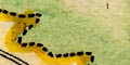
| chain dotted boundary |  |
|
|
|
|
|
|
|
|
|
|||||||||||||||||||||||
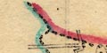
| boundary shaded | |
|
|
|
 |
||||||||||||||||||||||||||||
| swash lettering | |
|
|
|
|
|
|||||||||||||||||||||||||||
| detached part shown | |
|
|
|
 |
|
|
|
|
|
|
|
|
|
|
|
|
|
|
|
|
|
|
|
|
||||||||
