
 Return to list of Features

NB: typical illustrated examples are described, NOT ALL examples.
absence of evidence is not evidence of absence
The map is drawn within a trapezium. There are scales of latitude and longitude for a trapezoid projection on the borders; graduated and labelled in degrees. The map includes from 8d to 33d E longitude (left to right), from 52d to 63d N; the British Isles with Scotland more badly distorted than the rest, Ireland, parts of the coast of Europe, and scatters of northern islands. Be very careful reading figures off the map, their shapes are not the familiar shapes of today's numbers. The prime meridian about 20d W of London, probably the Canary Isles in the Atlantic.
I do not intend to deduce anything from measurements of the scales, but:-
at 52d N 26d longitude = 563 mm
at 63d N 10d longitude = 150 mm
11d latitude = 364 mmThere are labels alongside the left border. At 63d N:-
1 gradus longitu. i~hoc pal. co~tinet miliaria 28 1/2 fereat 58d N:-
miliaria 42 1/2which seems wrong? The '4' is quite clear, in the expected shape for the date of the map, perhaps a little old fashioned.
at 53d N:-
miliaria 32 1/2
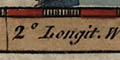
The borders have scales of latitude and longitude in a trapezoid projection, labelled at degree intervals. The south border (left) covers 11.5 to 27 degrees E longitude; the latitude covers from 49 to 61 degrees N. The map has part of the coast of France, and the Orkneys but not Shetland. The longitude of Greenwich can be estimated to suggest:-
prime meridian 22 degrees Ewhich is about the Cape Verde islands. For Hampshire:-
Winchester 20.1 degrees E
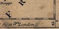
The map has latitude and longitude scales printed in the map borders, based on a prime meridian 20 degrees W of Greenwich, perhaps the Canary Islands?
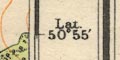
On the second and later states of the map there are scales of latitude and longitude printed in the borders. The scales are fitted between the map edges and a decorative border, with some of the labelling in the map area. The projection is a trapezoid, or Donis, projection. The scales are chequered in 10 minute intervals, marked at 2 minutes, labelled at 10 minutes and degrees. The southern border of the maps includes from about 15d 10m to 26d 20m East; the sides from 50d 20m to 55d 50m North; it includes a corner of the coast of France, a little of SW Scotland, and the east side of Ireland, all in outline only.
The longitude of:-
Greenwich is 23d 30m East
Winchester is 22d 1m EastThe prime meridian is 23d 30m West of Greenwich, somewhere about the Cape Verde Islands.
There are latitude and longitude scales in all four borders; chequered at 2 minute intervals, labelled at degrees. The origin of these scales appears to be about 20d51m W of Greenwich, ie the longitude scale on the sheet runs from about 18 to 24 degrees. Mercator's prime meridian is in the Azores, west of Africa. It was later that the Greenwich meridian was accepted internationally.
The borders of the map have scales of latitude and longitude, chequered at 4 minute intervals with marks at 20 minute intervals, labelled at degrees. The projection is trapezoid. The map covers 26d 40m to 13d 20m E on the south border (left); 48d 20m to 61d 10m N on the top border (W). The longitude of Greenwich (estimated, the place is not shown) is about 24d 36m E ie longitude is from about:-
prime meridian 24d 36m WWhich is probably in the Cape Verde islands. The longitude of:-
Winchester 22d 48m Eestimated from the map.
The map borders have scales for latitude and longitude, the projection is some sort of conical projection? The scales are chequered in 10 minute intervals, labelled at degrees. Great Britain is within 7 to 23 degrees East, 50 to 60+ degrees N; London is at 20 degrees 38 minutes East. The prime meridian for the map is thus about 20 degrees 38 minutes W of Greenwich. This does not agree with any of the obvious early pre-Greenwich meridians: Canary Islands about 16-18 degrees W, Azores about 28-31 degrees W, Cape Verde Islands about 24 degrees W.
The projection has the size on paper of 1 degree latitude the same from south to north, as well as I can judge. 8 degrees latitude is 275.0 mm giving a scale for the map about 1 to 3238351. The map scale is about:-
1 to 3200000
51 miles to 1 inch
Latitude and longitude scales for a rectangular projection are printed in the borders of the map; divided at 6 degree intervals ie tenths of a degree, marked at degrees. The Latitude runs from 50d 36m N to 53d 6m N. The lngitude scale runs from 18d 3m E to 24d 6m E with London at 20d 42m E. The prime meridian for longitude is about 20d 47m W of Greenwich. (This does not seem to be either the Canaries or Cape Verde Islands?)
The left and bottom map borders have latitude and longitude scales; assumed to be for a rectangular projection. The scales are labelled at 5 minute intervals. Latitude runs up; 40, 45, 50, 55, 51, 5, 10, ... 30. The 51 is 51 degrees. Longitude runs eastward, left to right on the sheet; 10, 15, ... 55, 23, 5, 10, ... 55, 24, 5, 10. The 23 and 24 are marked with a degree sign and a prime, and the 23 is accompanied by 0 minutes. Winchester is about 23d 10m E of the map's prime meridian; it is 1d 19m W of Greenwich. The map's prime meridian is somewhere out in the Atlantic, probably the Cape Verde Islands which were one of the places used for the prime meridian before Greenwich was accepted internationally.
The map borders have scales of latitude and longitude for a rectangular projection; chequered at 4 minute intervals, labelled at degrees. The chart includes from 11d to 21d E, from 46d 50d to 52d 16m N. The prime meridian is in the Atlantic, about 27d 50m W of Greenwich.
A graticule is drawn at 1 degree intervals.
The chart shows the coast of Bretagne, Normandie, Picardie, France and Flanders; and the coast of southern England and Wales from Cardigan to Ipswich.
Printed in the map borders are scales of latitude and longitude for a rectangular projection; marked and labelled at degrees. Notice that the longitude scale increases from west to east; the longitude of Greenwich (not marked on the map) is about 27d E suggesting a prime meridian about 27d W from Greenwich, this is probably the Azores which are centred about 28d W and are the prime meridian on Christopher Saxton's map.
The map includes all of England and Wales, with parts of Scotland, Ireland, France, Belgium and the Netherlands.
The map has scales of latitude and longitude; chequered in one minute intervals, labelled in 10 minute intervals.
To give some idea of the shape of the projection, without complicated analysis, the following were measured (beware errors of pasting):-
at 56d N, 1d longitude = 170.5 mm
at 50d N, 4d longitude = 194.9 mm
1d latitude = 302.2 mmAt the latitude of Hampshire, round about 51d N:-
ratio longitudes at 51d and 50d = 1.02
ratio latitude/longitude = 1.58both figures just what they 'should' be.
The map includes from 2d 40m E to 6d 50m W, 50d 5m to 55d 45m N; England and Wales, part of Scotland and the edge of Ireland.
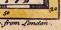
The map has scales of latitude and longitude in the borders for a trapezoid projection; chequered at 5 minute intervals, labelled at 1 degree intervals. The prime meridian goes through the middle of London, perhaps a little to the west. The
longitude, Winchester = 1d 20m WThe map includes from 2d 0m E to 6d 30m W, from 50d 10m to 56d 15m N; England and Wales, part of Scotland, edges of Ireland and France. The scales were measured to get an idea of the shape of Hampshire.
at 50d N 1d longitude = 61.3 mm
at 51d N 1d longitude = 60.0 mm
1d latitude = 93.9 mmthus:-
ratio of longitudes at 50d and 51d = 1.02
ratio latitude.longitude = 1.55which are fairly close to the required values, 1.02 and 1.58, for Hampshire to be 'square'.
The map borders are printed with scales of latitude and longitude for a trapezoid projection. The prime meridian is drawn through London, perhaps 1 minute West of the city. The
longitude, Winchester = 1d 17m WThese readings suggest that the plotting of Winchester is not that accurate; the table of data puts Winchester at 1d 18m W.
Some rough measurements were made from the scales. 6d longitude at 50d 10m N = 319.2 mm; 6d longitude at 55d 58m N = 277.9 mm; 2d latitude = 164.1 mm. These give, approximately:-
1d longitude at 50d N = 53.4 mm
1d longitude at 51d N = 52.2 mm
1d latitude = 82.1 mmThe shape of the projection is:-
ratio longitudes at 51d and 50d = 1.02
ratio latitude/longitude at 51d N = 1.55The expected values for this latitude, Hampshire, for a 'square' map are 1.02 and 1.58 respectively.
The map includes from 2d 15m E to 6d 35m W, 50d 20m to 55d 55m N; England and Wales plus parts of Scotland, Ireland and an edge of France.
The map borders have scales of latitude and longitude for a conical projection; chequered at 10 minutes, labelled at degrees. The prime meridian passes through London. A graticule is printed over the map at 1 degree intervals of latitude and at 1 degree intervals but on the half degrees of longitude. The map includes from 11d E to 11.5d W, 49d to 59.5d N; England and wales, Scotland including Orkney, and parts of the coasts of France, Germany, Denmark and Norway.
The 'shape' of Hampshire can be judged from the lat and long scales.
at 50d N 1d longitude = 28.4 mm
at 51d N 1d longitude = 27.8 mm
1d latitude = 45.3 mmthus:-
ratio of longitudes at 50d and 51d N = 1.02
ratio latitude/longitude at 51d N = 1.63The expected values for a 'square' map of Hampshire are 1.02 and 1.58.
Printed in the borders are scales of latitude and longitude for a rectangular projection; chequered at 5 minute intervals, labelled at 10 minute intervals. The map includes from 11d 55m to 21d 05m E, from 47d 50m to 52d 10m N. The prime meridian is somewhere in the Atlantic, about 18d 50m W of Greenwich.
The chart shows the coasts of Bretagne, Normandie, Picardie, France; the coast of southern England and Wales from Pembrokeshire to Suffolk; the Scilly Isles; and a tiny bit of Ireland.
scale line, scale
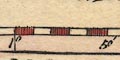
Printed on the left is a vertical scale line:-
Echelle des Lieues Marines a 20. par de Degrez.chequered in minutes, labelled 5, 10, 5 , 10, etc. The scale line is fitted to the latitude scale alongside. 60 leagues = 3 degrees = 385.0 mm gives a scale 1 to 866424, assuming a league of 3 nautical miles of 6080 feet. The chart scale is about:-
1 to 870000
4 leagues to 1 inch
13.5 statute miles to 1 inch
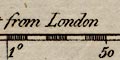
The border of the map is graduated with latitude and longitude scales at 1 minute intervals, numbered at 1 degree and 10 minute intervals.
The top border is labelled with roman figures, giving minutes from London instead of longitude values. Note that 360 degrees = 24 hours; III minutes after London time corresponds to 0 degree 45 minutes W longitude, IV minutes to 1 degree, V minutes to 1 degree 15 minutes, VI minutes to 1 degree 30 minutes.
The London meridian used is through St Paul's Cathedral, see the map notes.
Left, bottom and right margins, chequered in 5 minutes, marked at degrees and 10 minute intervals.
Top margin
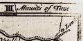
Minutes of Timemarked III, IIII, V, VI.
The map has scales for latitude and longitude in the borders; chequered in 5 minute intervals, labelled at 10 minute intervals. The graticule shows that the map is on a conical projection. The prime meridian passes through London, very slightly to the west side. The
longitude, Winchester = 1d 22m Wwhich does not agree with the prime meridian awfully well.
Crude measurements of the graticule give a shape for Hampshire:-
at 50d N 1d longitude = 58.8 mm
at 51d N 1d longitude = 60.8 mm
1d latitude = 60.4 mmFrom which:-
ratio longitudes at 50d and 51d N = 1.03
ratio latitude/longitude = 1,53The figures for a well proportioned map of the county are 1.02 and 1.58; but the projection might be much better for Great Britain as a whole.
The map includes from 3d E to 7.5d W, from 50d to 57d N; England and Wales, Scotland and part of Orkney, part of Ireland and an edge of France. The rest of Orkney and the Shetlands are mapped in an inset panel at the top right of the North sheet.
The borders of the map are printed with scales of latitude and longitude for a trapezoidal projection; chequered at 5 minute intervals, labelled at 1 degree intervals. The map includes from 1d 50m E to 6d 20m W, from 49d 55m to 56d 20m N; all of England and Wales, Scotland to north of the Firth of Forth, and the edges of Ireland and France.
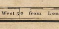
The map has scales of latitude and longitude, and a graticule of a conical projection. The bottom scale is labelled:-
West from London / East from London. The prime meridian goes through London, at about London Bridge. The:-
longitude, Winchester = 1d 26mThe shape of Hampshire can be judged from the graticule.
at 51d N 1d longitude = 62.0 mm
at 52d N 1d longitude = 60.7 mm
1d latitude = 100.9 mmthus:-
ratio longitudes at 51d and 52d = 1.02
ratio latitude/longitude = 1.64The figures which make Hampshire 'square' are 1.02 and 1.58.
Printed in the chart borders are scales of latitude and longitude for a ?rectangular projection; chequered at 1 minute intervals, labelled at 5 minute intervals. A graticule, latitude and longitude grid, is drawn at 5 minute intervals. The minutes of longitude and those of latitude are about the same size; which does not produce a 'square' plot.
The prime meridian for the chart is though Southampton, in the middle of the plot; the chart includes from 33m W to 34m E of Southampton, 50d 28m to 51d 4m N. The chart includes the whole of the Isle of Wight; the coast of Dorset from St Albans Head and Poole; the coast of Hampshire including the Solent and Southampton Water; and the coast of West Sussex as far as Arundel.
The borders have scales of latitude and longitude with the meridians clearly converging up the page. The prime meridian, 0 degrees Longitude, passes through London. There are marks and labelling at 1 degree intervals. The map covers 2 degrees E to 6 1/4 degrees W, 50 degrees to 55 1/2 degrees N; all of England and Wales, the edges of France, Scotland and Ireland.
5 degrees latitude = 227.5 mm gives a scale 1 to 2446557; the map scale is about:-
1 to 2400000
39 miles to 1 inch
The map border's have scales of latitude and longitude; chequered in minutes, labelled at 10 minute intervals. As the top scale is partly obscured it is not possible to judge safely what sort of projection is used; its seems to be a trapezoidal projection. The bottom scale is labelled:-
... West from LondonIt is possible to estimate the:-
longitude, Winchester = 1d 17.4m Wsuggesting a prime meridian near Greenwich?
The map borders have scales of latitude and longitude for a trapezoid projection; chequered at 10 minute intervals, labelled at 1 degree intervals. A graticule is printed over the map at 1 degree intervals. The prime meridian passes through the centre of London. The bottom scale is labelled:-
West Longitude from LondonThe map includes from about 3d E to 12d W, from 50d to 59d N; the whole of the British Isles excepting Orkney and Shetland, and a corner of the coast of France. Should the figures be needed the scales were measured:-
at 51d N 14d longitude = 432.0 mm
at 58d N 15d longitude = 359.2 mm
7d latitude = 297.0 mm
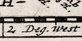
There are latitude and longitude scales in the borders, chequered at 5 minute intervals, labelled at 10 minute intervals. The scales are oblique, slanted as the compass rose. Printed bottom right is:-
Deg. W. Long. from London.
There are latitude and longitude scales in the map borders, chequered at 5 minutes, labelled at 10 minutes and at degrees, all in arabic numerals. The longitude scales are at the oblique angle of the map; the latitude scales are horizontal.
Printed in the map borders are scales of latitude and longitude for a rectangular projection; chequered in 2 minute intervals, labelled at 10 minute intervals. The ratio of the length of a minute of latitude to a minute of longitude is about 1.60, matching the 'correct' figure for this latitude, 1.58, fairly well.
Approximately the:-
longitude, Winchester = 1d 11m WTrusting this, the prime meridian is London, well west of Greenwich. The map includes from 0d 36m to 1d 54m W, 50d 3m to 51d 22m N; Hampshire and the Isle of Wight.
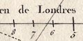
Printed in the map borders are scales of latitude and longitude; chequered at 10 minutes intervals, labelled at degrees, from a prime meridian in the Atlantic at about 28d W from Greenwich.
longitude, Winchester = 26d 50m E approximatelyThe projection implied is a trapezoidal projection, the top and bottom longitude scales are different, BUT the top scale is wider than the bottom - this is the wrong way round. Presumably the engraver doesn't understand what he is doing.
The map borders have rectangular latitude and longitude scales, chequered at 1 minute intervals, labelled at 5 minutes and degrees. Longitude is:-
Longitude West from LondonFrom the scales the:-
longitude, Winchester = 1d 14.4mroughly. This suggests a prime meridian several minutes west of Greenwich, perhaps St Paul's?
Note that 30 minutes longitude is 102.2 mm, giving a scale of 1 to 544610. The map scale is about:-
1 to 540000
8.5 miles to 1 inch
The map border is chequered at 2.5 minute intervals (24 divisions per degree) for latitude and longitude, labelled:-
Longit. W. from London.
The borders of the map have latitude and longitude scales, oblique to the sheet and borders of the map. These are chequered at 1 minute intervals, labelled at degrees and 30 minutes horizontally, at degrees and 15, 30, 45 minutes vertically. The bottom scale is labelled:-
Longitude W. from London.For more notes about lat and long scales see the map.
The map borders have rectangular latitude and longitude scales, chequered at 1 minute intervals, labelled at 10 minute intervals. The map covers 0d 30m to 2d 5m W, 50d 30m to 51d 25m N. The bottom scale states:-
West Longitude from LondonThe:-
longitude, Winchester = 1d 14 or 1d 15m Wsuggesting a prime meridian about 4 degrees W of Greenwich, perhaps St Paul's?
Printed in the chart borders are scales of latitude and longitude for a rectangular projection; chequered and labelled in minutes. The bottom and top scales of longitude are labelled:-
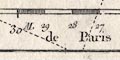
Longitude Occidentale du Meridien de ParisThe bottom scale has a second scale of marks and labels in minutes, labelled:-
Longitude Occidentale du Meridien de LondresFrom the scales, London is 2d 25m W of Paris.
Southsea Castle from the scales is 3d 33m W of Paris, 1d 8m W of London. The longitude of the castle from Greenwich is 1d 05.1m W; thus the chart's London prime meridian is about 3m W of Greenwich (St Paul's Cathedral is 5m W of Greenwich).
The chart includes from 0d 40m to 2d 10m W of London, 50d 24m to 51d 0m N. The chart shows the whole of the Isle of Wight with coast from Durlston Head and Poole Harbour, Dorset; the coast of Hampshire including The Solent and Southampton Water; the coast east to Selsey Bill, Selsey Harbour and Pagham, West Sussex.
Printed in the map borders are scales of latitude and longitude for a rectangular projection; chequered at 1 minute intervals, labelled at 5 minute intervals. A graticule, latitude and longitude grid, is printed across the map at 5 minute intervals. The bottom scale of longitude is labelled:-
West Long: from LondonMeasuring off the map as well as possible:-
longitude, Winchester = 1d 8m Wsuggesting that the prime meridian was about 10 degrees west of Greenwich. The error in the town position might not be small.
The ratio of latitude to longitude scales is 1.55, very close to the value, 1.58 at 51d N, to make a 'square' map.
Same as Kitchin; but tinted, the chequers in blue. If you look closely at the four corners there are tiny differences in coverage, as if the map borders are shifted slightly. Also notice an error in the bottom scale, the 0d 30m mark and label are 5 minutes out of position.
There are scales of latitude and longitude scales for a recatngualr projection printed in the map borders; chequered at 5 minute intervals, labelled at 10 minute intervals. Printed upper left:-
Longit. West from London.Reading form the scales the:-
longitde, Winchester = 1d 13.4m W approxsuggesting a prime meridian several minutes west of Greenwich, perhaps at St Paul's?
The 51d N parallel and 1d W meridian are drawn across the map; a minimalist graticule.
Printed in the map borders are scales of latitude and longitude for a rectangular projection; chequered and labelled in 15 minute intervals. The lower longitude scale is labelled:-
Longit. West from London
printed in the map borders are scales of latitude and longitude for a rectangular projection; chequered at 1 minute intervals, labelled at 5 minute intervals. The bottom longitude scale is labelled:-
West Longit. from LondonAs well as can be measured from the scales the:-
longitude, Winchester = 1d 8.0m WImplying a prime meridian 10 degrees W of Greenwich.
A graticule, latitude and longitude grid, is printed over the map at 5 minute intervals.
The map includes from 0d 28m to 2d 7m W, from 50d 34m to 51d 23m N; the whole of Hampshire including the Christchurch area now in Dorset, and the Isle of Wight.
The map's borders have scales for latitude and longitude; chequered at 1 minute intervals, labelled at 10 minute intervals. The top longitude scale is labelled:-
Longit. W. from London.The 51d N parallel and 1d W meridian are drawn across the map, a minimalist graticule.
The map includes 0d 39m to 1d 55m W, 50d 38m to 51d 25m N; the county of Hampshire and the Isle of Wight. Reading from the scales the:-
longitude, Winchester = 1d 18m Wsuggesting a prime meridian at Greenwich.
Detail notes see the map.
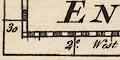
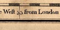
Printed in the borders of the map are scales of latitude and longitude for a trapezoid projection; chequered at 10 minute intervals, labelled at degrees. The bottom scale is labelled:-
Longit. from LondonThe graticule is printed across the map at 1 degree intervals. The prime meridian is east of London, but not through Greenwich; it is about 3d W. The:-
longitude, Winchester = 1d 14m WThe map includes from 2.5d E to 6d W, from 48.5d to 56.5d N; England and Wales with parts of Scotland and the coast of France.
Printed in the map borders are scales of latitude and longitude for a trapezoid projection; chequered at 10 minute intervals, labelled at degrees. The prime meridian passes through London, a tiny bit west of centre. The:-
longitude, Winchester = 1d 22mNotice that the longitude of Winchester is frequently not a good guide to the location of the prime meridian on maps of the whole country.
Printed in the map borders are scales of latitude and longitude for a trapezoid projection; chequered at 5 minute intervals, labelled at 30 minute intervals.
Looking closely at the engraved degree marks for latitude, left and right, they appear slanted. It is possible to imagine that a conical projection is being suggested. As there is no graticule it is not easy to test this.
The map includes from about 2d E to 7d W, 49d 45m to 56d 0m N; England and Wales with part of southern Scotland, and the east coast of Ireland, with routes marked. There is also a tiny corner of France.
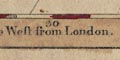
The prime meridian runs through central London, perhaps, only guessing, St Paul's Cathedral. The bottom longitude scale is labelled:-
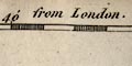
Long. East from London.
Long. West from London.
The map has scales of latitude and longitude in the borders for a rectangular projection; chequered at 10 minute intervals, labelled at 30 minute intervals.
The prime meridian runs through central London, perhaps St Paul's Cathedral, not Greenwich. Roughly:-
longitude, Winchester = 1d 12m WThe bottom scale of longitude is labelled:-
Longitude West from London.
Longitude East from London.The chart includes from 4d 10m E to 7d 15m W, 47d 10m to 52d 20m N; roughly southern England and wales from Cardigan Bay to Orford Ness.
There are neither scales nor grid of latitude and longitude on this chart. Another map in the series, (Selsea Bill, Owers, etc, HMCMS:FA2000.21.3) was surveyed a little later, 1786, and has both lat and long scales and a lat and long grid over the sea. The scales are graduated at 5 second intervals; the grid is drawn at 3 minute intervals. Longitude is measured west of the meridian of Paris.
Printed in the chart borders are scale of latitude and longitude; chequered and labelled in 10 minute intervals. Remember that the map has East at the top; longitude scales are left and right, latitude scales are top and bottom. The chart includes from 10d 30m to 20d 10m E, from 43d 10m to 52d 30m N. The prime meridian is in the Atlantic about 17d 45m W of Greenwich - for the longitude scale on the right (south). The longitude scale on the left (north) is labelled the other way, from a prime meridian running through the:_
Observatoiremarked at Paris, France. This is 19d 59m E of the other prime meridian.
There is no scale line, but from measuring the scale of latitude, 8d = 621.3 mm, giving a chart scale about:-
1 to 1400000
6.5 leagues to 1 inch
22.5 statute miles to 1 inchThe chart covers the coast of Spain from cap Orgetal to the french border; the coast of France the spanish border to Dunkirk; labelled:-
PARTE DE FRANCEincluding Gasconne, Guyenne, Saintogne, Aunis, Poitou, Britagne, Normandie, and Picardie; the coast of southern England and Wales from Cardigan to Orford Ness; the Scilly Isles; and a tiny corner of Ireland.
Printed in the map borders are scales of latitude and longitude for a recatmgular projection; chequered at 2 minute intervals, labelled at 10 minute intervals. Printed by the lower border is:-
Longitude West from London
In the map border are rectangular latitude and longitude scales; chequered at 1 minute intervals, labelled at 5 minute intervals. The bottom longitude scale is labelled:-
Longitude Wst. from Londonminutes of latitude = mm, gives a map scale of 1 to . The map scale is about:-
1 to
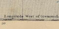
miles to 1 inchCary is the first to use longitude west from the Greenwich meridian, which was not formally established as the international prime meridian till 1884.
Printed in the borders are scale of latitude and longitude for a rectangular projection; chequered at 2 minute intervals, labelled at 10 minute intervals. The top border is labelled:-
Longit. West from LondonThere is a lat and long grid; just the parallel at 51 degrees west and the meridian at 1 degree north.
There are rectangular latitude and longitude scales in the map borders, chequered at 1 minute intervals, labelled at 5 minute intervals in arabic numerals, degrees labelled in roman numerals. The bottom border:-
Longitude West from London
Printed in the map borders are scales of latitude and longitude for a rectangular projection; chequered in minutes, labelled at 15 minute intervals expressed in degrees and fractions, eg:-
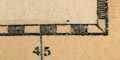
50 3/4for 50d 45m. The longitude of Portsmouth is about 16d 24 or 25m E. Doing a few sums: the longitude is based on a prime meridian in the Canary Islands, about 17 1/2 degrees W of the modern Greenwich meridian. The map includes from 16d 13m to 16d 49m E of the Canaries, from 50d 40m to 50d 56m N; Hampshire from Stokes Bay to Langstone Harbour, from the coast to level with Bishops Waltham; the north east corner of the Isle of Wight; and a few features in neighbouring West Sussex as far as Selsey Bill and Pagham.
There are latitude and longitude scales in the four borders of the map. They are chequered at 1 minute intervals, labelled at 10 minute intervals. The longitude scale is labelled:-
West Longitude from GreenwichThe scales are rectangular on the page.
There are latitude and longitude scales in three borders of the map (the fourth border is tucked in the spine). They are chequered at 10 minute intervals, labelled at 20 minute intervals. Degrees are labelled in roman caps. The longitude scale is labelled:-
West Longitude
Printed in the map borders are scales of latitude and longitude for a rectangular projection; chequered at 2 minute intervals, labelled at 10 minute intervals, the degree labels in roman numerals. The bottom scale is labelled:-
Longitude West from London.As far as can be judged the
longitude, Winchester = 1 d 12 1/2m Wsuggesting a prime meridian in central London, not Greenwich.
The map covers 0d 42m to 1d 44m W, 50d 32m to 51d 26m N; the whole of Hampshire and the Isle of Wight.
There are scales of latitude and longitude for a trapezoid projection, printed in the borders of the map; marked at 10 minute intervals, labelled at degrees. These are necessary to plot Ptolemy's data, which is just lists of places with their coordinates. The map maker has chosen a meridian, 20d E, through the east side of London to be vertical. The prime meridian of Ptolemy's longitude figures is in the Canary Islands. The map includes from 4d to 35d E, 51d to 63d 30m N. The British Isles including the Orkneys, and parts of the coasts of France and Germany. NB these are Ptolemy's coordinates, don't mistake them for modern values!
For Hampshire the
longitude, Winchester = 18d 50m EEach of Ptolemy's places from The Geography is plotted by a neat, clear circle using his coordinates, and labelled in Latin.
Printed in the map borders are scales of latitude and longitude for a trapezoidal projection. All the scales are chequered at 1 minute intervals. The latitude scales and the top longitude scale are labelled in degrees and minutes, but the bottom longitude scale is labelled in minutes and four second intervals of time. The bottom scale is labelled:-
Minutes of Times
Seconds of Time against the IV and III.48 marks.The:-
Meridian of Portsmouth Royal Academy Long. 1 [degree] 6 [minutes] 15 [seconds] W from Greenwich.is drawn and labelled (but not the corresponding parallel of latitude).
Using the map's scales the
longitude, Winchester = 1d 18.3m Wagreeing with a prime meridian at Greenwich.
Latitude and longitude are shown by neither grid nor scales on the chart.
The chart does not have scales of latitude or longitude, but printed upper right is:-
REMARKS
Longitude of the Royal Academy at Portsmouth 1[d]. 6[m]. 15[s]. West from Greenwich
Latitude ... Do. ... at Do. ... 50.48.00 North
The borders of the map are printed with rectangular scales for latitude and longitude, chequered at 5 minute intervals, labelled at 15 minute intervals. Detail notes see the map.
The map scale might be estimated from the latitude scale.
Latitude and longitude scales are not shown. There is a printed remark:-
Longitude of the Royal Academy at Portsmouth 1[d].6[m].15[s] West from Greenwich
Latitude ... ... Do. ... ... 50[d].48[m].00[s] North
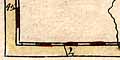
The original map had scales of latitude and longitude in its borders. One small segment remains on the jigsaw puzzle.
The map borders have latitude and longitude scales; chequered and labelled at 5 minute intervals. The bottom scale is labelled:-
Lnge. W. of GreenwichThe map covers 0d 40m to 1d 50m W, 50d 36m to 51d 25m N. Winchester is about 1 degree 17 minutes West, suggesting either inaccurate plotting or a prime meridian 1-2 minutes west of Greenwich, or perhaps Greenwich.
There are rectangular latitude and longitude scales in the pink tinted map borders, chequered in minutes, marked every 5 minutes in arabic numerals, degrees in roman numerals. The lower border is labelled:-
Longitude Wst. from LondonReading from the map scales the:-
longitude, Winchester = 1d 12.6m Wwhich suggests a prime meridian in London well west of Greenwich, perhaps St Paul's?
Printed in the map borders are scales of latitude and longitude; chequered at 10 minute intervals, labelled at degrees. Although the divisions looked slanted on top and bottom scales the projection seems to be rectangular. The map includes from 1d 40m E to 5d 40m W, from 45d 55m to 55d 55m N; England and Wales, an outline of Scotland up to Edinburgh, and the edges of Ireland and France.
The prime meridian is a little east of London, but perhaps no at Greenwich. The approximate:-
longitude, Winchester = 1d 12m Wwhich conforms to this estimate.
Printed in the map borders are rectangular scales for latitude and longitude; chequered at 1 minute intervals, labelled at 5 minutes intervals. The bottom scale states:-
Long. W. fr. London.The longitude of Winchester on the map is about 1 degree 12 minutes W, which accords with a prime meridian about 6 minutes W of Greenwich. Notice that, in error (I assume), the map has 1 degree N marked at the 51 degree parallel. The map covers about 0d 40m to 1d 43m W, 50d 34m to 51d 25m N.
The map extends beyond its printed borders in the NE and SW, and includes the Isle of Wight.
Latitude and longitude scales are printed in the map borders, for a rectangular projection; chequered and labelled at 10 minute intervals. The bottom longitude scale is labelled:-
Longitude West of Greenw[h].The longitude of Winchester is about 1d 18.2m W.
The map includes roughly 0d 40m to 1d 55m W, 50d 25m to 51d 35m N; the whole of Hampshire and the Isle of Wight. (Remember that these notes mostly ignore the Isle of Wight.)
There are scales of latitude and longitude in the map borders for a trapezoid projection; marked and labelled at 1 degree intervals. A graticule is drawn at 1 degree intervals. There are insufficient graduations on the scales to make useful calculations about the projection. Latitude cannot be measured from the map as there is only one marked parallel.
The prime meridian appears to be through Greenwich.
Printed in the map borders are scales of latitude and longitude for a rectangular projection; chequered at 1 minute intervals, labelled at 5 minute intervals. The bottom scale is labelled:-
Longitude West from LondonFrom the scales the:-
longitude, Winchester = 1d 12.6m Wwhich suggests a prime meridian well west of Greenwich in the middle of London, perhaps St Paul's?
The map includes from 0d 43m to 1d 43m W, from 50d 34m to 51d 24m N; the whole of Hampshire with the Christchurch are of Dorset, and the Isle of Wight.
Printed in the borders are scales of latitude and longitude for a rectangular projection.
Printed in the map borders are scales of latitude and longitude; chequered at 10 minute intervals, labelled at degrees. The prime meridian is somewhere through London.
Printed in the map borders are scales of latitude and longitude for a rectangular projection; chequered at 1 minutes intervals, labelled at 5 minute intervals. The ratio of the latitude/longitude scales is about 1.62, near the value, 1.58 at 51d N to make a 'square' map.
The bottom scale is labelled:-
Longitude West from Greenwich.and reading from the map the:-
longitude, Winchester: 1d 17.1m Wnot too far from the accepted value 1d 18.5m W.
The map includes from 0d 41m to 1d 55m W, from 50d 31m to 51d 29m N; the whole of Hampshire including the Christchurch area, Dorset that was then part of the county, and the Isle of Wight.
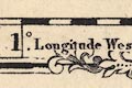
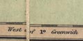
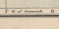
Scales of latitude and longitude for a trapezoid projection are printed in the borders of the map; chequered at 10 minute intervals, labelled at 1 degree intervals. The bottom scale is labelled:-
Longitude East of GreenwichThe map covers from 49d 50m to 56d 10m N, 2d 0m E to 6d 30m W; all of England and Wales, southern parts of Scotland, the edge of Ireland, and a bit of the coast of France.
Scales of latitude and longitude are printed in the map borders, for a trapezoid or some sort of conical projection? chequered in minutes, labelled at 5 minute intervals. The bottom scale is labelled:-
Longitude West from GreenwichReading from the scales the
Longitude, Winchester = 1d 18 1/4m Wwhich agrees closely enough with the statement.
The map covers from 0d 41m to 1d 58m W, from 50d 32m to 51d 24m N; The whole of Hampshire, including the Christchurch area now Dorset, and the Isle of Wight.
Latitude and longitude scales are printed in the borders for a trapezoid projection; chequered at minutes, marked at 5 minute intervals. The map includes form 0d 42m to 1d 53m W, from 50d 28m to 51d 39m N; the whole of Hampshire including the Christchurch area of Dorset, and the Isle of Wight.
Printed in the map borders are scales of latitude and longitude for a rectangular projection; chequered at 1 minute intervals, labelled at 5 minute intervals. The map includes from 0d 40m to 1d 55m W, from 50d 29m to 51d 31m N; the whole of Hampshire and the Christchurch area of Dorset, and the Isle of Wight.
The bottom scale is labelled:-
Longitude West from GreenwichReading from the scales the:-
longitude, Winchester = 1d 17.1m Wwhich is in fair agreement with a prime meridian at Greenwich, from which winchester is 1d 18.1m W.
Printed in the map borders are scales of latitude and longitude for a conical projection; chequered at 5 minute intervals, labelled at degrees. The prime meridian is labelled:-
0 / Meridian of GreenwichA latitude and longitude grid, a graticule, is printed over the map at degree intervals.
The map includes most of Gloucestershire, Oxfordshire, Buckinghamshire, Hertfordshire, Essex, Middlesex, London, Berkshire, Wiltshire, Dorset, Hampshire, Isle of Wight, Surrey, West Sussex, East Sussex, and Kent.
Printed in the map borders are scales of latitude and longitude for a trapezoid projection; marked at 1 minute intervals, labelled at 10 minute intervals. The ratio of lat/long scales makes a 'square' map.
The bottom Longitude scale is labelled:-
Longitude West from Greenwich.As well as can be read the:-
longitude, Winchester = 1d 17.7m W(The accepted value, now, is 1d 18.5m W.)
The map includes from 0d 40m to 2d 0m W, 50d 27m to 51d 33m N; Hampshire including the Christchurch area now Dorset, and the Isle of Wight.
Printed in the map borders are scales of latitude and longitude for a slanted rectangular projection; chequered at 5 minutes intervals, labelled at 10 minute intervals. The map includes from 0d 40m to 1d 55m W, from 50d 25m to 51d 30m N; the whole of Hampshire, including parts of Dorset that were in Hampshire, and the Isle of Wight.
Estimating from the scales the:-
longitude, Winchester = 1d 17.5m Wroughy, which suggest a prime meridian close to Greenwich. The bottom scale is labelled:-
West Longitude
Printed in the map borders are scales of latitude and longitude for a rectangular projection; chequered in minutes, labelled at 5 minute intervals. The map includes 0d 42m to 1d 58m W, 50d 28m to 51d 30m N; the whole of Hampshire and the Isle of Wight. The bottom scale is labelled:-
Longitude West from Greenwichand the
longitude, Winchester = 1d 18m Wagrees with this.
Printed in the map borders are scales of latitude and longitude for a trapezoid projection; chequered at 2 minute intervals, labelled at 10 minute intervals. The ratio of the longitude scales top/bottom is 1.01 which is not as much as it should be for the span of latitudes. The ratio of latitude to longitude scales is about 1.57 which is about correct for a map at this latitude. The bottom scale of longitude is labelled:-
Longitude West from GreenwichThe map includes from 0d 30m to 2d 10m W, from 50d 35m to 51d 23m N; the whole of Hampshire and the Isle of Wight.
Printed in the map borders are scales of latitude and longitude for a rectangular projection. The bottom scale is labelled:-
Longitude West from GreenwichReading as well as possible from the map the:-
longitude, Winchester = 1d 18.9m Wwhich is close to the accepted value, 1d 18.5m W. The ratio of latitude to longitude scales is 1.60, close to the value, 1.58 at 51dN, to make a 'square' map.
The map includes from 0d 29m to 2d 14m W, from 50d 37m to 51d 22m N; the whole of Hampshire and the Isle of Wight, and some adjacent parts east and west.
Printed in the map borders, which are tinted pale brown, are scale of latitude and longitude; chequered in minutes, labelled at 5 minute intervals. The projection is decidedly odd, trapezoid, but upsidedown; the longitude scale at the top is wider than the scale at the bottom! The ratio of the bottom (S) scale to top (N) scale is 0.94, it should be about 1.02.
The ratio of latitude/longitude scales is 1.61; this is close to the value to produce a 'square' map, 1.58 at latitude 51d N.
Measured from the map as well as can be, the:-
longitude, Winchester: 1d 16.6m WSuggesting a prime meridian about 2 degrees W of Greenwich.
There are two discreet marks inside the top and bottom borders, labelled:-
2 [degrees]which could be taken to be the meridian for the map. This meridian runs through Langstone Harbour and between Basingstoke and Odiham. It is 1, not 2, degrees west of Greenwich. Inside the left border is a mark labelled:-
51 [degrees]of latitude.
Printed in the map borders are scales of latitude and longitude for a rectangular projection; chequered at 1 minute intervals, labelled at 5 minute intervals. The bottom scale is labelled:-
Longitude West from GreenwichThe map includes from 0d 42m to 1d 53m W, from 50d 31m to 51d 23m N; the whole of Hampshire with the Christchurch area of Dorset, and the Isle of Wight.
Scales of latitude and longitude are printed in the borders, divided at minute intervals, labelled a 10 minute intervals; the bottom scale labelled:-
Longitude West from GreenwichThis accords with
longitude, Winchester = 1d 18.5m WestThe lat and long scales suggest a trapezoid projection.
Both sheets have latitude and longitude scales for a rectangular projection printed in the borders; divided at one minute intervals, labelled at ten minute intervals.
The bottom scale is labelled:-
Longitude West from GreenwichThe two maps include from 0d 49m to 1d 55m W, from 50d 36m to 51d 24m North; the whole of Hampshire and the Christchurch are of Dorset, and the Isle of Wight.
Printed in the chart borders are scales of latitude and longitude for a rectangular projection; chequered at 1 minute intervals, tinted red and yellow, labelled at 5 minute intervals. The bottom scale is labelled:-
West from GreenwichA graticule is printed across the chart at 5 minute intervals. The map includes from 0d 38m to 1d 20m W, from 50d 33m to 50d 51m N: part of the coast of West Sussex, from Bognor to the Hants border, showing The Owers; part of the coast of Hampshire from Sussex to Southampton Water, including Spithead; the east half of the Isle of Wight from Cowes round to St Catherine Point.
Printed in the map borders are scales of latitude and longitude. These appear to be drawn for a trapezoid projection, which is barely worthwhile on such a small map.
Printed within the borders are scales of latitude and longitude for a trapezoid or rectangular projection; chequered in minutes, labelled at 5 minute intervals. The lower scale is labelled:-
Longitude West from GreenwichHowever, the
longitude, Winchester = 1d 17.5m Wrather than the 1d 18.4m W expected. Calculations from the scales suggest that there could be a trapezoid projection, but this is uncertain, and I incline to think the projection is rectangular. The ratio lat/long scales = 1.56 at 51 degree N, the expected value for a 'square' map is 1.58.
The map borders have scales of latitude and longitude for a rectangular projection; chequered at 2 minute intervals, labelled at 10 minute intervals. The map includes from 0d 45m to 1d 52m W, 50d 38m to 51d 28m N; Hampshire and the Isle of Wight. The longitude of Winchester is 1d 18.5m W which agrees with the label on the bottom longitude scale:-
West from GreenwichThe ratio lat/long scales is 1.60 which is 'correct' for Hampshire's latitude.
Printed in the map borders are scales of latitude and longitude for a rectangular projection; chequered at 1 minute intervals, labelled at 5 minute intervals and degrees. The bottom border is labelled:-
Longitude West from London
The map has a graticule, latitude and longitude grid, printed at 10 minute intervals, for a trapezoid projection. The grid is labelled in the borders at 10 minute intervals. The ratio of the longitude scales top/bottom is 1.01; this is close to the 'correct' value, 1.02, for the latitude range. The ratio of latitude to longitude scales is 1.58, exactly the value for a 'square' map. The graduations at the bottom, longitude, are labelled:-
W. from GreenwichThe
longitude, Winchester = 1d 18.5m Wwhich accords with the Greenwich prime meridian.
The map includes from 0d 45m to 1d 55m W, from 50d 30m to 51d 25m N; the whole of Hampshire and the Isle of Wight. Odd corners of the county stick out beyond the borders of the map.
The borders also have labels for the graticule cells; A..H from left to right and 1..6 from top to bottom, so the graticule can be used as a simpler index grid.
Printed in parts of the map borders that are not obscured by decoration, coat of arms, and extremities of the county spilling over the frame, are scale of latitude and longitude; chequered in minutes, labelled at 10 minute intervals. The bottom scale is labelled:-
Longitude West from GreenwichAs well as can be judged the:-
longitude, Winchester = 1d 18.5m WMaking some rough measurements from the scales:- The ratio of the length of minutes of latitude to minutes of longitude is 1.58, which makes this a 'square' map. The lengths of the top and bottom longitude scales are in ratio 0.95, this is a trapezoidal projection, though for the range of latitudes a ratio 0.98 would have been expected.
Printed in the borders of the maps are scales of latitude and longitude for a trapezoid, or more scientific projection. The north sheet scales are chequered in minutes, labelled at 5 minute intervals; the south sheet scales have no chequers or marks for minutes, but are just marked and labelled at 5 minute intervals. The bottom scale, north sheet, is labelled:-
Longitude West of GreenwichFrom the longitude scales the:-
longitude, Winchester = 1d 18.8m Win agreement with the label.
The maps include from 0d 38m to 1d 58m W, from 50d 37m to 1d 23m N; the whole of Hampshire including the Christchurch area now Dorset, plus the Isle of Wight The two sheets sensibly include slightly different ranges of longitude.
Printed in the map borders are scales of latitude and longitude for a type of conical projection; chequered at 10 minute intervals and labelled at degrees.
The map includes from 2d E to 6d W, from 50d to 55d 40m N; the whole of England and Wales, with the Isle of Man, with an outline of parts of Scotland and the coast of France.
The map borders have rectangular latitude and longitude scales, marked at 5 minute intervals, labelled at 10 minute intervals. The bottom border is labelled:-
West from GreenwichThe scale of the map could be estimated from the latitude scale.
Printed in the map borders are scales of latitude and longitude for a conical projection; chequered in 10 minute intervals, labelled at degrees. The bottom longitude scale is labelled:-
Longitude East from Greenwichto the right of the prime meridian.
The map includes from about 1d 30m E to 5d 40m W, from 49d 40m to 56d 10m N; the whole of England and Wales, with southern Scotland in outline, and part of the coast of France.
Along the borders of the map there are small gradation marks, without any labelling. These are latitude and longitude scales, marks at 10 minute intervals. The 1 degree W meridian marks are the ones that line up with the left part of Hayling Island; the 51 degree N marks roughly line up with Petersfield.
The ratio of longitude scales top/bottom is about 0.96, about correct for a trapezoidal projection at this spread of latitude. The ratio of latitude to longitude scales is about 1.28, not quite right for a 'square' map at this latitude.
Printed in the map borders are scales of latitude and longitude for a trapezoid projection; chequered in minutes, labelled at 10 minute intervals. The bottom longitude scale is labelled:-
Longitude West of GreenwichAs well as can be read the:-
longitude, Winchester = 1d 18.2m Wwhich agrees with the accepted figure 1d 18.4m W.
The international agreement of Greenwich as the prime meridian was made at a conference in the United States 1884, the year this map was published. It was already well established as a prime meridian in use by many nations as well as Britain.
The map includes from 0d 23m to 1d 53m W, from 50d 31m to 51d 26m N; the whole of Hampshire and parts of Dorset which were Hampshire, and the Isle of Wight.
There is a rectangular latitude and longitude grid, a graticule, printed over the map, at 10 minute intervals, labelled in the borders at 30 minute intervals. The longitude of Winchester is 1 degree 18 1/2 minutes W corresponding to a prime meridian at Greenwich (accepted internationally 1884).
The map covers 0 degree 45 minutes to 1 degree 55 minutes W, 50 degrees 30 minutes to 51 degrees 30 minutes N; Hampshire including the Christchurch area, now Dorset, and the Isle of Wight.
The graticule also serves as an index grid. The 10x10 minute cells are labelled in the borders A..H top to bottom, 1..6 left to right. These are referred to by the:-
INDEXat the back of the atlas, where:-
NOTE,- The letters and numbers after the names correspond with those in the borders of the map, and indicate the square in which the name will be found.For example:-
Winchester, Hampshire ... D 3in which square you will find the word though the town symbol is in E3.
Printed in the borders are scales of latitude and longitude for a ?trapezoid projection; chequered at 10 minute intervals, labelled at degrees. The prime meridian is Greenwich; the bottom scale is labelled:-
Longitude West from GreenwichThe map includes from 2 or 3d E to 6 or 7d W, 49d 50m to 56d 15m N; England and wales, the south of Scotland, and a corner of France.
Printed in the map borders are scales of latitude and longitude; chequered at 1 minute intervals, labelled at 15 minute intervals. The map projection is rectangular. The map includes from 0d 43m to 1d 55m W, from 50d 29m to 51d 29m N; the whole of Hampshire and the Isle of Wight.
The ratio of latitude to longitude scales is 1.57, near enough the correct value, 1.58 for 51d N, for the map to be 'square'.
Printed in the map borders are scales of latitude and longitude for a conical projection; chequered at 10 minute intervals, labelled at 30 minute intervals. The map includes from 1d 40m E to 5d 40m W, from 49d 5m to 52d 30m N; plus an inset map for the Scilly Isles.
A graticule, latitude and longitude grid, is printed at 30 minute intervals. This grid is also an index grid. Its 'squares' are labelled A..O (no J) across, h..o (no j) down. The north sheet presumably has a..h.
Printed in the map borders are sales of latitude and longitude; chequered at 1 minute intervals, labelled at 5 minutes intervals.
(This note is at the edge of my knowledge and comprehension; beware.) The projection used for the Hampshire sheets of this map series is a Cassini projection using a central meridian at Greenwich, and perhaps a central meridian base on Butterton Hill for the westerly sheets.
lat and long |
|||||||||||||||||||||||||||||||||
| latitude scale |  |
 |
 |
 |
 |
|
|
|
|
|
|
|
|
 |
|
|
|
|
|
|
|
|
|||||||||||
| lat and long scales | |
|
|
|
|
|
|
|
|
|
|
|
|
|
|
|
|
|
|
|
|
|
|
|
|
|
|
|
|
|
|
|
|
| hours from ... | |
|
|
|
|
|
|
|
|
|
|
|
|||||||||||||||||||||
| lat and long grid | |
|
|
|
|
|
|
|
|
|
|
|
|
|
|
|
|
|
|
|
|
|
|
|
|
|
|
|
|||||
| rectangular | |
|
|
|
|
|
|
|
|
|
|
|
|
|
|
|
|
|
|
|
|
|
|
|
|
|
|
|
|
|
|
||
| trapezoid | |
|
|
|
|
|
|
|
|
|
|
|
|
|
|
|
|
|
|
|
|
|
|
|
|
|
|
|
|
|
|
||
| conical | |
|
|
|
|
|
|
|
|
|
|
|
|
|
|
|
|
|
|
|
|
|
|||||||||||
| prime meridian in W | |
|
|
|
|
|
|
|
|
|
|
|
|
|
|
|
|
|
|
||||||||||||||
| prime meridian London | |
|
|
|
|
|
|
|
|
|
|
|
|
|
|
|
|
|
|
|
|
||||||||||||
| prime meridian Greenwich | |
|
|
|
|
|
|
|
|
|
|
|
|
|
|
|
|
|
|
||||||||||||||

