
Old Hampshire Mapped

Post Office Circulation 1890
Map Features(Hampshire details)
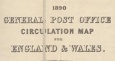
1890 GENERAL POST OFFICE CIRCULATION MAP FOR ENGLAND & WALES.
Stanford's Geographical Establishment, London
up is N
scale
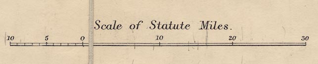
Scale of Statute Miles.The scale has 30 miles marked at 10 mile intervals, plus 10 miles leftwards divided at miles, marked at 5 miles intervals. The 30+10 miles = 99.7 mm gives a scale 1 to 645675; the map scale is about:-
1 to 650000
10 miles to 1 inch
symbols
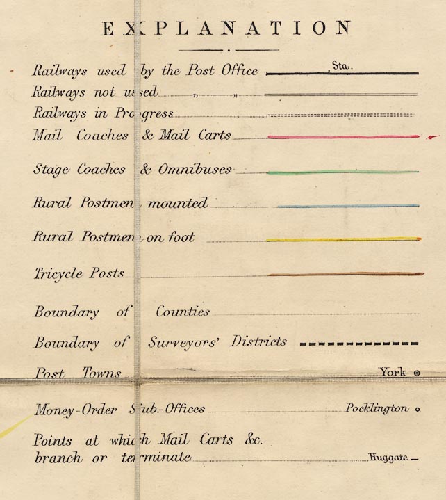
EXPLANATION[The scale line is drawn next.]
Railways used by the Post Office [bold line, and a line for a station]
Railways not used [double light lines]
Railways in Progress [double light dotted lines]
Mail Coaches & Mail Carts [line tinted red]
Stage Coaches & Omnibuses [line tinted green]
Rural Postmen mounted [line tinted blue]
Rural Postmen on foot [line tinted yellow]
Tricycle Posts [line tinted brown]
Boundary of Counties [light dotted line]
Boundary of Surveyor's Districts [bold dashed line]
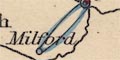
Post Towns [name, upright lowercase, and double circle]
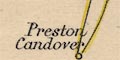
Money-Order Sub.-Offices [name, italic lowercase, and circle]
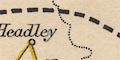
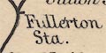
Points at which Mail Carts &c. branch or terminate [name, backsloped italic lowercse, and dash]
To avoid overcrowding the map, only a selection of Money Order Sub-Offices is given in the populous Districts
The portions of the Map coloured pink mark the separate districts of the Postmasters of Manchester Liverpool and Birmingham
The county boundaries are drawn by a light dotted line; the bolder dashed line is the post office surveyor's district boundary.
The post office surveyors' districts bear no relationship to counties (just as postcodes today are independent of local authority administration; confusing to the public, but making good sense to the postmen delivering the mail.)
Hampshire mostly lies in the south central PO surveyor's district covering all or parts of Middlesex, Buckinghamshire, Berkshire, Wiltshire, Hampshire, Surrey, Dorset and Isle of Wight. Eastern parts of Hampshire are in a south eastern PO surveyor's district stretching across all or parts of West Sussex, East Sussex, Surrey, and Kent.

post town.
money order sub office.
end of a post route.
mail coach or mail cart, red,
stage coach or omnibus, green,
mounted rural postman, blue,
rural postman on foot, yellow
or tricycle, brown.
Railways are drawn by bold lines if they are part of the postal system, otherwise by light double lines, and by light dotted lines if they are in still course of construction. The railways (not their companies) shown in use are:-
Andover and Redbridge RailwayThe GWR line from Newbury to Winchester, and the Petersfield Railway from Midhurst, are shown as lines not used. A railway under construction is shown down the west bank of Southampton Water, on a line which never got built quite that way, which looks as if it is aiming for a closest crossing to Cowes, Isle of Wight..
Basingstoke and Salisbury Railway
Berkshire and Hampshire Railway
Bishops Waltham Railway
Bishopstoke to Gosport branch railway
Brockenhurst to Christchurch branch railway
Chichester to Portsmouth Railway
Eastleigh to Salisbury branch railway
Fareham to Cosham branch railway
Farnham to Alton branch railway
Hurstbourne to Fullerton branch railway
London and Southampton Railway
Lymington Railway
Mid Hants, Alton Lines, Railway
Portsmouth Railway
Reading, Guildford and Reigate Railway
Ringwood, Christchurch and Bournemouth Railway
Salisbury and Dorset Junction Railway
Southampton and Dorchester Railway
Southampton and Netley Railway
Stokes Bay Railway and Pier
Swindon, Grafton and Marlborough Railway


