
Old Hampshire Mapped
Introduction
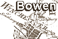
Bowen's Hampshire 1720The maps used are in the collection of Hampshire County Council Museums Service. This study concentrates upon what can be seen from the maps; studies of the background of mapping in England, and map makers have been published elsewhere.
A facsimile of the road book has been published:-
Bowen, Emanuel: 1970 (reprint) & 1720: Britannia Depicta; Ogilby Improved: Graham, Frank (6 Queen Terrace, Newcastle upon Tyne, Tyne and Wear)(reprint):: ISBN 0 900409 39 8; Dewey 942.071The following pages include material relevant to Hampshire:-

on pages 59-67
0 - 33.5 miles
London, Kensington; Brentford, Hounslow, Middlesex; Egham, Bagshot, Surrey, to Hampshire border at Blackwater River
coat of arms and text for Whitchurch
coat of arms and text for Shaftesbury
text for Staines
continues to Hartley Row, Hook, Newnham, Basingstoke, Wootton St Lawrence, Whitchurch, Hurstbourne, Andover, Hampshire
coat of arms and text for Honiton
text for Basingstoke
Andover, Middle Wallop, Hampshire; Salisbury, White Sheet Hill, Wiltshire
coat of arms and text for Milbourn Port
coat of arms and text for Ashburton
36.5 to 73 miles
part of Surrey; Liphook, Hampshire; part of West Sussex; Petersfield, Horndean, Cosham, Portsmouth, Hampshire
coat of arms and text for Portsmouth
text for Portsea Island
coat of arms and text for Francis North
66 to 104 miles
Andover, Monxton, Hampshire; Amesbury, Shrewton, Warminster, Wiltshire
coat of arms and text for Andover
text for Warminster
text for Amesbury
text for maiden Bradley
30.5 to 63.5 miles
Guildford, Godalming, Surrey; Midhurst, Chichester, West Sussex
coat of arms and text for Bishoprick of Chichester
coat of arms and text for Petersfield
coat of arms and text for Anthony Brown of Cowdrey Place
text for Midhurst
0 to 29 miles
Midhurst, West Sussex; Petersfield, Winchester, Hampshire
coat of arms for Winchester
coat of arms for Deanery of Winchester
coat of arms for Charles paulet, Marquis of Winchester
29.5 to 61.5 miles
Bagshot, Frimley, Surrey; part of Hampshire, Farnham Heath; Farnham, Surrey; Bentley, Alton. New Alresford, Hampshire
text for Farnham
text for Alton
part of text for Southampton
coat of arms and text for James Cecil, Earl of Salisbury
continues to Southampton, Hampshire
AND branch route
0 to 25.5 miles
Southampton, Romsey, Hampshire; Whiteparish, Salisbury, Wiltshire
coat of arms and text for Southampton
text for New Alresford
coat of arms and text for Charles Fitzroy, Duke of Cleveland
coat of arms and text for Southampton
50 to 85.5 miles
Basingstoke, Sutton, Stockbridge, Broughton, East Dean, Hampshire; part of Wiltshire
coat of arms and text for Stockbridge
text for Blandford
text for Isle of Portland
0 to 35.5 miles
Oxford, Oxfordshire; Abingdon, east Ilsley, Newbury, Berkshire; Kingsclere, Hampshire
coat of arms and text for Bishoprick of Chester (!)
text for Ilsley
text for Donnington Castle
Basingstoke, Alton, Petersfield, Hampshire; Chichester, West Sussex
coat of arms and text for Chichester
text for Alton
text for Vale of the White Horse
North Tidworth, EWiltshire; tiny gusset of Hampshire; Salisbury, Wiltshire; Cranborn, Wimbourne Minster, Poole, Dorset
coat of arms and text for Poole
coat of arms and text for Wimborne St Giles
text for Wantage
text for Winterbourne
introduction
Map of Hampshire
60 to 97 miles
New Alresford, Winchester, Romsey, Malwood Castle, Ringwood, Hampshire
coat of arms and text for Lymington
text for Romsey
text for Malwood Castle
text for Ringwood
98 to 110.5 miles
part of Hampshire; Knaston, Poole, Dorset
0 to 22 miles
Poole, Christchurch, Dorset; Lymington, Hampshire
0 to 12 miles
Southampton, Winchester, Hampshire
coat of arms of Christchurch
coat of arms of Deanery of Christchurch
text for New Forest

