rivers
Bowen's Hampshire 1720ford,
pond,
ferry
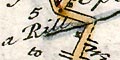
Most rivers are just drawn where they cross the road. Occasionally the river is drawn alongside, eg in the Itchen valley, pl.130 mile 72-78.
Braiding is not shown, but it is implied for instance at Stockbridge where the Test crosses several times in parallel, pl.135 mile 71.
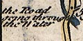
A ford is clearly shown and labelled at Alresford, pl.129 mile 58 the Road going through the Water
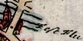
Here there is also a Pond, ie Alresford Pond pl.129 mile 59.
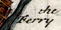
a Ferry is labelled across the Itchen pl.264 by Southampton.


