scale

Bowen's Hampshire 1720

Miles Bowen's road maps of Hampshire have no scale line or other formal indication of scale alongside the map.

The scale is implied by the markings on the roads:-
The beginning of the Road is always at the bottom on
the left Hand, in the Page following the Title; whence you
proceed upwards from 1, 2, 3, 4, 5 &c Miles untill you come
to the Top of the first Collum; and so on in like man~er
from the Bottom of the 2d. 3d. &c. beginning in every
Page on the left Hand as before directed -

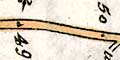
The Black Dots or Points in the middle of the Road,
are the Stations of the Miles, with their respective
nos. affixed to them.
Scale The scale of the road maps has been estimated by measuring the straighter segments of road from mile spot to mile spot. Badly kinked lengths were not measured. The measurements are small, and therefore inaccurate, ie measuring 10mm or so plus or minus 0.2mm has an error of 2%. By measuring a lot of segments and averaging, the error in the average is reduced. There seem to be differences in scale from plate to plate.
1 mile = 11.3 +-0.02mm
The scale of the road maps, assuming a modern mile, is:-
1 to 142000
2 1/4 miles to 1 inch
The measurements made are listed below.

 
     pl.60       pl.73       pl.97       pl.216      pl.217 
      
     12.8        8.8         10.8        11.3        11.2 
     10.7        10.2        32.0 (3)    32.6 (3)    11.0 
     10.6        10.7        11.1        21.1 (2)    11.5 
     46.7 (4)    22.3 (2)    12.1        34.6 (3)    9.9 
     14.0        11.0        10.2        22.2 (2)    11.1 
     10.4        11.2        15.0        31.3 (3)    11.7 
     11.9        10.4        11.0        11.5        13.5 
     24.9 (2)    11.0        11.3        11.0        10.8 
     12.0        10.0        13.0        45.9 (4)    11.1 
     21.6 (2)    10.9        13.0        43.2 (4)    10.3 
     13.1        12.0        14.0        20.8 (2)    10.5 
     9.3         11.2        12.0        12.2 (2)    11.0 
     12.0                    11.1                    12.9 
     11.3                    10.0                    11.3 
     10.7                    12.9                    9.0 
     10.8                    11.4                    11.2 
     10.5                    22.0 (2)                22.0 (2) 
     12.2                                            11.5 
     12.2                                            13.0 
     15.7 

totals/no of mile segments 
     293.4       139.7       232.9       297.7       260.5 
     25          13          20          27          23 
averages 
     11.7        10.7        11.6        11.0        11.3 

overall average  1 mile = 11.3 


The range of mile lengths for the 5 plates were:- 
     9.3 - 15.7 
     8.8 - 11.2 
    10.0 - 15.0 
    10.4 - 11.5 
     9.0 - 12.9  


Bowen's Hampshire 1720, contents
General index
Old Hampshire Mapped