Map features
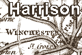
Harrison's Hampshire 1788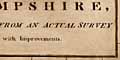
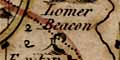
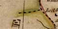
Selbone and Lomer are the only beacons plotted (they are shown on the hills map).
and fortifications; polygonal wall.
|
| Map featuresHarrison's Hampshire 1788 |
| Map feature |
Some images can be clicked for more information. |
|
| title cartouche, map maker |
|
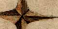
| compass rose |
|
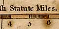
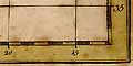
| scale line |
|
| latitude and longitude scales; and grid |
|
| coast form lines; plain sea. |
|
| rivers; wiggly lines narrowing upstream, a few rivers are labelled. |
|
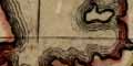
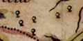
| relief; groups of small hillocks. |
|
|
beacons; tower with smoke or flames on a hill. Selbone and Lomer are the only beacons plotted (they are shown on the hills map). |
|
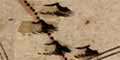
| woods, forest; groups of small symbolic trees, a circle on a trunk. |
|
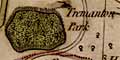
| parks; ring of fence palings, usually with trees; the is not just a conventional oval but attempts to show the shape of the park. |
|
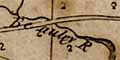
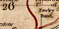
| hundred boundaries; dotted line; hundreds are keyed to a table by number, parts are labelled. |
|
|
county boundary; dashed line. |
|
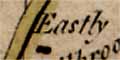
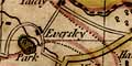
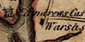
| settlements; hamlets, villages, towns, etc |
|
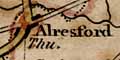
| towns; market days, etc |
|
|
roads; principal and other roads, parallel lines,
graded into two sizes. |
|
|
coastal defence, castles; two towers. and fortifications; polygonal wall. |
 
| Harrison's Hampshire 1788, contents |

| General index |

| Old Hampshire Mapped |