
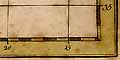
Old Hampshire Mapped
Hampshire Map Projections
The 'correct' ratio lat/long expressed in miles for a spherical Earth at 51 degree N is 1/cos(51) = 1.59. With this ratio a 1 mile x 1 mile square of land plots to a 1 unit x 1 unit square on paper.
MERCATOR'S PROJECTION
The earth's graticule is projected from the centre of its sphere to a 'vertical' cylinder tangential to the equator.
Latitude plots by r.tan(latitude)
Longitude plots by 2.pi.r.longitude/360
For Hampshire
1 degree latitude = r.(tan(51 +0.5) - tan(51 - 0.5))
1 degree longitude = 2.pi.r/360
ratio lat/long = 2.546
Mercator's projection stretches Hampshire 60 percent N-S.
1 mile x 1 mile becomes 1 unit x 1.60 units on paper.
SIMPLE CYLINDRICAL, PLATE CAREE
The graticule is rectangular lat and long scales with equal units each way.
For Hampshire
ratio lat/long = 1.00
Simple Cylindrical stretches Hampshire 58 percent E-W.
1 mile x 1 mile becomes 1.58 units x 1 unit on paper.
CYLINDRICAL EQUAL AREA, LAMBERT'S PROJECTION
A cylinder of paper is wrapped round the Earth, tangential at the equator. The graticule is projected horizontally from positions on the Earth's axis.
Latitude plots by r.sin(latitude)
Longitude plots by 2.pi.r.longitude/360
For Hampshire
1 degree latitude = r (sin(51 +0.5) - sin(51 - 0.5))
1 degree longitude = 2.pi.r/360
ratio lat/long = 0.629
Cylindrical Equal Area stretches Hampshire 152 percent E-W
1 mile x 1 mile becomes 1.52 units x 1 unit on paper.