 |
Map features
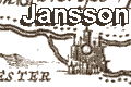
Jansson's Hampshire 1646 |
|
| Map feature |
Some images can be clicked for more information.
|
 |
title cartouche; scroll cartouche 'HANTONIAE COMITATUS
Cum BERCHERIA' |
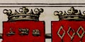 |
coat of arms; coats of arms of earls of Winchester
and Southampton. |
 |
orientation; the map has both compass rose and labelled
borders, and rhumb lines. |
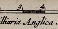 |
scale line; scroll cartouche with two scale lines,
'Milliari Anglica' and 'Milliari Germanica'. |
 |
coast shaded; into a plain sea, a few sandbanks are shown. |
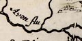 |
rivers; wiggly lines narrowing upstream. |
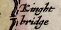 |
bridges; some bridges are clearly marked. |
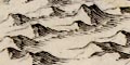 |
relief; groups of hillocks shaded to the right. |
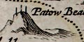 |
beacons; a post or posts on a hillock. |
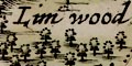 |
woods, forests; groups of small tree symbols. |
 |
parks; a ring of fence palings, shaded to the right, perhaps
with trees etc. |
 |
county boundary; dashed lines; the two counties
are labelled. |
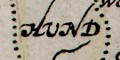 |
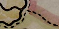
hundred boundaries; dotted lines, the areas labelled. |
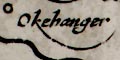 |
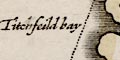
settlements; hamlets, villages, towns, cities, etc. |
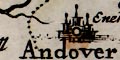 |
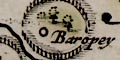
market towns; and other towns |
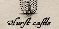 |
coastal defence, castles; circle, buildings, towers
with flags.
|
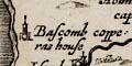 |
miscellany; windmills, water mills, copperas works. |


