Map features
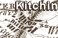
Kitchin's Hampshire 1751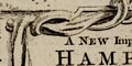

Some places outside the county are drawn for the sake of continuity, Farnham for instance, on one of the main roads.
|
| Map featuresKitchin's Hampshire 1751 |
| Map feature |
Some images can be clicked for more information. |
|
| title cartouche; monumental block of stone, scenery and figures, 'A NEW Improved MAP of HAMPSHIRE' |
|
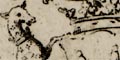
| dedication and coat of arms; to the Duke of Bolton, Charles Pawlet. |
|
| orientation; compass rose, circle and cardinal points. |
|
| lat and long scales; printed obliquely in the borders. |
|
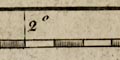
| scale line; 'British Statute Miles'. |
|
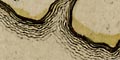
| coast form lines; sea plain, coast drawn with form lines. |
|
|
coastal defence; castles and fortifications. |
|
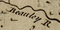
| rivers; wiggly lines narrowing upstream; some rivers are labelled. |
|
| bridges; some bridges are clearly marked. |
|
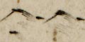
| relief; groups of hillocks shaded on the east side. |
|
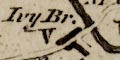
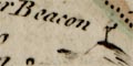
| beacons; post with cresset on a bracket? |
|
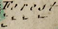
| woods, forests; a litter of tree symbols. |
|
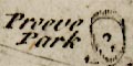
| parks; ring of fence palings, perhaps with trees and a house. |
|
|
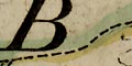
county boundary; bold dashed line, tinted along with the
hundred boundaries. Adjacent counties are labelled, eg: 'SURREY' Some places outside the county are drawn for the sake of continuity, Farnham for instance, on one of the main roads. |
|
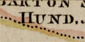
| hundred boundaries; dotted lines, tinted; areas labelled. |
|
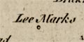
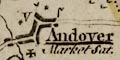
| settlements; houses, hamlets, villages, towns, cities, with Market Days, etc; and a table of symbols. |
|
| market towns; and other towns |
|
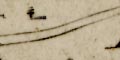
| roads; double continuous line; road distances from town to town. |
|
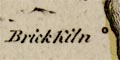
| miscellaneous; brickworks, school. |
 
| Kitchin's Hampshire 1751, contents |

| General index |

| Old Hampshire Mapped |