
Old Hampshire Mapped
Map Scales
Notesfrom
features
It is worth remembering a couple of conversion figures:-
1 miles = 63360 inchesIt is easier to make accurate measurements in millimetres (mm) than inches (it's easier to find a ruler with mm nowadays anyway).
1 inch = 25.4 mm
Computer program OLDMAPS.exe has been used in the Old Hampshire Mapped project to automate this process. It uses about twenty towns and calculates the map scale, its rotation from the ngr 'north' etc, and makes it possible to lay down today's National Grid on an old map.
When dealing with distances on maps you must bear in mind that a map, on a flat two dimensional piece of paper, is a representation of the curved two dimensional surface of the globe; shapes are distorted, distances are altered. A map is made using a particular projection, making its particular distortions; good practice will have printed data about the projection on the map, or in an associated handbook. The apparent distance between two places on the map will be different for different projections. All the distances given in the tables below are based on positions, national grid references, on Ordnance Survey maps - you can look up the OS handbook to find out about its projection. Old maps, not even early OS maps, will not have used the same projection.
There are serious problems in measuring distances between places which are not just points on the map, towns, for example, have extent, they are not at a mathematical point. On both new and old maps the plotted position of a feature may not be just where the feature is - or was, remember that the feature, especially a settlement, may have spread and shifted in time. The parish church is probably the best point to use for comparing old and new positions.
line
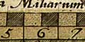
A scale line has a stated number of miles on it; it can be measured with a ruler and a hand lens, millimetres are a good unit as it is practical to read a length to a fraction of a millimetre quite easily. Then calculate:-
[miles] x 63360 x 25.4 / [mm]is the scale ratio, eg, for a 10 mile scale line, 65mm long:-
10 x 63360 x 25.4 / 65 = 247591.38It would be ridiculous to quote the accurate figure as the map scale. The error of measurement should be estimated. I would quote the scale to 2 significant figures at best, ie:-
1 to 250000The scale can also be given in miles to 1 inch, by dividing:-
247591.38 / 63360 = 3.9076922I feel that a pessimistic assessment of error should be taken, the scale quoted to 1 significant figure, ie:-
4 miles to 1 inch.The smaller the scale line the greater the error in measuring.
shrinks
A very rough guide:- paper changes 0.2% in length per 10% change in relative humidity.
distances
You cannot measure a long length of road to reduce the error of calculating a scale because of the bends. Another method could serve, though it is time comsuming. Each fairly straight mile is measured, and the average found to get an estimate of 1 mile in millimetres along the road.
An example, using a map from Bowles's Post Chaise companion. This map has 6 strips of road marked in miles, measured in mm:-
     8.0   9.0   8.3   8.2   9.5   7.9
     9.2   9.6   8.4   9.1   8.6   8.6
     9.9   9.4   7.7   9.5   9.6   8.8
     8.3   9.0   8.0   8.2   8.0   9.1
     8.0   8.7   8.0   8.9   9.0   8.1
     8.8   7.7  11.3   9.0  11.1   7.6
     9.7  11.6  10.9   8.6   8.2   9.8
     9.5   9.3   8.2   8.8   8.9   9.8
     7.9   9.0   8.9   8.0
     9.0         8.9
     8.2         7.4
     8.7
totals:-
   105.2  83.3  96.0  78.3  72.9   69.7

TOTAL 505.4mm = 57 miles

1 mile = 8.87mm, scale 1 to 181505 or 2.86 miles to 1 inch
Respecting the errors the map scale is:-
1 to 180000In practice the estimate does not take into account the wigglyness of the roads and the scaling of the map is not quite right.
3 miles to 1 inch.
Also in practice, it is not possible to measure only straight bits of road, there are too few straights! This leads to a bias in the measurements; each wiggle means the segment is measured a little too small, the scale comes out slightly too big.
1 degree latitude = 69.17 milesA degree of latitude does vary in length from latitude to latitude because the earth is an oblate spheroid, not an exact sphere. The length given here is true for Hampshire.
Do not make the mistake of using longitude for this calculation. It is possible, but longitude varies considerably from latitude to latitude, and you need to know just where you are and the local length of a degree of longitude.
SCALES
Scales are best expressed in neutral terms as ratio '1 to whatever'. The following table relates the more familiar expressions of miles-to-inches to ratios:-
inches to 1 mile              1 to how many
          miles to 1 inch
          (rounded off)

0.02      50                       3168000
0.02112   47.348                   3000000
0.025344  39.457                   2500000
0.03168   31.566                   2000000
0.04      25                       1584000
0.04166'  24                       1520640
0.04224   23.674                   1500000
0.05      20                       1267200
0.05555'  18                       1140480
0.06336   15.782              1 to 1000000
0.06666'  15                       950400
0.08333'  12                       760320
0.1       10                       633600
0.12672   7.891                    500000
0.2       5                        316800
0.25      4                        253440
0.25344   3.946                    250000
0.3168    3.156                    200000
0.3333'   3                        190080
0.5       2                        126720
0.6336    1.578               1 to 100000
1         1                   1 to 63360
1.2672    0.789                    50000
2         0.5                      31680
2.5       0.4                 1 to 25344
2.5344    0.395               1 to 25000
3         0.333                    21120
4         0.25                     15840
5         0.2                      12672
5.0688    0.197                    12500
6         0.167               1 to 10560
6.336     0.158               1 to 10000
8         0.125                    7920
10        0.1                      6336
12        0.0833                   5280
12.672    0.0789                   5000
15        0.0667                   4224
20        0.05                     3168
24        0.0417                   2640
25        0.04                1 to 2534.4
25.344    0.0395              1 to 2500
50        0.02                     1267.2
50.688    0.0197                   1250
60        0.0167                   1056
126.72    0.00789                  500
Markers are put in the right column just to guide the
eye to commonly used scales.