
Morden's Maps of Hampshire
Introduction
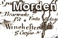
Morden's playing card map, Hampshire 1676by Robt Morden
cards
The 52 Countries of England and Wales, described in a Pack of Cards ... by Robert Morden at the Atlas in Cornhill, Will. Berry at the Globe in the Strand, Robert Green in Budge Row, and George Minikin at the King's Head in S. Martin'sIt is suggested that, like similar packs on this and other subjects the cards were for instruction, education, rather than for serious use as playing cards. Morden's own words on the preliminary cards belie this idea.
There is an introduction on a preliminary card:-
The Explanation of these Cards.The last remark reminds the user that the cards have no spots, but have at the top edge the suit shown by its usual symbol, and a roman number from I to X, or a vignette portrait of a common fellow, Queen Catherine of Braganza, and King Charles II.
The four Suites are the 4 parts of England, the 13 Northern Counties are Clubs, the Western are Spades, the Eastern are Hearts, and the Southern are Diamonds, in each Card you have a Map of the County with the cheife Towns and Rivers, a Compas for the Bearings, and a Scale for Mensuration, there is also given the Length, Breadth, and Circumference of each County, the Latitude of the Cheife Citty or Towne, and its Distance form London. First the reputed and then the Measured Miles by Esqr. Ogilby with his leave we have Incerted. there is also the Road from London to each Citty or Towne, the great Roads are drawn with a double line, the other Roads a single line, as also the cheif Hills and other remarks The use of these cards are the same as with the Common Cards in all respects only useing the Numbers in these insted of the spots in the Other.
Another preliminry card has
A Mapp of England & WalesThis is tiny; the scale line of 60 miles is 8.2mm long in the facsimile version, a scale of 1 to 13700000 (13738302) wrongly assuming a statute mile. The counties are labelled with a letter or two; Hampshire is 'Ha'. The map manages to fit in a compass rose, scale line and royal coat of arms, and a caption:-
The 52 Counties of England and Wales, geographically described in a pack of Cards, whereunto is added ye Length, Breadth, & Circuit. of each County the Latitude Scituation and distance from London of ye principal Cities, Towns, and Rivers, with other Remarks as plaine and ready for the playing all our English Games, as any of ye Common Cards.The pack of cards is rare: only one pack is thought to exist. These notes are made from a reproduction set published by Harry Margary, Lympne, Kent, 1972, copied from the set then owned by David Kingsley.
map


