
Old Hampshire Mapped
County Map Projections
Most of Old Hampshire Mapped does not investigate map projections. Beyond some simple ideas outlined below the subject is decidedly technical. The identification of the projection used for maps is beyond the analysis that we wish to do; we hope that the reliable digitised images, supplied in the 'raw' image files and which can be used for measurements, will enable the user of the website to explore this sort of thing. But the user should be warned: the early maps are not super accurate in the first place, so measurements from them may have errors which obscure what projection was used; the map maker may not have used a projection to make his map, but have applied, somehow or other, lat and long scales to a plot copied from an even earlier map.
Simple cartesian x,y plotting is how coordinates in the National Grid Reference (NGR) system have been designed to work. The projection that lies behind the system is well described in publications from the Ordnance Survey and others; it is a modified Transverse Mercator projection. The ngr system is a very convenient, comprehensible tool. Only excepting the funny coding of the coordinates; a two letter coding for 100Km squares, and an unseparated sequence of numbers for smaller eastings and northings. The NGR system is metric. A typical grid reference:-
SU907568that is 490.7 Km east, 156.8 Km north of the ngr origin. Some GIS software prefers the values in metres. More figures can be given, giving a more accurate position reference.
is
(490.7,156.8)
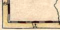
SZ09 at bottom left to SU86 at top right
Not all the (9x8 = 72) 10Km squares contain bits of the county.
Using the National Grid System a 1 mile x 1 mile square of land is 1 unit x 1 unit on the map, for everyday purposes.
As a consequence of the projection used, if latitude and longitude are shown, the parallels are slightly curved upwards at the ends, concave to the north; meridians are straight but inlcined inwards towards the system's central meridian, 2 degrees W. Magnetic north is inclined by an amount which varies over time, noted on the published maps.
The NGR system has been in use since the 1930s, with a preceeding military British Grid System dating to 1919, modified 1927.
An entirely different sort of grid appears on some maps, an index grid which marks off the map's sheet of paper into convenient labelled cells by which to find a place on the map from a list. John Norden's map of Hampshire, 1595, has such an index grid; it was then an innovation in map making. The map borders are marked off in 2 mile intervals, labelled 2..48 from left to right, and a..x (no i, no u) from top to bottom. This is not a plotting device but a handy reference device.
Latitude and longitude can be used very simply for plotting by setting up a rectangular grid; this is a Simple Cylindrical Projection or Plate Caree: but. At the equator a degree of latitude is roughly the same length in miles as a degree of longitude - ignoring the asphericity of the Earth's globe. At the equator, a square grid would be satisfactory for a small map. Half way up the globe, where Hampshire lies, a degree of longitude is shorter in miles, though a degree of latitude is much the same. A square grid here distorts distances, the map is stretched E-W. The lat long grid has to be rectangular rather than square to give a true picture of everyday miles. For Hampshire, roughly at the 51 degree N parallel:-
1 degree latitude = 69.13 milesThe ratio approximately corresponds to the inverse of the cosine of the latitude; 1/cos(51) = 1.59. The real figure allows for the asphericity of the earth which is an oblate spheroid not a sphere. The miles in a degree of latitude also vary with latitude because of the oblate shape, but not much over the size of a county.
1 degree longitude = 43.62 miles
ratio = 1.585
Dower 1838
Dower's map of Hampshire, 1838, has rectangular latitude and longitude scales in its borders; the bottom scale labelled:-
Longitude West from GreenwichThe ratio of latitude to longitude scales is about 1.57. This is equal within errors to the value for the latitude of Hampshire.
Useful Numbers
At 51 degrees N the following values are useful:-
1 degree latitude = 69.13 miles
1 degree longitude = 43.621 miles
1 minute latitude = 1.152 miles
1 minute longitude = 0.727 miles
1 mile = 0.868 degrees latitude
1 mile = 1.375 degrees longitude
radius of Earth = 3960.8 miles
The length of a degree of longitude is different in the north of Hampshire compared with the south. Hampshire is within latitudes 50d 40m to 51d 25m N.
| latitude | 1 degree longitude | |
| degrees minutes | miles | |
| 51 | 25 | 43.23 |
| 20 | 43.31 | |
| 15 | 43.39 | |
| 10 | 43.46 | |
| 05 | 43.54 | |
| 51 | 00 | 43.62 |
| 55 | 43.70 | |
| 50 | 43.78 | |
| 45 | 43.85 | |
| 50 | 40 | 43.93 |
The figures are based on a table supplied by the Hydrographic Office, to whom thanks. They are extracted from Admiralty Publication NP240.
The ratio of the length of 1 degree longitude at the north and south of Hampshire is 0.98, a 2 percent difference. This is hardly important for a Hampshire county map and is smaller than the errors of plotting of early maps.
If it is necessary, for a map that extends further North-South, a quick fix to improve the plotting is to use a trapezoid projection. The north and south borders of the map are both straight horizontal lines on paper, divided equally in minutes of longitude, but the north border has smaller unit lengths. Meridians are drawn by straight lines joining up corresponding points. Parallels are drawn horizontally straight across the map sheet joining divisions on the latitude scales on the sides. The outline shape is a trapezium.
Saxton 1579
The trapezoid projection was first used by Donis Nicolaus Germanus, a german benedictine monk from Reichenbach, for maps in editions of Ptolemy's Geographia, from 1466 onwards. It is sometimes known as a Donis projection. The lat long scales on Christopher Saxton's map of Anglia are like this, the map of England and Wales is the general map for his set of county maps published 1579 in its second state, 1590s. The county maps do not have lat and long scales.
Marshall 1798
Mr Marshall's map of the Western Districts of the Southern Counties, including Hampshire, 1798, has what might be a trapezoid projection. Lacking the graticule we can only make an assumption that that the meridians would have been drawn straight.
The 1 degree W meridian would be vertical on the page; other meridians sloping in towards it at the North. The parallels are horizontal on the page. The ratio of longitude scales top/bottom is 1.14, the expected ratio for the scales on this map, 50d 30m to 51d 28.7m N, is 1.02. The average ratio lat/long is 1.60, about the expected value for a 'square' map at 51 degree N.
It is an additional problem that magnetic or compass north is not the same as north defined by a meridian line. The magnetic North Pole is not at the rotational North Pole of the Earth. Even worse the magnetic pole shifts over time. If a map maker wants to plot a map with compass north at the top the lat and long scales will have to be drawn on the slant. They can be rectangular and rotated, or trapezoid and rotated, or perhaps just sheared into parallelogram instead of rectangular cells, and perhaps even sheared and rotated. Robert Morden's scales are probably sheared and rotated.
Harrison 1788
John Harrison's map of Hampshire, 1788, has latitude and longitude scales printed in the borders and a graticule is printed across the map at 5 minute intervals.
It has parallelogram latitude and longitude scales, sheared rectangular scales. The parallels are aligned horizontally on the page; the meridians are 2.6 degrees E of N. The ratio of lat/long scales is 1.16 which would stretch the county 36 percent E-W. 1 mile x 1 mile on the ground becomes 1.37 units x 1 unit on paper. It is likely that Harrison copied a map and applied lat and long scales to it.
afterwards
In all cases be aware that just because an early map has lat and long scales does not mean that places were plotted using these scales, using positions found from astronomical observations. If a map was copied from some earlier map the lat and long scales might just be added afterwards! The seemingly incorrect lat and long scales found on an old map scales might be the scales that best fit a pre-existing plot.
North on some maps has been estimated as part of the exercise to fit an index grid (the National Grid System) to an old map. This process is described in the notes for the software used, OLDMAPS.exe.
Steers, J A: 1965 (14th den) & 1927: Introduction to the Study of Map Projections: University of London Press
Harley, J B: 1975: Ordnance Survey Maps, a Descriptive Manual: HMSO & Ordnance Survey
Chamberlin, W (et al): 1950: Round Earth on Flat Paper: National Geographical Society
Hinks, A R: 1942 (2nd edn): Map Projections
Lee, L P: 1944: Nomenclature and Classification of Map Projections; Empire Survey review: vol.7: pp.190-