
Old Hampshire Mapped
Introduction
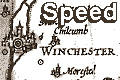
Speed's Hampshire 1611described and devided.
This study concentrates upon what can be seen from the map; studies of the background of county mapping in England, and map makers have been published elsewhere.
John Speed's atlas, Theatre of the Empire of Great Britaine, was compiled between 1596 and 1610:-
The / Theatre / of the Empire / of Great / Britaine: / Presenting / An Exact Geography / of the Kingdomes of England, / Scotland, Ireland, / and the Iles adioyning: / with / The Shires, Hundreds, Cities and / Shire-townes, within ye Kingdome / of England, divided and / described / By / Iohn Speed. / Imprinted at London / Anno / Cum Privilegio / 1611 / and are to be solde by Iohn Sudbury & Georg / Humble in Popes-head alley at ye signe of ye white Horse.Sudbury and Humble were the first english firm to specialise as map and print sellers, and were necessary to Speed to undertake the task of making his ideas a reality.
Speed refers to:-
... mine owne travels through every province of England ...but openly admits:-
... my many additions, and dimensions of the Shire-townes and Cities true platformes ...
I have put my sickle into other mens corne ...
Little of Speed's maps is original; he has copied, adapted, compiled. His mapping is not entirely copying, the content is revised, though errors are perpetuated. Historical notes were added, perhaps taken from Camden's Britannia. Decoration is added, coats of arms of nobility for example with advice from William Smith on heraldry. The deer and hounds in the New Forest of Hampshire are a pretty extra. Speed sent his maps to be engraved by the best hands, most by Jodocus Hondius the elder in the Netherlands to whom Speed was introduced by Camden; the results are a pleasure to view.
Speed adds hundreds where these were missing from his source; or the equivalent areas:-
The Shires divisions, into Lathes, Hundreds, Wapentakes and cantreds ... I have separatedIf not available on earlier maps the information came from the Parlament Rowles or failing there, the Nomina Villarum, in their Sheriffes booke.
The maps have inset maps, town plans:-
... some have bene performed by others, without scale annexed, the rest by mine owne travels, and unto them for distinction sake, the scale of paces.Hampshire's map has a town plan of Winchester, with a scale of pases, ie performed by John Speed himself. Speed's atlas is the first comprehensive collection of town plans for the country.
Descriptive text about counties is printed on the reverse of the county maps with a list of hundreds and an index of parishes showing what hundred they are in.


