
Old Hampshire Mapped
Longitude of Winchester
The accepted position of Winchester is:-
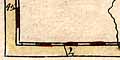
1° 18.4' Wfrom the Greenwich Meridian. I am not sure what is the centre position of Winchester. I have read the 'middle' of the city as shown on the maps.
Readings away from the correct number might indicate:-
- error in my reading
- error in the map maker's plotting
- a different prime meridian
Two Early Maps
The two early readings use prime meridians out in the Atlantic. Bertius's map, 1616, perhaps uses the Canary Islands. Bill's map, 1626, probably uses the Cape Verde Islands.
Maps 1695 Onwards
The readings from maps of Morden 1695 onwards are plotted in a histogram, drawn with counts grouped in .3 minute longitude intervals. Measurements are not much better than +-.2minutes, some are worse than that!
Longitude of Winchester
1° 24.1'      X
1° 23.8'
1° 23.5'
1° 23.2'
1° 22.9'
1° 22.6'
1° 22.3'
1° 22.0'
1° 21.7'
1° 21.4'      X
1° 21.1'      X
1° 20.8'
1° 20.5'
1° 20.2'
1° 19.9'      X
1° 19.6'
1° 19.3'
1° 19.0'      X
1° 18.7'      XXXXX
1° 18.4'      XXXXXXXX
1° 18.1'      XXX
1° 17.8'      XX
1° 17.5'      XXXX
1° 17.2'      XXX
1° 16.9'      XX
1° 16.6'      XX
1° 16.3'
1° 16.0'
1° 15.7'
1° 15.4'
1° 15.1'      X
1° 14.8'      X
1° 14.5'      X
1° 14.2'      X
1° 13.9'
1° 13.6'      XXXX
1° 13.3'      X
1° 13.0'
1° 12.7'      XX
1° 12.4'      X
1° 12.1'
1° 12.0'
1° 11.7'
1° 11.4'      X
1° 11.1'      X
1° 10.8'      X
1° 10.5'
1° 10.2'      X
1° 9.9'
1° 9.6'
1° 9.3'
1° 9.0'
1° 8.7'       XXX
1° 8.4'
There are too few readings to get sure conclusions from this tabulation. BUT: a few guesses are possible.
The obvious cluster is around 1° 18.4' W, which corresponds to the Greenwich meridian.
There could, perhaps should, be clusters at about 1° 17.2' W, 1° 14.6 W, 1° 13.6' W, 1° 12.7' W, 1° 11.0' W, 1° 8.7' W. corresponding to prime meridians in different parts of London.
A meridian at St Paul's would put Winchester at 1° 13.3' W, so the spread of readings from 1° 12.7 to 1° 15.1' W might reflect the use of this meridian.
Clustering can occur as a result of copying.
(A scatter diagram of minutes against quarter century was no more informative.)