 Kennet and Avon Canal Kennet and Avon Canal |
 |
|
|
|
MILE 40
|
Milton Lilbourne and Pewsey, Wiltshire : KAC40.00=KAC41.00 |
|

|
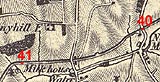
KandAC mile 40
|
|
|
|
KandAC mile 40 - OS 1inch map, early 19th century
|
|
|
... not a lock to bother your peaceful cruising ...
|
|
|
The Kennet and Avon Canal from mile 40 to 41 is part of the Fifteen
Mile Pound which roughly follows a contour line on the side of Pewsey
Vale. The Great Western Railway line to the south west is on the south
of the canal, and begins to run away from the line of the canal. The
small stream from the eastward joins the Dean Water in watercress beds
on the south side, before becoming the River Avon. The towpath is on
the south side.
|
|
|
|
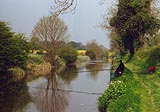
The canal eastwards from New Mill Bridge. Fishing with a long pole
seems to be the thing these days, no reel. The rods are fancy looking
material. If you want to fish on the off side why don't you go to the
off side and use a handier shorter rod?
|
|
|
|
New Mill Bridge, Milton Lilbourne
|
|
|
|
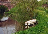
New Mill Wharf, Milton Lilbourne
|
|
|
New Mill lies to the south, with the Lydiard Arms.
|
|
|
|
A bit of New Mill to the south of the canal.
|
|
|
KandAC culvert 40.10
|
|
|
|
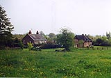
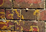
Thatch and brick, on the edge of New Mill.
|
|
|
|
KandAC winding point 40.33
|
|
|
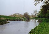
If you can see them there are watercress beds across the road on the
south side, on the Dean Water.
|
|
|
|
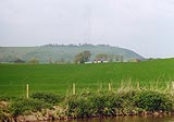
Martinsell Hill, and hillfort, visible to the north.
|
|
|
There used to be (?is) a local tradition of walking to the top of the
Martinsell Hill on Palm Sunday.
|
|
|
|
Steps made in the canal embankment from a canal side garden.
|
|
|
Parish boundary Milton Lilbourne - Pewsey: SU17566171
|
|
|
KandAC culvert 40.47
|
|
|
|
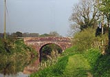
Milkhouse Water Bridge, Pewsey
|
|
|
|
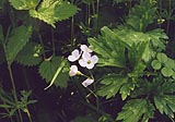
Lady's smock, Cardamine pratensis.
|
|
|
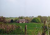
The farm to the south is Anvill's Farm.
|
|
|
KandAC culvert 40.72
|
|
|
|
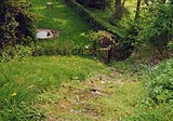
Pillbox (SU170619) in the field on the off side, north side.
|
|
|
|
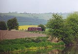
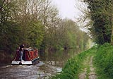
Boat, travelling eastward towards Milkhouse water Bridge in the
distance.
|
|

|
Kennet and Avon Scrapbook 2000
|
|