 Kennet and Avon Canal Kennet and Avon Canal |
 |
|
|
|
MILE 49
|
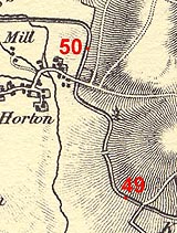
Bishops Cannings and Allcannings, Wiltshire : KAC49.00=KAC50.00 |
|

|
KandAC mile 49
|
|
|
|
KandAC mile 49 - OS 1inch map, early 19th century.
|
|
|
... chalk downland, fields of corn, willows, thorn hedges, rushes,
moorhens and the blue flash of a kingfisher ...
|
|
|
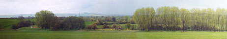
The Kennet and Avon Canal from mile 49 to 50 is part of the Fifteen
Mile Pound which roughly follows a contour line on the side of Pewsey
Vale. The towpath is on the south side.
|
|
|
|
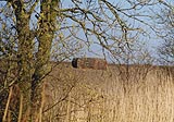
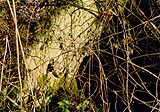
Another pillbox, on the shoulder of The Knoll.
|
|
|
Parish boundary Allcannings - Bishops Cannings: SU05616249
|
|
|
|
Horton Fields Swing Bridge, Bishops Cannings
|
|
|
|
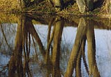
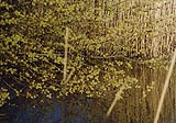
More reflections on water.
|
|
|
|
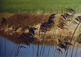
Pretty Graminae??
|
|
|
The hill to the east of the canal is called The Knoll, height
161m=523ft.
|
|
|
|
KandAC culvert 49.41
|
|
|
|
Willow catkins.
|
|
|
|
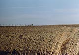
Ploughland on The Knoll beside the canal.
|
|
|
|
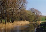
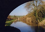
Canal eastwards of Horton Chain Bridge
|
|
|
A typical stretch of the canal, eastwards of Horton Chain Bridge seen
from the Pewsey Road.
|
|
|
|
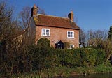
Canal Cottage, Bishops Cannings
|
|
|
|
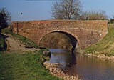
Horton Chain Bridge, Bishops Cannings
|
|
|
|
Canal westwards of Horton Chain Bridge.
|
|
|
|
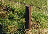
There seem to be no mileposts left on this part of the canal; this
might be the post of milepost 49 I.
|
|
|
|
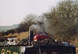
Signs of a cosy wood stove on a canal boat.
|
|

|
Kennet and Avon Scrapbook 2000
|
|