 Kennet and Avon Canal Kennet and Avon Canal |
 |
|
|
|
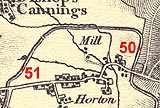
MILE 50
|
Bishops Cannings, Wiltshire : KAC50.00=KAC51.00 |
|

|
KandAC mile 50
|
|
|
|
KandAC mile 50 - OS 1inch map, early 19th century.
|
|
|
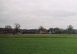
... across the fields a cluster of brick, timber frame, whitewash,
thatch, tile, slate, and a large church ...
|
|
|
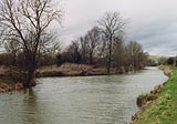
The Kennet and Avon Canal from mile 50 to 51 is part of the Fifteen
Mile Pound which roughly follows a contour line on the side of Pewsey
Vale. The towpath is on the south side.
|
|
|
KandAC culvert 50.16
|
|
|
KandAC culvert 50.38
|
|
|
Horton Waste Weir, Bishops Cannings
|
|
|
|
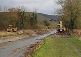
Maintenance work on the canal, diggers etc by the drained canal.
|
|
|
|
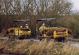
Two caterpillar tracked maintenance vehicles carrying coir rolls which
are used to reinforce the rebuilding of the canal bank.
|
|
|
|
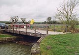
Bishops Cannings Swing Bridge, Bishops Cannings
|
|
|
|
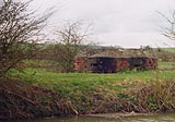
Pillbox just west of Bishops Cannings swing bridge, on the off side.
The canal was a defence line against invasion forces in World War II.
The pillbox is polygonal concrete, facing south.
|
|
|
|
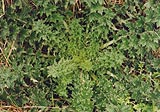
Highly organised leaves, a thistle.
|
|
|
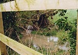
There are several culverts under the canal in this area, draining
water into Spaniel's Brook which feeds Etchilhampton Water to the
south.
|
|
|
|
KandAC culvert 50.62
|
|
|
KandAC culvert 50.72
|
|
|
|
KandAC winding point 50.76
|
|
|
|
Horton village, what there is of it.
|
|
|
|
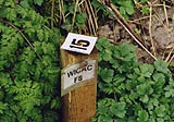
Location post '15' for fishing, 'WICAC F8'; Wiltshire something
something Angling Club?
|
|
|
|
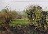
St Mary's Church, Bishops Cannings, Wiltshire, across the fields on
the opposite side of the canal. The style is Early English, about 13th
century; the spire on the tower at its crossing, and the high stair
turret, are 15th century additions.
|
|
|
There is a small steeple, on the stairhead, alongside the large
steeple. The local rumour is that when the littl'un grows up as big as
the big'un the World will End.
|
|

|
Kennet and Avon Scrapbook 2000
|
|