 Kennet and Avon Canal Kennet and Avon Canal |
 |
|
|
|
MILE 51
|
Bishops Cannings, Wiltshire : KAC51.00=KAC52.00 |
|

|
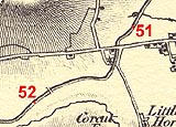
KandAC mile 51
|
|
|
|
KandAC mile 51 - OS 1inch map, early 19th century.
|
|
|
... occasional neat brick arches going from nowhere to nowhere ...
|
|
|
The Kennet and Avon Canal from mile 51 to 52 is part of the Fifteen
Mile Pound which roughly follows a contour line on the side of Pewsey
Vale. The towpath is on the south side.
|
|
|
|
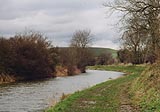
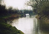
The canal east of Horton Bridge.
|
|
|
|
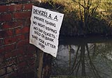
Notice to fishermen by the path from road to towpath at Horton Bridge;
this is Devizes Angling Association water.
|
|
|
|
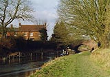
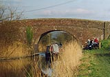
Horton Bridge, Bishops Cannings
|
|
|
|
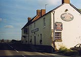
Bridge Inn, Bishops Cannings
|
|
|
|
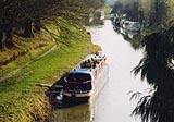
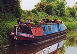
Boats on the canal by Horton Bridge.
|
|
|
|
Canal on west side of Horton Bridge; the Bridge Inn sits up for
custom.
|
|
|
|
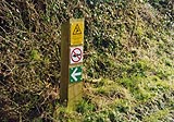
No fishing sign, danger of electric wires catching your cast; these
signs are very new, they appeared in the late 1990s.
|
|
|
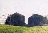
Near where the road to Little Horton turns away from the canal you can
see two large concrete tank traps standing on the top of the canal
bank. These are part of a southern England defence line based on the
Kennet and Avon Canal being a 'natural' barrier to invading troops.
|
|
|
|
Cast concrete tank traps, little softened by ivy.
|
|
|
|
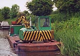
BWB work boats moored by the towpath.
|
|
|
|
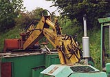
JCB type digger, dredge, scoop, whatever.
|
|
|
|
Boat Dipper moored.
|
|
|
|
Boat Dipper.
|
|
|
|
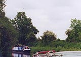
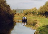
Another boat on the canal.
|
|
|
|
Another boat on the canal.
|
|
|
|
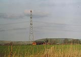
Field barn and pylon and the ridge of hills north of the Vale of
Pewsey.
|
|
|
|
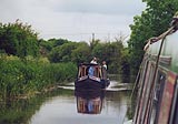
Boats passing.
|
|
|
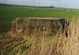
On the north side of the canal, by the field track which crosses at
Lay Wood Bridge is a pillbox. The canal was a defence line against
invasion forces in World War II. The pillbox is polygonal concrete,
facing south.
|
|
|
|
Pillbox at Lay Wood Bridge.
|
|
|
|
Lay Wood Bridge, Bishops Cannings
|
|
|
|
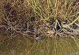
A pair of mallard duck, Anas platyrhynchos, on the quieter opposite
bank.
|
|
|
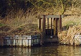
At about the 52 mile point there is a flood valve in the north bank of
the canal. The water runs into Spaniel's Brook.
|
|
|
|
Flood valve by Lay Wood.
|
|
|
Parish boundary Bishops Cannings - Roundway: SU03016269
|
|

|
Kennet and Avon Scrapbook 2000
|
|