 Kennet and Avon Canal Kennet and Avon Canal |
 |
|
|
|
MILE 55
|
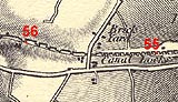
Rowde, Wiltshire : KAC55.00=KAC56.00 |
|

|
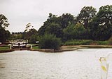
KandAC mile 55
|
|
|
|
KandAC mile 55 - OS 1inch map, early 19th century.
|
|
|
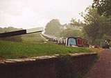
... the canal slides down a steep escarpment ...
|
|
|
The Kennet and Avon Canal from mile 55 to 56 continues down the Caen
Hill Flight of locks levelling out to the Foxhangers locks in the Avon
Valley. The towpath is on the south side.
|
|
|
|
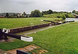
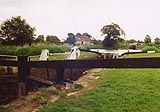
Caen Hill Locks, Rowde
|
|
|
Canals run level, on contours or a series of cuttings and embankments,
or rise up hills in steps - locks. The road out of Devizes to the west
runs parallel to the canal down the same hill; once carts, now cars
and lorries, run up and down with few problems. The road down Caen
Hill is an isolated stretch of dual carriageway between ordinary main
roads, the result of hopeless road planning, lit by horrible street
lamps which are a night time blemish visible from miles away. The
railway also follows this route into Devizes from the west but
'mainline' trains do not attempt steep hills and the rails go to one
side of the hill; Devizes Station is off to one side and down the
hillside a bit, from where the rails tunnel through a ridge into the
Pewsey Vale.
|
|
|
KandAC winding point 55.37
|
|
|
|
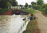
KandAC lock 28
|
|
|
|
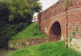
Upper Foxhangers Bridge, Rowde
|
|
|
Upper Foxhangers Farm lies to the south of the canal.
|
|
|
|
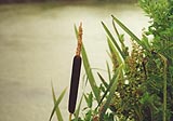
Bullrush, Typha latifolia, in the canal.
|
|
|
KandAC culvert 55.43
|
|
|
|
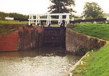
KandAC lock 27
|
|
|
Upper Foxhangers Cottages are on the north side of the canal.
|
|
|
|
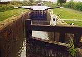
KandAC lock 26
|
|
|
Off the hill the view opens out and you can see the main road on the
south side, and the remains of the railway embankment giving trains a
running start at the slope.
|
|
|
|
KandAC lock 25
|
|
|
|
The pound between lock 25 and lock 24 is short; its volume is
increased by a side pound, alongside lock 24.
|
|
|
|
KandAC lock 24
|
|

|
Kennet and Avon Scrapbook 2000
|
|