 Kennet and Avon Canal Kennet and Avon Canal |
 |
|
|
|
MILE 62
|
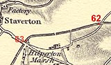
Semington and Hilperton and Staverton and Trowbridge, Wiltshire
KAC62.00=KAC63.00 |
|

|
KandAC mile 62
|
|
|
|
KandAC mile 62 - OS 1inch map, early 19th century.
|
|
|
... from the quiet canal you can hear the busy roar of traffic of the
other world ...
|
|
|
The Kennet and Avon Canal from mile 62 to mile 63 is now in the valley
of the River Avon. The towpath is on the north side.
|
|
|
|
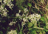
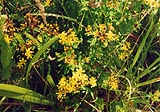
Plant, not sure about this, Stellaria sp?
|
|
|
|
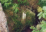
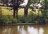
A wince which served a plug has gone down the embankment in a land
slip, just by a culvert and overflow.
|
|
|
|
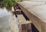
On the towpath side there is a concrete slab over an overflow weir,
which has grooves for stop planks to adjust the water height.
|
|
|
This period of BWB work is visually horrible.
|
|
|
|
The offside overflow weir is more discrete.
|
|
|
KandAC culvert 62.22
|
|
|
Hilperton Marsh, which as a settlement is mostly Hilperton Marsh Farm,
lies on the south side of the canal.
|
|
|
|
Square stemmed St John's wort, Hypericum tetrapterum; it does have a
square stem, I looked carefully.
|
|
|
Parish boundary Semington - Hilperton: ST87096054
|
|
|
|
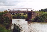
Hilperton Marsh Swing Bridge No 1, Hilperton
|
|
|
|
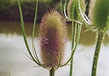
Common or fuller's teasel, Dipsacum fullonum; the flowers nearly all
over.
|
|
|
|
Hilperton Marsh Bridge, Hilperton
|
|
|
Parish boundary Hilperton - Staverton - Trowbridge: ST86776049
|
|
|
The parish boundary between Staverton and Trowbridge runs
approximately along the canal from this point westwards, mostly on the
offside, the south side.
|
|
|
KandAC culvert 62.47
|
|
|
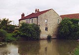
The buildings on the south east side of the canal as it turns a bend
are Maxcroft. To the north west is Nestle's factory, Staverton
Condensary, by the River Avon, making use of Wiltshire's dairy herds.
When first built it made condensed milk, about 1898.
|
|
|
|
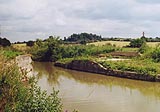
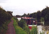
Boat moored by the canal eastward of Marsh Wharf.
|
|
|
|
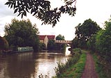
The canal eastward of Hilperton Bridge.
|
|
|
|
Marsh Wharf, Trowbridge
|
|
|
|
Milepost 63
|
|

|
Kennet and Avon Scrapbook 2000
|
|