 Kennet and Avon Canal Kennet and Avon Canal |
 |
|
|
|
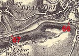
MILE 66
|
Bradford-on-Avon and Westwood, Wiltshire : KAC66.00=KAC67.00 |
|

|
KandAC mile 66
|
|
|
|
KandAC mile 66 - OS 1inch map, early 19th century.
|
|
|
... deep shaded by woods cooing with pigeons ...
|
|
|
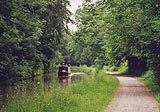
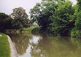
The Kennet and Avon Canal from mile 66 to mile 67 runs parallel the
River Avon and the railway and a minor road from Bradford-on-Avon to
Turleigh, all in a deepening valley. This is part of Nine Mile Pound.
The towpath is on the north side.
|
|
|
|
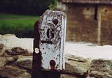
Milepost 66
|
|
|
|
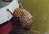
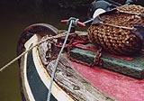
Stern fender.
|
|
|
|
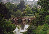
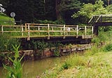
Looking back, north east, from the towpath it is possible to see
Barton Bridge, an old packhorse bridge across the Avon.
|
|
|
The River Avon is 70ft below the canal. In 1802 the whole canal slid
down to join it. Samuel Miles, in Lives of the Engineers:-
|
|
|
... the cutting is mostly through open rock and beyond that through
beds of tough clay interspersed with strata of fuller's earth. The
water at these points worked serious mischief, for after a heavy fall
of rain it would filter through the earth, and the weight of the mass
pressing down from above, tended to force out the soft clay, causing
extensive slips. On one occasion, not less than seven acres of land
slid into the canal, forcing the whole down into the river in the
valley below. To remedy this source of mischief, soughs or small
tunnels were carried into the hillside for a considerable distance, at
a level much below that of the canal. ...
|
|
|
The landslip put up the cost of the canal.
|
|
|
|
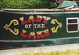
Boat name, Lady of the Lake.
|
|
|
|
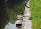
The stone walls of the canal are difficult for ducks to climb, so
little ramps have been made for them. They seem to fly out at other
spots quite happily.
|
|
|
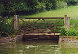
There is a plug in the bed of the canal at about 66m 4ch. The plug is
an iron bound square of wood in a hole in the canal bed. A chain from
the plug could be wound up by a wince, a roller turned by hand spikes,
with a ratchet and pawl to stop it slipping back. Water going down the
hole runs into a culvert and thence to a nearby stream. Sections of
the canal could be stopped off by stop gates or stanks to be drained
for maintenance.
|
|
|
|
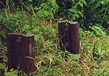
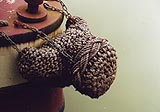
remains of the wince for the canal plug.
|
|
|
|
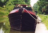
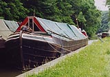
Work boat moored by the canal.
|
|
|
|
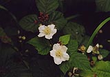
Blackberries, to come, Rubus caesius?
|
|
|
|
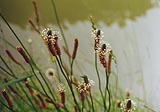
Great plantain, Plantago major.
|
|
|
|
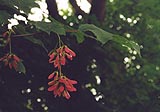
Sycamore, Acer sp.
|
|
|
The wood on the south side on a steep edge is Gripe Wood; you can see
the river through the trees on the north side, and occasionally a
racing sculls or pair.
|
|
|
|
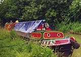
Boat on the canal.
|
|
|
|
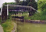
Bradford Swing Bridge, Bradford-on-Avon
|
|
|
|
Meadows Bridge, Bradford-on-Avon
|
|
|
|
KandAC culvert 66.44
|
|
|
There is an overflow on the offside; its runoff joins the stream
passing by the sewage works that side.
|
|
|
|
Canal overflow weir.
|
|
|
|
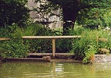
A place for cows to drink?
|
|
|
|
Canal.
|
|
|
There is a plug in the canal bed at about 66 miles 46 chains.
|
|
|
The woods on the north side are called Becky Addy Wood. There was a
stone quarry in the wood; stone was taken by tramroad across the
Avoncliff Aqueduct to a wharf. On top of the hillside that side is the
village of Westwood.
|
|
|
|
Stern fender
|
|
|
|
Boat bow, and how.
|
|
|
|
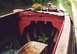
Wood structure inside the bow of an old boat.
|
|
|
|
The bow of an old boat.
|
|
|
|
Work boat.
|
|
|
|
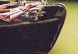
Bow of old boat; bow fender, cleat, etc.
|
|
|
|
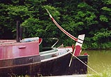
Stern of old boat; curved tiller.
|
|
|
Parish boundary Bradford-on-Avon - Westwood: ST81266020
|
|

|
Kennet and Avon Scrapbook 2000
|
|