 Kennet and Avon Canal Kennet and Avon Canal |
 |
|
|
|
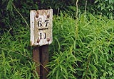
MILE 67
|
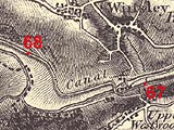
Westwood and Winsley, Wiltshire : KAC67.00=KAC68.00 |
|

|
KandAC mile 67
|
|
|
|
KandAC mile 67 - OS 1inch map, early 19th century.
|
|
|
... closely confined in a valley, with river and railway ...
|
|
|
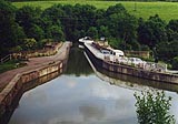
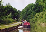
The Kennet and Avon Canal from mile 67 to mile 68 crosses over the
River Avon and the railway by an aqueduct, to the north side of the
valley. The canal is in Nine Mile Pound. The towpath is on the north
side up to Avoncliff Aqueduct, there it roves to the south side.
|
|
|
|
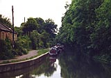
Canal eastwards from Avoncliff.
|
|
|
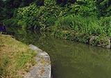
The canal from Avoncliff is in a new concrete lined bed, which had to
be repaired soon after it was done I believe. The width, depth, and
profile make it difficult for wider vessels to pass.
|
|
|
There were stop gates and there is a stop groove at about 67m 16ch;
and a plug beyond at about 67m 17ch. There is mooring along here.
|
|
|
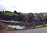
The road, which crosses the aqueduct with the canal, to serve the
small settlement, the railway, and the canal are squeezed close
together just here. The tiny settlement, pub and a few cottages, is
Avoncliff. There is access to the other side of the canal by road from
Westwood on the hillside, and access to Avoncliff under the aqueduct -
there is no real necessity for access by road across the canal.
|
|
|
|
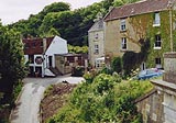
The tiny group of buildings at the aqueduct. The very ugly fence along
the access track seems unnecessary, as does vehicular access.
|
|
|
|
Cross Guns, Westwood
|
|
|
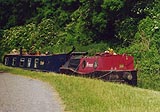
On the south side is Avoncliff Villa. There was a tramroad down the
hillside on the south side, carrying stone from quarries. Later the
tramroad was continued across the aqueduct to reach the railway.
|
|
|
|
Avoncliff Aqueduct, Westwood
|
|
|
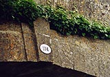
Parish boundary - : ST80436001
|
|
|
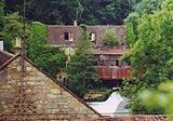
The River Avon, over which the canal aqueduct crosses, is the boundary
between parishes. Avoncliff Mill can be seen by the river, where there
is a fine weir. There's another mill the other end of the weir; both
were flock mills, breaking up old woollen material to make stuffing
for mattresses etc. From here westwards the railway winds about the
valley behind the bushes along the towpath. Turleigh, closer and
occasionally visible through the bushes, and Winsley villages lie on
the hillside to the north. There is mooring each side of the aqueduct.
|
|
|
|
Weir, and the water mill on the northward side of the River Avon with
a breast shot wheel.
|
|
|
KandAC winding point 67.26
|
|
|
|
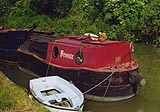
Boats Emily and Bronte, a dum barge and a pusher, moored westward of
Avoncliff Aqueduct.
|
|
|
|
The pusher, Bronte.
|
|
|
|
Canal westward of the turn at Avoncliff Aqueduct.
|
|
|
|
Location of stop gates and a stop groove at about 67m 28ch.
|
|
|
Avoncliff Stone Wharf, Winsley
|
|
|
|
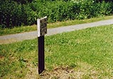
Milepost 67 II
|
|
|
There is a plug in the bed of the canal at about 67m 51ch. You may
notice a sewage works on the south side; you won't see it. About level
with this point the River Avon is joined by the River Frome.
|
|
|
|
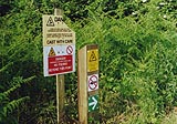
A fine crop of modern canal signs warning not to cast your fishing
lines into the electric wires above.
|
|
|
|
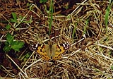
Painted lady butterfly, Cynthia cadui, posing on the towpath.
|
|
|
|
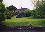
Canalside house by Winsley Bridge.
|
|
|
|
Winsley Bridge, Winsley
|
|
|
There is a plug at about 67m 70ch.
|
|
|
|
Milepost 68
|
|

|
Kennet and Avon Scrapbook 2000
|
|