|
ACM1934.74.8:-
|
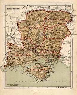
Map, chromolithograph, Hampshire with the Isle of Wight, scale about 5.5
miles to 1 inch, by William Hughes, printed by James S Virtue and Co, London,
about 1868.
|
|
map feature:-
|
colour printed & lat and long scales (rectangular) & scale line &
rivers & relief (some) & hill hachuring & woods & forests &
parks ( a few) & county & electoral data (?) & settlements &
roads & railways & canals |
|
inscription:- |
-on- printed
LONDON, J. S. VIRTUE & Co. LIMITED. W. HUGHES
-- bottom |
|
scale line:-
|
10 miles = 45.2 mm |
|
dimension:- |
wxh, sheet = 27x36.5cm |
|
wxh, map = 240x297mm (BUT extends beyond this frame to 27cm wide) |
|
scale = 1 to 360000 ? (1 to 356050 from scale line assuming a modern mile) |
 |
|

|
Map Group -- Hughes 1868 -- with Research Notes
|
 |
|
|
town names:-
|
|
Hampshire
|
Hampshire
|
|
map name
|
modern name
|
|
Alton
|
Alton
|
|
Andover
|
Andover
|
|
Basingstoke
|
Basingstoke
|
|
Bishops Waltham
|
Bishops Waltham
|
|
Christ Church
|
Christchurch
|
|
Fareham
|
Fareham
|
|
Fordingbridge
|
Fordingbridge
|
|
Gosport
|
Gosport
|
|
Havant
|
Havant
|
|
Kingsclere
|
Kingsclere
|
|
Lymington
|
Lymington
|
|
Alresford
|
Alresford
|
|
Odiham
|
Odiham
|
|
Petersfield
|
Petersfield
|
|
Portsmouth
|
Portsmouth
|
|
Ringwood
|
Ringwood
|
|
Romsey
|
Romsey
|
|
Southampton
|
Southampton
|
|
Stockbridge
|
Stockbridge
|
|
Whitchurch
|
Whitchurch
|
|
Winchester
|
Winchester
|
|
 |
|

| top of page |
| MN: 5.10.2001 |


