|
FA1998.125:-
|
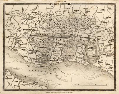
Map, uncoloured engraving, Environs of Portsmouth, scale about 2 miles to 1
inch, Portsmouth area, Hampshire, probably engraved by I Dower and published by
Thomas Moule, 1840s.
|
|
Includes Portsmouth Harbour and Langstone Harbour, area around Fareham, Gosport,
Portsmouth, Havant, and the edge of West Sussex; the railway from Southampton to
Gosport has been added to an earlier version, 1837, of the map, this railway was
a branch of the London and South Western Railway, LSWR, opened 1842.
|
|
map feature:-
|
not coloured & scale line & coast shaded & forests & relief
& hill hachuring & fortifications & rivers & harbours &
depth soundings & settlements & roads & rivers & railways |
|
dimension:- |
scale = 1 to 130000 ? (approx, 1 to 128133 ?) |
 |
|

|
Map Group -- Moule 1836 -- with Research Notes
|
 |
|

| top of page |
| MN: 4.10.2001 |


