|
FA1996.36:-
|
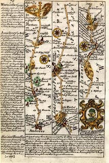
Strip map, road map, two sided sheet taken from a road book, Britannia
Depicta or Ogilby Improv'd, text by John Owen, Middle Temple, London, maps by
Emanuel Bowen, published Thomas Bowles, St Paul's Churchyard, London, 1720
onwards.
|
|
P.77 header page for the Roads from London to Barnstaple, and the description of
London continued.
|
|
P.78 Andover, Hampshire to Amesbury, Warminster, etc Wiltshire, with the coat of
arms of Andover.
|
|
map feature:-
|
county & settlements & rivers & woods & relief & hillocks
& bridges & roads & compass rose & coat of arms |
|
dimension:- |
wxh = 12x18.5cm |
 |
|

|
Map Group -- Bowen 1720 -- with Research Notes
|
 |
|
|
town names:-
|
|
Hamp Shire
|
Hampshire
|
|
map name
|
modern name
|
|
Andover
|
Andover
|
|
 |
|

| top of page |
| MN: 4.10.2001 |


