|
FA1997.3:-
|
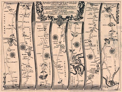
Strip map, uncoloured copper plate engraving, road map, part of The Road from
London to Pool, scale about 1 mile to 1 inch, from the road book, Britannia,
published by John Ogilby, White Friars, London, 1675.
|
|
Pl.97 from Alresford through Winchester, Romsey, Ringwood, Hampshire, to Poole,
Dorset; then from Poole to Christchurch, Dorset and Lymington, Hampshire; and
the road from Southampton to Winchester, Hampshire.
|
|
map feature:-
|
not coloured & title cartouche & compass rose & roads &
settlements & relief & hillocks & streets & rivers & coast
shaded & road distances & trees |
|
inscription:- |
printed -on- title cartouche
The Road from LONDON to POOL in the Count. Dorset: / By JOHN OGILBY Esqr.
his Maties. Cosmograph: / ...
|
|
dimension:- |
wxh, sheet = 48x38.5cm |
|
wxh, plate = 456x346mm |
|
wxh, map = 444x338mm |
|
scale = 1 to 63360 ? (nominal) |
 |
|
|
reference:- |
Ogilby, John: 1675: Britannia - A Geographical and Historical Description of the
Principal Roads thereof |

|
Map Group -- Ogilby 1675 -- with Research Notes
|
 |
|
|
town names:-
|
|
Hampshire
|
Hampshire
|
|
map name
|
modern name
|
|
Christ Church
|
Christchurch
|
|
Limington
|
Lymington
|
|
Alresford
|
Alresford
|
|
Ringwood
|
Ringwood
|
|
Rumsey
|
Romsey
|
|
Southampton
|
Southampton
|
|
Winchester
|
Winchester
|
|
 |
|

| top of page |
| MN: 4.10.2001 |


