|
FA1997.6:-
|
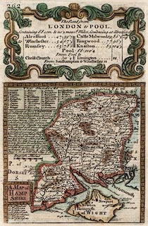
Map, road strip map and county map, two sided sheet taken from a road book,
Britannia Depicta or Ogilby Improv'd, text by John Owen, Middle Temple, London,
maps by Emanuel Bowen, 1720, published Thomas Bowles, St Paul's Churchyard,
London, about 1764.
|
|
P.262 the road from London to Pool, listed details; and a map of the whole
county of Hampshire, with the Isle of Wight, scale about 13.5 miles to 1 inch.
|
|
The Old English Miles used by the map maker is 1.26 statute miles.
|
|
P.261 Egremont and Cockermouth, to Carlisle, Cumberland.
|
|
map feature:-
|
county & settlements & rivers & woods & relief & hillocks
& bridges & roads & compass rose & scale line & title
cartouche |
|
scale line:-
|
10 miles = 23.7 mm |
|
dimension:- |
wxh, sheet = 14.5x20.5cm |
|
wxh, plate = 122x186mm (?) |
|
wxh, map (county) = 118x117mm |
|
scale = 1 to 850000 ? (from town positions using DISTAB.exe) |
 |
|

|
Map Group -- Bowen 1720 -- with Research Notes
|
 |
|
|
town names:-
|
|
Hamp Shire
|
Hampshire
|
|
map name
|
modern name
|
|
Alton
|
Alton
|
|
Andover
|
Andover
|
|
Basingstoke
|
Basingstoke
|
|
Bushwaltham
|
Bishops Waltham
|
|
Christ Church
|
Christchurch
|
|
Farham
|
Fareham
|
|
Fordingbridge
|
Fordingbridge
|
|
Gosport
|
Gosport
|
|
Havant
|
Havant
|
|
Kingsclere
|
Kingsclere
|
|
Lemington
|
Lymington
|
|
Alresford
|
Alresford
|
|
Odiam
|
Odiham
|
|
Petersfield
|
Petersfield
|
|
Portsmouth
|
Portsmouth
|
|
Ringwood
|
Ringwood
|
|
Rumsey
|
Romsey
|
|
Southampton
|
Southampton
|
|
Stockbridg
|
Stockbridge
|
|
Whitchurch
|
Whitchurch
|
|
Winchester
|
Winchester
|
|
 |
|

| top of page |
| MN: 4.10.2001 |


