|
B1990.1794.1:-
|
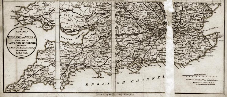
Road map, uncoloured engraving, New Map of England and Wales, scale about 21
miles to 1 inch, inserted in Cary's New Itinerary, by John Cary, 181 Strand,
London, 6th edn, 1815.
|
|
The map shows the principal roads of the country graded as Direct, Mail, or
Cross roads.
|
|
map feature:-
|
not coloured & folded (printed in sections, leaving margins within the map
for the folds) & scale line & coast shaded & country & county
& table of counties (keyed to areas by numbers) & settlements &
roads & post roads |
|
inscription:- |
printed -on- title cartouche
A / NEW MAP / OF / ENGLAND AND WALES, / ADAPTED TO / CARY'S NEW ITINERARY, /
SHEWING / the Whole of the Roads Direct & Cross / CONTAINED / In that Work.
|
|
inscription:- |
printed -on- bottom centre
London: Published by J. Cary Engraver and Map seller, No.181 Strand
|
|
dimension:- |
scale = 1 to 1300000 ? (approx, 1 to 1306285 ?) |
 |
|

|
Map Group -- Cary 1815 -- with Research Notes
|
|
|
 |
|

| top of page |
| MN: 4.10.2001 |


