|
FA1990.20.1:-
|
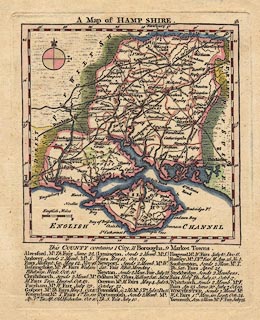
Map, hand coloured engraving, A Map of Hamp Shire ie Hampshire, scale about
11 miles to 1 inch, by Thomas Kitchin and Thomas Jefferys, 1749, published by
Robert Sayer et al, London, 1775.
|
|
Market days are listed in text below the map.
|
|
inscription:- |
printed -on-
A Map of HAMP SHIRE.
-- title |
|
map feature:-
|
hand coloured & compass rose & scale line & lat and long scales
(rectangular) & coast form lines & rivers & forests (a few) &
relief & hillocks (a few) & county & settlements & roads &
road distances & market days |
|
scale line:-
|
8 miles = 18.2 mm |
|
dimension:- |
wxh, sheet = 18x23cm |
|
wxh, plate = 147x184mm |
|
wxh, map = 135x138mm |
|
scale = 1 to 710000 ? (1 to 707404 from scale line assuming modern mile) |
|
longitude, Winchester = 1d 10.9m W (approx) |
 |
|

|
Map Group -- Kitchin and Jefferys 1749 -- with Research Notes
|
 |
|
|
town names:-
|
|
Hamp Shire
|
Hampshire
|
|
map name
|
modern name
|
|
Alton
|
Alton
|
|
Andover
|
Andover
|
|
Basingstoke
|
Basingstoke
|
|
Waltham
|
Bishops Waltham
|
|
Christ Church
|
Christchurch
|
|
Farham
|
Fareham
|
|
Fording Bridge
|
Fordingbridge
|
|
Gosport
|
Gosport
|
|
Havant
|
Havant
|
|
Kingsclear
|
Kingsclere
|
|
Lymington
|
Lymington
|
|
Alresford
|
Alresford
|
|
Odiam
|
Odiham
|
|
Petersfield
|
Petersfield
|
|
Portsmouth
|
Portsmouth
|
|
Ringwood
|
Ringwood
|
|
Rumsey
|
Romsey
|
|
Southampton
|
Southampton
|
|
Stockbridge
|
Stockbridge
|
|
Whitchurch
|
Whitchurch
|
|
Winchester
|
Winchester
|
|
 |
|

| top of page |
| MN: 4.10.2001 |


