Map Collection

Whitworth 1770
FA1997.111:- 
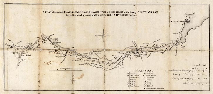
Map, uncoloured engraving, Plan of the intended Navigable Canal from Andover to Redbridge, Southampton, in the County of Southampton, ie the Andover Canal, Hampshire, scale about 1 mile to 1 inch, surveyed by Robert Whitworth, engineer, 1770 and 1789.
map feature:-  not coloured & compass rose & scale line & coast form lines & rivers & relief & hill hachuring & settlements & roads & table of parishes & table of distances & canals
scale line:-  4 miles = 100.0 mm
dimension:-  wxh, sheet = 78.5x40.5cm
wxh, plate = 643x281mm
wxh, map = 628x265mm
scale = 1 to 64000 ? (1 to 64374 from scale line assuming a modern mile)

  Map Group -- Whitworth 1770 -- with Research Notes

town names:- 
County of Southampton Hampshire
map name modern name
Andover Andover
Rumsey Romsey
Southampton Southampton
Stockbridge Stockbridge

  top of page
MN: 8.1.2002