Map Collection

Hutchinson 1748 (relevant?)
FA1998.15:- 
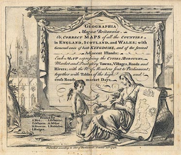
Title page, of Geographia Magnae Britanniae, with county maps of England, Scotland and Wales, published 1748.
inscription:-  printed -on- GEOGRAPHIA / Magnae Britanniae. / Or, CORRECT MAPS of all the COUNTIES / in ENGLAND, SCOTLAND, and WALES; with / General Ones of both KINGDOMS, and of the several / Adjacent Islands: / Each MAP expressing the CITIES, BOROUGHS, / Market and Presbytery Towns, Villages, Roads and / Rivers; with the No. of Members sent to Parliament; / together with Tables of the high and / cross Roads, market days, / &c. -- within a fancy cartouche and scene with a map of Great Britain, globe, theodolite, etc,
inscription:-  printed -on- Printed for / S. Birt. I. Osborne. / T. Osborne. A. Millar. / D. Browne. I. Robinson. / I. Hodges.
inscription:-  printed -on- S. Wale invt. & fecit
inscription:-  printed -on- Published according to Act of Parliament October 12th. 1748.
dimension:-  wxh = 19.5x17cm

  Map Group -- Hutchinson 1748 -- with Research Notes

  top of page
MN: 13.11.2001