|
FA1998.16:-
|
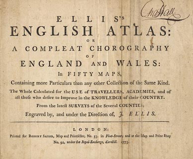
Title page, of Ellis's English Atlas, in fifty county maps etc, by J Ellis,
London, 1765, published 1773.
|
|
The reverse is the index page; which includes p2 a post map of England and
Wales, and p3 Britain under the saxon Heptarchy.
|
|
inscription:- |
printed -on-
ELLIS'S / ENGLISH ATLAS: / OR / A COMPLEAT CHOROGRAPHY / OF / ENGLAND AND
WALES: / In FIFTY MAPS, / Containing more Particulars than any other Collection
of the Same Kind. / The Whole Calculated for the USE of TRAVELLERS, ACADEMIES,
and of / all those who desire to Improve in the KNOWLEDGE of their COUNTRY. /
From the latest SURVEYS of the Several COUNTIES; / Engraved by, and under the
Direction of, J. ELLIS.
|
|
inscription:- |
printed -on- bottom
LONDON / Printed for Robert Sayer, Map and Printseller, No.53. in
Fleet-Street; and at the Map and Print Shop / No.92, under the Royal-Exchange,
Cornhill. 1773.
|
|
dimension:- |
wxh = 26.5x22cm |
 |
|

|
Map Group -- Ellis 1765 -- with Research Notes
|
 |
|

| top of page |
| MN: 14.3.2000 |


