|
FA1998.31:-
|
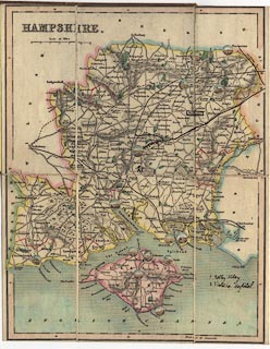
Map, Hampshire, and the Isle of Wight, scale about 1 to 470000, 7 miles to 1
inch, with vignette illustrations of towns, published 1850s?
|
|
Judging by which railways are shown built and being built the date of the map is
between 1853 and 1857. The railways shown are London and Southampton Railway now
called the London and South Western Railway open 1840, Bishopstoke to Gosport
branch open 1842, Eastleigh to Salisbury branch open 1847, Chichester to
Portsmouth branch open 1847, Fareham to Cosham branch open 1848, Berkshire and
Hampshire Railway open 1848, Reading, Guildford and Reigate Railway open 1849;
and authorised but not opened Basingstoke and Salisbury Railway authorised 1846
opened 1857, and Portsmouth Railway authorised 1853 opened 1859.
|
|
Belonged to W A Crawford, Winchester, Hampshire.
|
|
map feature:-
|
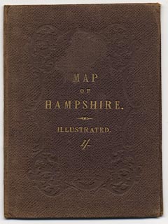
colour printed & sectioned for folding & folded (in stiff cover) &
scale line & lat and long scales & county & rivers & relief
& hill hachuring & settlements & parks & roads &
railways |
|
inscription:- |
printed -on- cover
MAP / OF / HAMPSHIRE / 1/-
|
|
scale line:-
|
12 miles = 41.7 mm (approx) |
|
dimension:- |
wxh, folded = 9.5x13cm |
|
wxh, sheet = 19.5x24.5cm |
|
wxh, map = 187x241mm |
|
scale = 1 to 460000 ? (approx, 1 to 463121 ?) |
|
longitude, Winchester = 1d 18.5m W (roughly) |
 |
|

|
Map Group -- Unknown 1850s -- with Research Notes
|
 |
|

| top of page |
| MN: 28.12.2001 |


