|
FA1998.157:-
|
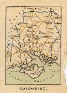
Map, hand coloured engraving, Hampshire, with the Isle of Wight, scale about
14 miles to 1 inch, published in an Atlas of England by R Butters, 22 Fetter
Lane, Fleet Street, London, 1803.
|
|
map feature:-
|
north point (with its fleur de lys pointing south!) & scale line & coast
shaded & rivers & parks (few) & county & settlements &
roads |
|
inscription:- |
printed -on- bottom
HAMPSHIRE.
|
|
scale line:-
|
10 miles = 17.9 mm |
|
dimension:- |
wxh, map = 88x122mm (approx) |
|
scale = 1 to 900000 ? (1 to 899075 from scale line assuming modern mile) |
 |
|

|
Map Group -- Butters 1803 -- with Research Notes
|
 |
|

| top of page |
| MN: 4.10.2001 |


