|
FA1999.16:-
|
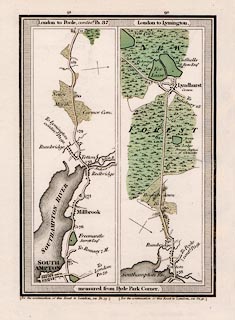
Strip map, road map, part of route London to Poole, Dorset, and London to
Lymington, Lymington and Pennington, Hampshire, scale about 1 inch to 1 mile,
probably published by E Mogg, London, 1814.
|
|
P.91 from Southampton via Millbrook and Redbridge on way to towards Poole,
Dorset.
|
|
P.92 from Redbridge via Lyndhurst, Hampshire.
|
|
Inns are mentioned along the route.
|
|
map feature:-
|
title cartouche & north point & up is destination & coast form lines
& rivers & canals & woods & forests & parks &
settlements & inns & milestones & roads & turnpike roads &
turnpike gates & distances from London & streets |
|
inscription:- |
printed -on- title cartouche at top
London to Poole, contind. Pa.87
|
|
inscription:- |
printed -on- title cartouche at top
London to Lymington.
|
|
inscription:- |
printed -on- bottom
measured from Hyde Park Corner.
|
|
dimension:- |
scale = 1 to 65000 ? (estimate) |
 |
|

|
Map Group -- Mogg 1814 -- with Research Notes
|
tr> |
|

| top of page |
| MN: 9.11.2002 |


