|
FA1999.33:-
|
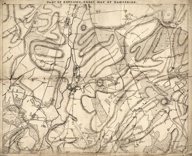
Map, uncoloured lithograph, part of a Great Map of Hampshire, sheet 36? area
south of Winchester, scale about 5 inches to 1 mile, by Nathaniel Lipscomb
Kentish, Kingsgate Street, Winchester, Hampshire, about 1823.
|
|
The map includes parts of - St Cross, Winchester; Chilcomb; Compton, Compton and
Shawford; Otterbourne; Twyford; Owslebury; etc, in Hampshire.
|
|
It is felt that this sheet is a trial sheet, perhaps made to raise subscriptions
for the whole project; the ambitious scale of the project and its costs would
have made it difficult to find support, no other sheets in the series have been
seen, as yet; the title includes 'part of' which would not have been used if the
sheet were part of a complete series? lithography is unusual for a map of this
period.
|
|
Pigot's Directory for Hampshire lists 'Kentish, Nathl. L. author of the great
Map of Hants. Kingsgate-st' Winchester, 1823-24.
|
|
Correspondence between Kentish and Robert Drummond about mapping his estate,
refers to the large scale map in preparation, 1823.
|
|
map feature:-
|
not coloured & rivers & canals & woods & relief & hill
hachuring & settlements & roads & mills & windmills & water
mills & milestones & road distances & streets & |
|
inscription:- |
printed -on- top centre
PART OF KENTISH'S GREAT MAP OF HAMPSHIRE
|
|
inscription:- |
printed -on- bottom
Drawn from Actual survey & Published by & for Nat. Lipscomb Kentish,
Winchester.
|
|
inscription:- |
-on-
J WHATMAN / TURKEY MILL / 1823
|
|
dimension:- |
wxh, sheet = 84.5x66.5cm |
|
wxh, map = 754x605mm |
|
scale = 1 to 13000 ? (estimated from milestones 2 miles = 247.5mm is 1 to 13004
assuming statute mile) |
 |
|
|
reference:- |
Norgate, Martin: 2000: Notes from Kentish's Map of Hampshire: Hampshire CC
Museum Service:: ISBN 1 85975 380 9 |

|
Map Group -- Kentish 1823 -- with Research Notes
|
 |
|

| top of page |
| MN: 4.10.2001 |


