|
FA1999.56:-
|
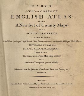
Atlas, leather bound, Cary's New and Correct English Atlas, county maps of
England and maps of Wales, by John Cary, 188 Strand, London, 1787.
|
|
The county maps, in alphabetical order, each have a page of descriptive text;
the maps are documented separately.
|
|
At the back of the atlas is a list of routes, this gives county and place name
for points along the route, thus acting as an index to route on the maps; then
there is an index to market and borough towns; and last a list of post towns and
their receiving houses.
|
|
inscription:- |
printed -on- title page
CARY'S / NEW and CORRECT / ENGLISH ATLAS: / BEING / A New Set of County Maps
/ FROM / ACTUAL SURVEYS. / EXHIBITING / All the Direct & principal Cross Roads,
Cities, Towns, and most considerable Villages, Parks, Rivers, / NAVIGABLE CANALS
&c. / Preceded by a General MAP of South Britain, / SHEWING / The Connexion of
one Map with another. / ALSO / A General Description of each County, / AND /
Directions for the junction of the Roads from one County to / ANOTHER. / LONDON.
/ Printed for JOHN CARY, Engraver, Map and Print-seller, the corner of Arundel
Street, Strand. / Published as the Act directs Septr. 1st 1787.
|
|
dimension:- |
wxh = 25x32cm |
 |
|

|
Map Group -- Cary 1787 -- with Research Notes
|
 |
|

| top of page |
| MN: 12.7.2002 |


