|
FA1999.60.1:-
|
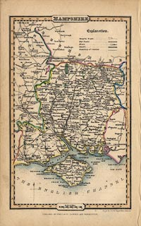
Map, hand coloured engraving, Hampshire, scale about 13 miles to 1 inch, from
A Pocket Topography of England, by Pigot and Co, London, 1835, edition of
1841.
|
|
map feature:-
|
title cartouche & north point & scale line & lat and long scales
& coast form lines & rivers & parks & county & settlements
& roads & canals & railways |
|
inscription:- |
printed -on- bottom right
Pigot & Slater Engravers Manchr.
|
|
inscription:- |
printed -on- bottom centre
PUBLISHED BY PIGOT & Co. LONDON AND MANCHESTER
|
|
scale line:-
|
10 miles = 19.1 mm |
|
dimension:- |
scale = 1 to 840000 ? (1 to 842588 from scale line assuming modern mile) |
|
scale = 1 to 860000 ? (1 deg latitude = 129.2mm is 1 to 861597) |
|
wxh, sheet = 12x19.5cm |
|
wxh, map = 104x164mm |
|
longitude, Winchester = 1d 16.6m W (approx) |
 |
|

|
Map Group -- Pigot 1835 -- with Research Notes
|
 |
|
|
town names:-
|
|
Hampshire
|
Hampshire
|
|
map name
|
modern name
|
|
Alton
|
Alton
|
|
Andover
|
Andover
|
|
Basingstoke
|
Basingstoke
|
|
Bishops Waltham
|
Bishops Waltham
|
|
Christ Church
|
Christchurch
|
|
Fareham
|
Fareham
|
|
Fordingbridge
|
Fordingbridge
|
|
Gosport
|
Gosport
|
|
Havant
|
Havant
|
|
Kingsclere
|
Kingsclere
|
|
Lymington
|
Lymington
|
|
New Alresford
|
Alresford
|
|
Odiham
|
Odiham
|
|
Petersfield
|
Petersfield
|
|
Portsmouth
|
Portsmouth
|
|
Ringwood
|
Ringwood
|
|
Romsey
|
Romsey
|
|
Southampton
|
Southampton
|
|
Stockbridge
|
Stockbridge
|
|
Whitchurch
|
Whitchurch
|
|
Winchester
|
Winchester
|
|
 |
|

| top of page |
| MN: 25.2.2003 |


