 |
more images |
|
FA1999.62:-
|
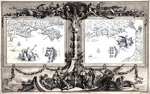
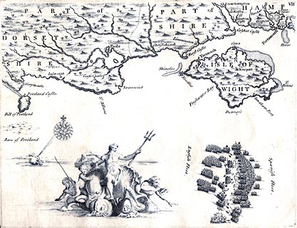
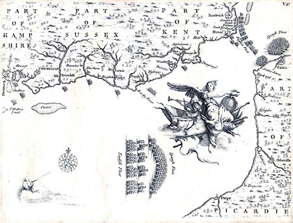
Chart, engraved plates VII and VIII, Progress of the Armada, drawn by H
Gravelot, engraved and published by John Pine, London, 1739.
|
|
Pl.7 - 4 August 1588, the Spanish and English fleets engaged in battle south of
the Isle of Wight, in the calm weather the English tow their ships close to the
Spanish by row boats; Drake is attacking the south flank in an attempt, which
failed, to drive the Spanish north onto the Ower Banks.
|
|
Pl.8 scene 1 - 5-6 August 1588; the Spanish in their battle formation sail
eastwards towards the Straits of Dover trailed by the English in four squadrons;
all along the coast volunteer ships are leaving harbour to support the English
fleet.
|
|
Pl.8 scene 2 - 6 August 1588; the Spanish are anchored in an exposed position
off Calais waiting for Parma's invasion fleet from the Netherlands, which was
late; the English are waiting off Calais Cliffs, and Howard has called Seymour's
squadron from his protective patrol off Kent, to his support.
|
|
The two maps are printed in blue from separate plates, within a decorative
border, printed in black, which includes a portraits of Sir Martin Frobisher and
Sir John Hawkins, and a scene of ?Lord Howard bestowing a knighthood.
|
|
map feature:-
|
compass rose & winds & coast form lines & county & settlements
& castles |
|
inscription:- |
printed -on- bottom
Published by John Pine, June 24, 1739. according to Act of Parliament.
|
|
inscription:- |
printed -on- bottom left
H. Gravelot delin.
|
|
inscription:- |
printed -on- bottom right
J. Pine Sculp.
|
|
dimension:- |
wxh = 63.5x39.5cm |
 |
|

|
Map Group -- Pine 1739 -- with Research Notes
|
 |
|


