|
FA1999.75:-
|
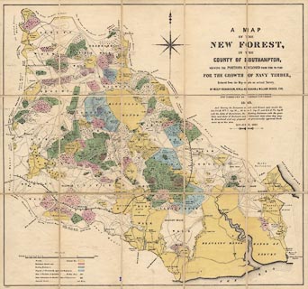
Map, Map of the New Forest, Hampshire, scale about 1.5 inches to 1 mile,
showing portions enclosed for Navy Timber, by Richardson, King, Abraham and
William Driver, 1789, corrected by Thomas Couchman, 1849, corrected to 1867.
|
|
map feature:-
|
compass rose & scale line & coast form lines & rivers & bridges
& woods & forests & settlements & roads & railways &
mounted & sectioned for folding |
|
inscription:- |
printed -on- upper right
A MAP / OF THE / NEW FOREST, / IN THE / COUNTY OF SOUTHAMPTON, / SHEWING THE
PORTIONS ENCLOSED FROM TIME TO TIME / FOR THE GROWTH OF NAVY TIMBER, / ....
|
|
scale line:-
|
3 miles = 99.6 mm |
|
dimension:- |
scale = 1 to 48000 ? (1 to 48474 from scale line assuming modern mile) |
 |
|

|
Map Group -- Richardson 1789 -- with Research Notes
|
 |
|

| top of page |
| MN: 10.10.2002 |


