|
FA1999.107:-
|
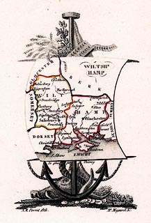
Map, engraving, Wiltshe Hamp ie Wiltshire and Hampshire with the Isle of
Wight, scale about 45.5 miles to 1 inch, by Aristide Michel Perrot, drawn by
Thierry, engraved by Mme Migneret, France, 1823.
|
|
The map is very small, Hampshire is only about 3cm wide, the 2 counties on a
sheet suspended from rods mounted on an anchor; above are wheat stalks, oak
leaves and what could be ribbons, below is a boar's head and the flukes of the
anchor; plate number 'P.126.' is engraved top right.
|
|
The map was published in L'Angleterre, or description Historique et
Topographique du Royaume-Uni de la Grande-Bretagne' by Etienne Ledoux, 9 Rue
Guenegaud, Paris, France, 1824.
|
|
map feature:-
|
coast form lines & rivers & county & settlements |
|
inscription:- |
printed -on- lower centre
Le plan par Thierry
|
|
inscription:- |
printed -on- bottom
A. M. Perrot 1823 / Me. Migneret Sc.
|
|
dimension:- |
wxh, map = 68x109mm (approx) |
|
wxh, sheet = 9.5x15.5cm (approx) |
|
scale = 1 to 2900000 ? (from town positions using DISTAB.exe) |
 |
|

|
Map Group -- Perrot 1823 -- with Research Notes
|
 |
|
|
town names:-
|
|
Hamp
|
Hampshire
|
|
map name
|
modern name
|
|
Alton
|
Alton
|
|
Andover
|
Andover
|
|
Basingstoke
|
Basingstoke
|
|
Christchurch
|
Christchurch
|
|
Farnham
|
Fareham
|
|
Gosport
|
Gosport
|
|
Havant
|
Havant
|
|
Lymington
|
Lymington
|
|
Odiham
|
Odiham
|
|
Petersfield
|
Petersfield
|
|
Portsmouth
|
Portsmouth
|
|
Ringwood
|
Ringwood
|
|
Romsey
|
Romsey
|
|
Southampton
|
Southampton
|
|
Stockbridge
|
Stockbridge
|
|
Winchester
|
Winchester
|
|
 |
|

| top of page |
| MN: 4.10.2001 |


