|
FA1999.124:-
|
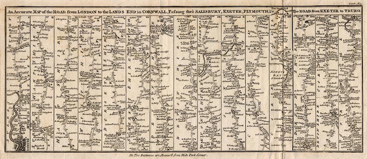
Strip map, road map, uncoloured engraving, the Road from London to the Lands
End, and the Road from Exeter to Truro, scale about 2 miles to 1 inch, published
in the Gentleman's Magazine, London, about 1765.
|
|
London; Staines, Middlesex; Egham, Bagshot, Surrey; Basingstoke, Whitchurch,
Andover, Hampshire; Salisbury, Wiltshire; Shaftesbury, Sherborne, Dorset;
Yeovil, Somerset; Axminster, Honiton, Exeter, Plymouth, Devon; Looe, St Austel,
to Senan and the Lands End, Cornwall.
|
|
Exeter, Tavistock, Devon; Liskeard, to Truro, Cornwall.
|
|
map feature:-
|
not coloured & title cartouche & up is destination & coast shaded
& rivers & relief & hillocks & settlements & roads &
distances from London & streets |
|
inscription:- |
printed -on- title cartouche
An Accurate MAP of the ROAD from LONDON to the LANDS END in CORNWALL,
Passing thro' SALISBURY, EXETER, PLYMOUTH &c. / The ROAD from EXETER to
TRURO.
|
|
inscription:- |
printed -on- top left
Gent: Mag:
|
|
inscription:- |
printed -on- bottom
NB: The Distances are Measur'd from Hide Park Corner.
|
|
dimension:- |
wxh, sheet = 47.5x20.5cm |
|
wxh, map = 434x175mm |
 |
|

|
Map Group -- Gent Mag 1765 -- with Research Notes
|
 |
|

| top of page |
| MN: 4.10.2001 |


