|
B1999.371.1:-
|
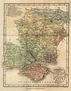
Map, hand coloured engraving, Soil and Substrata of ... the County of Hants,
scale about 6 miles to 1 inch, engraved by Neele, Strand, published by R
Philips, New Bridge Street, London, 1810.
|
|
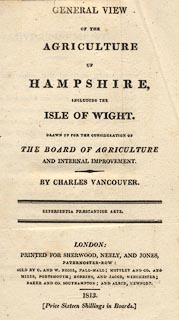
Made for a report, General View of the Agriculture of Hampshire, to the Board of
Agriculture and Internal Improvement, by Charles Vancouver, published by
Sherwood, Neely, and Jones, Paternoster Row, London, 1813.
|
|
map feature:-
|
title cartouche & oval cartouche & up is N & lat and long scales
(rectangular) & table of symbols (for the soil areas) & coast shaded
& rivers & woods & forests & parks & county &
settlements & roads |
|
inscription:- |
printed -on- title cartouche
Map / Exhibiting / the leading Character of / SOIL & SUBSTRATA / of the / 8
Districts comprised / in the County of / HANTS / Engraved for / Mr. Vancouver's
/ Agricultural Report / 1810
|
|
dimension:- |
wxh, sheet = 23.5x31.5cm |
|
wxh, map = 196x250mm |
|
scale = 1 to 390000 ? (1 to 394746 from 45 minutes latitude = 211.5mm) |
 |
|

|
Map Group -- Vancouver 1810 -- with Research Notes
|
 |
|

| top of page |
| MN: 5.8.2002 |


