|
B1999.518.1772.3.2:-
|
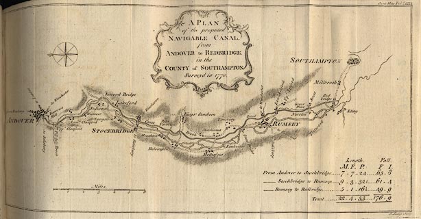
Map, uncoloured engraving, Plan of the proposed Navigable Canal from Andover
to Redbridge, Hampshire, scale about 2 miles to 1 inch, engraved by J Lodge,
surveyed 1770.
|
|
Published in the Gentleman's Magazine, vol.41 March 1772 between pp.128-29.
|
|
Canal or river navigation running beside the River Anton and River Test, from
Andover, via or near Stockbridge, Kings Somborne, Romsey to Redbridge,
Southampton, Hampshire.
|
|
map feature:-
|
not coloured & compass rose (simple, fleur de lys marks north) & scale
line & relief & canals & rivers & bridges & settlements
& title cartouche & scroll cartouche & table of distances |
|
scale line:-
|
6 miles = 75.0 mm |
|
inscription:- |
printed -on- map
A PLAN / of the proposed / NAVIGABLE CANAL, / from / ANDOVER to REDBRIDGE. /
in the / COUNTY of SOUTHAMPTON. / Surveyed in 1770.
-- scroll cartouche |
|
inscription:- |
printed -on- bottom right
J. Lodge Sculp.
|
|
inscription:- |
printed -on- top right
Gent. Mag. Feby. 1772
|
|
dimension:- |
wxh, plate = 355x180mm (?) |
|
wxh, map = 343x168mm |
|
scale = 1 to 130000 ? (1 to 128748 from scale line assuming statute mile) |
 |
|

|
Map Group -- Gent Mag 1770s -- with Research Notes
|
 |
|

| top of page |
| MN: 25.2.2002 |


