|
B2001.83.1:-
|
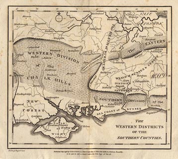
Map, uncoloured engraving, The Western Districts of the Southern Counties,
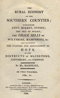
scale about 1 to 620000, about 10 miles to 1 inch, included in The Rural Economy
of the Southern Counties, vol.11, by Mr Marshall, published by G Nicol, Pall
Mall, and G G and J Robinson, Paternoster Row, and J Debrett, Piccadilly,
London, 1798.
|
|
The map covers the central south east of England - parts of Berkshire,
Middlesex, Surrey, East Sussex, West Sussex, Hampshire, Dorset and the Isle of
Wight.
|
|
map feature:-
|
not coloured & compass rose & up is N & lat and long scales &
coast shaded & rivers & relief & hill hachuring & county &
settlements |
|
inscription:- |
printed -on- title, lower right
THE / WESTERN DISTRICTS / OF THE / SOUTHERN COUNTIES.
|
|
inscription:- |
printed -on- bottom left
Mutlow. sc Russel Court
|
|
inscription:- |
printed -on- bottom
Published July 1798, by G. G. & J. Robinson, Pater Noster Row, G. Nicol,
Pall Mall, & J. Debrett, Piccadilly. / to be put in with a Guard before the
Title Page of Vol. II.
|
|
dimension:- |
wxh, sheet = 24.5x22cm |
|
wxh, plate = 234x211mm |
|
wxh, map = 215x187mm |
|
scale = 1 to 620000 ? (1 to 619938 from 55 minutes latitude = 164.6 mm) |
|
longitude, Winchester = 1d 13.5m W (approx) |
 |
|

|
Map Group -- Marshall 1798 -- with Research Notes
|
 |
|
|
town names:-
|
|
Hampshire
|
Hampshire
|
|
map name
|
modern name
|
|
Alton
|
Alton
|
|
Andover
|
Andover
|
|
Basingstoke
|
Basingstoke
|
|
Bishops Waltham
|
Bishops Waltham
|
|
Christchurch
|
Christchurch
|
|
Fareham
|
Fareham
|
|
Fordingbridge
|
Fordingbridge
|
|
Gosport
|
Gosport
|
|
Havant
|
Havant
|
|
Kingsclere
|
Kingsclere
|
|
Lymington
|
Lymington
|
|
Alresford
|
Alresford
|
|
Odiham
|
Odiham
|
|
Petersfield
|
Petersfield
|
|
Portsmouth
|
Portsmouth
|
|
Ringwood
|
Ringwood
|
|
Romsey
|
Romsey
|
|
Southampton
|
Southampton
|
|
Stockbridge
|
Stockbridge
|
|
Whitchurch
|
Whitchurch
|
|
Winchester
|
Winchester
|
|
 |
|

| top of page |
| MN: 5.8.2002 |


