 |
more images |
|
FA2000.2:-
|
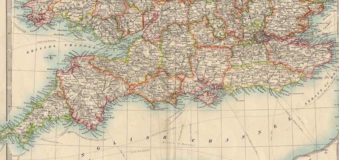
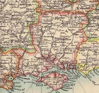
Railway map, coloured, England and Wales, southern sheet, scale about 19
miles to 1 inch, by W and A K Johnston, Edinburgh, Lothian and London, about
1900s.
|
|
Most of Suffolk, Cambridgeshire, Huntingdonshire, Bedfordshire, Warwickshire,
Worcestershire, Herefordshire, Gloucestershire, Somerset, Devon, Cornwall,
Oxfordshire, Buckinghamshire, Bedfordshire, Hertfordshire, Essex, Middlesex,
London, Berkshire, Wiltshire, Dorset, Hampshire, Isle of Wight, Surrey, West
Sussex, East Sussex, Kent.
|
|
Most of Cardiganshire, Carmarthenshire, Pembrokeshire, Radnorshire,
Brecknockshire, Glamorganshire, Monmouthshire.
|
|
map feature:-
|
scale line & lat and long scales & lat and long grid & rivers &
relief & hill hachuring & county & settlements & railways &
shipping routes |
|
inscription:- |
printed -on- lower right
ENGLAND / AND WALES / (Southern Sheet) / ....
|
|
inscription:- |
printed -on- bottom centre
Engraved, printed & Published by W. & A.K. Johnston, Edinburgh & London.
|
|
scale line:-
|
40+10 miles= 65.9 mm |
|
dimension:- |
wxh, sheet = 48x37cm |
|
wxh, map = 426x323mm (plus bits outside border) |
|
scale = 1 to 1200000 ? (1 to 1221050 from scale line assuming a statute
mile) |
 |
|

|
Map Group -- Johnston 1900s -- with Research Notes
|
 |
|
|

|
 |
|

| top of page |
| MN: 7.1.2002 |


