|
FA2000.6:-
|
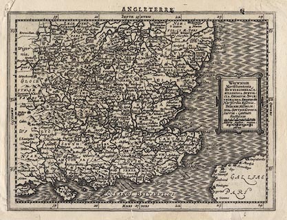
Map, uncoloured engraving, Warwicum Northamptonia Huntingdonia ... etc, part
of Angleterre, England, showing Hampshire, scale about 20 to 30 miles to 1 inch,
by Gerhard Mercator 1595, published by Jodocus Hondius, 1630?
|
|
Shows - Warwickshire, Northamptonshire, Huntingdon, Oxfordshire,
Buckinghamshire, Hertfordshire, Norfolk, Suffolk, Essex, Middlesex, Berkshire,
Wiltshire, Hampshire, Surrey, East Sussex, West Sussex, Kent, Isle of Wight; the
text on the reverse is in French.
|
|
scale line:-
|
20 miles = 24.1 mm (small miles) |
|
scale line:-
|
22 miles = 29.2 mm (large miles) |
|
inscription:- |
printed -on- title cartouche
Warwicum / Northamptonia / HUNTINGDONIA CA: / NTABRIGIA, SUFFOL: / CIA,
OXONIUM, BUCK: / INGHAMIA, BEDFORdia / Hartfordia Essexia / BERCERI MIDELSE: /
XIA, SOUTHA~TONIA / Surria, Cantium / Southsexia
|
|
dimension:- |
wxh, sheet = 27.5x21cm |
|
wxh, plate = 258x190mm |
|
wxh, map = 256x188mm |
|
scale = 1 to 1700000 ? (2 degrees latitude = 128.6mm is 1 to 1731985) |
 |
|

|
Map Group -- Mercator 1595 -- with Research Notes
|
 |
|
|
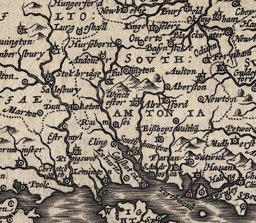
town names:-
|
|
Southamtonia
|
Hampshire
|
|
map name
|
modern name
|
|
Aulton
|
Alton
|
|
Andover
|
Andover
|
|
Basynstoke
|
Basingstoke
|
|
Bisshops Waltha~
|
Bishops Waltham
|
|
Christchurch
|
Christchurch
|
|
Faran
|
Fareham
|
|
Havant
|
Havant
|
|
Kingeselere
|
Kingsclere
|
|
Leminton
|
Lymington
|
|
Alresford
|
Alresford
|
|
Odiam
|
Odiham
|
|
Porthmouth
|
Portsmouth
|
|
Ringswod
|
Ringwood
|
|
Rumsei
|
Romsey
|
|
South hampton
|
Southampton
|
|
Stokbridge
|
Stockbridge
|
|
Winchester
|
Winchester
|
|
 |
|

| top of page |
| MN: 4.10.2001 |


